- Ross Island
Infobox Islands
name = Ross
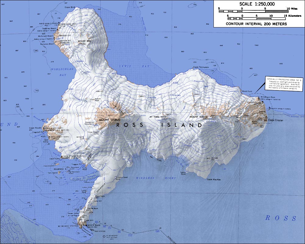
image caption = Map of Ross Island
locator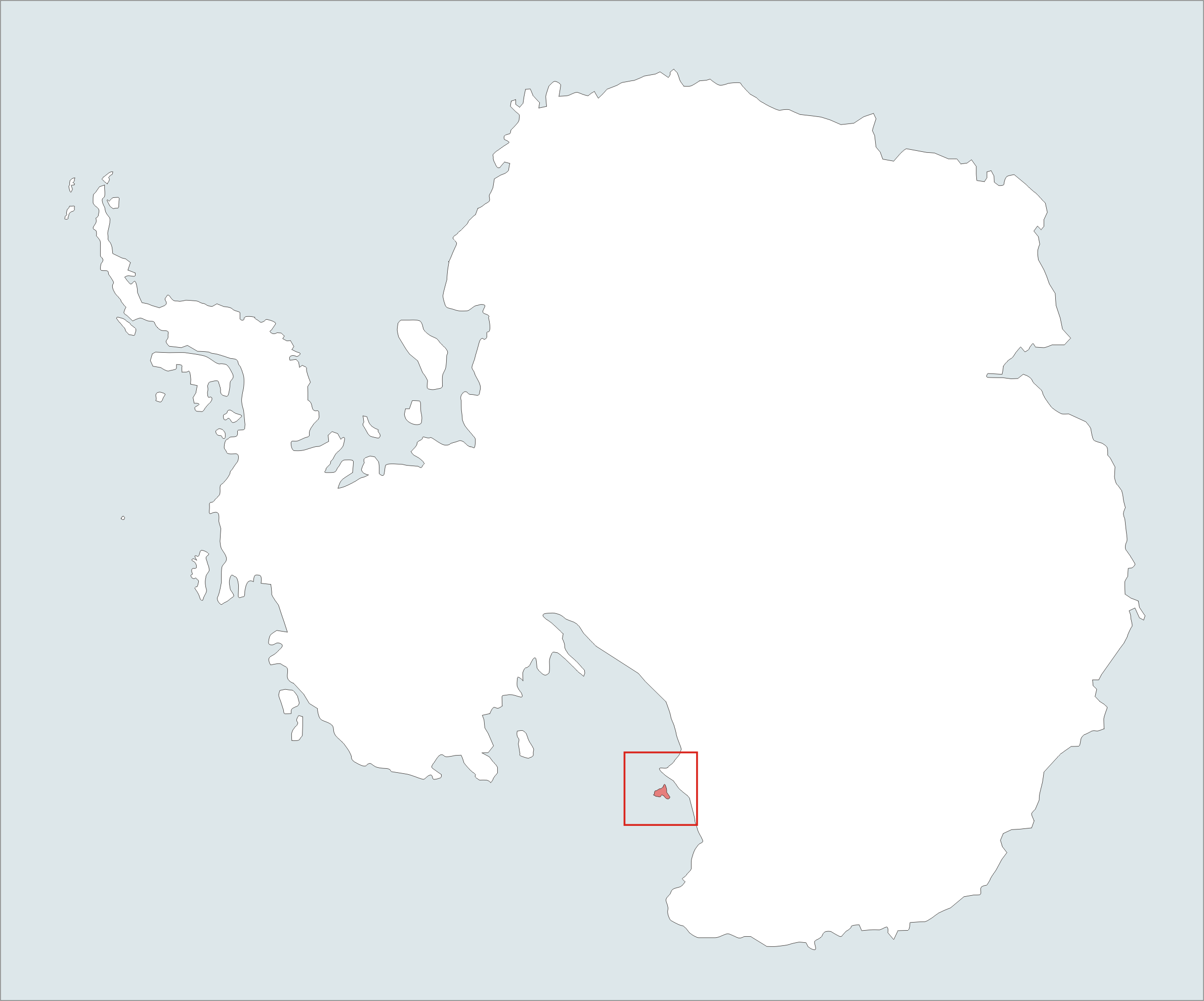
map_custom = no
nickname =
location =Antarctica
coordinates = coord|77|40|S|168|00|E|type:isle|display=inline,title
archipelago =
total islands =
major islands =
area = convert|2460|km2|sqmi|0|abbr=on
length =
width =
highest mount = Erebus
elevation = convert|3794|m|ft|0|abbr=on
population =
population as of =
density =
ethnic groups =
country = Antarctica
additional info = Administered under theAntarctic Treaty System Ross Island is an island formed by four
volcano es in theRoss Sea byAntarctica , off the coast ofVictoria Land in McMurdo Sound. Its area is 2,460 km² (950 sq mi); only a small portion of the island is free of ice and snow. SirJames Clark Ross discovered it in1841 , and it was later named in honour of him byRobert F. Scott . The planet's southernmost active volcano, Erebus (3794 m), as well as the dormant volcano Terror (3230 m), are situated on the island. They were named by Ross after his ships HMS "Erebus" and HMS "Terror". The third highest elevation isMount Bird .Despite its relatively small size, Ross Island is the world's 6th highest island.
Ross Island was the base for many of the early expeditions to Antarctica. It was and still is the southernmost island reachable by sea. Huts built by Scott's and Shackleton's expeditions are still standing on the island, preserved as historical sites.
Ross Island lies within the boundaries of
Ross Dependency , which is claimed byNew Zealand .Today Ross Island is home to
New Zealand 'sScott Base , and the largest Antarctic settlement, theU.S. Antarctic Program 'sMcMurdo Station .Greenpeace establishedWorld Park Base on the island and it ran for five years, from1987 to1992 .Ross Island supports a colony of approximately half a million
Adélie Penguin s, which call this frigid climate home.See also
*
Erebus Ice Tongue
*List of antarctic and sub-antarctic islands
*McMurdo Sound
*Ross Sea References
*
External links
* [http://www.niwascience.co.nz/pubs/wa/11-3/map NIWA New Zealand]
Wikimedia Foundation. 2010.