- Chestatee, Georgia
-
Chestatee is a small town in northeastern Forsyth County, Georgia, United States, due west of the confluence of the Chestatee River into the Chattahoochee River. Originally a Cherokee settlement, it was called Atsunsta Ti Yi.
The word "Chestatee" is a Cherokee word meaning roughly "pine torch place" or "place of lights", because they would use bonfires along the riverbanks to light their torches. They would then use these torches for hunting deer and other wild game in the forest.
The Vann Ferry, owned by Cherokee Indian Chief Vann, is just east of Chestatee, on the road to Gainesville, Georgia.
Municipalities and communities of Forsyth County, Georgia City 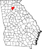
Unincorporated
communitiesChestatee | Coal Mountain | Matt
Footnotes ‡This populated place also has portions in an adjacent county or counties
Coordinates: 34°17′39″N 83°59′59″W / 34.29417°N 83.99972°W
Categories:- Populated places in Forsyth County, Georgia
- Georgia (U.S. state) geography stubs

Wikimedia Foundation. 2010.