- Cockpole Green
-
Coordinates: 51°31′23″N 0°50′46″W / 51.523°N 0.846°W
Cockpole Green
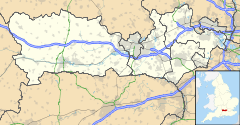
 Cockpole Green shown within Berkshire
OS grid reference SU800811 Unitary authority Wokingham, Windsor and Maidenhead Ceremonial county Berkshire Region South East Country England Sovereign state United Kingdom Post town Wargrave Postcode district RG10 Dialling code 0118 Police Thames Valley Fire Royal Berkshire Ambulance South Central EU Parliament South East England UK Parliament Berkshire List of places: UK • England • Berkshire Cockpole Green is a village in Berkshire, England. Part, including the original village green lies within the civil parish of Hurley and part within the civil parish of Wargrave. Therefore, it is served by two unitary authorities.
The settlement lies near to the A321 road, and is situated approximately 2.5 miles (4.0 km) east of Henley-on-Thames.
Towns Civil parishes Other villages
and hamletsArborfield · Arborfield Cross · Arborfield Garrison · Barkham · Billingbear · Charvil · Cockpole Green · Crazies Hill · Farley Hill · Finchampstead · Gardeners Green · Grazeley · Hare Hatch · Holme Green · Hurst · Kiln Green · Ravenswood · Remenham · Riseley · Ruscombe · Ryeish Green · Shinfield · Sindlesham · Sonning · Spencers Wood · Swallowfield · Three Mile Cross · Twyford · Upper Culham · Wargrave · Whistley Green · Winnersh · WoosehillCategories:- Berkshire geography stubs
- Villages in Berkshire
- Wokingham
- Windsor and Maidenhead
Wikimedia Foundation. 2010.

