- Tobyhanna (village)
Geobox Village
name = The Village of Tobyhanna
native_name =
other_name =
other_name1 =
category =
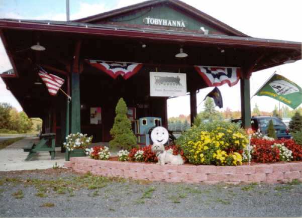
image_caption = Tobyhanna Station
etymology = American Indian for "a stream whose banks are fringed with alder"
nickname =
motto ="Its really not that bad."
country = United States
state = Pennsylvania
region = Monroe
region_type = County
Township =Coolbaugh Township, Pennsylvania
timezone = EST
utc_offset = -5
timezone_DST = EDT
utc_offset_DST = -4
postal_code = 18466-9715
postal_code_type = ZIP code
area_code = 570
area_code_type =
code2_type =
code2 =
free_type =
free =
free1_type =
free1 =
map1_locator = Pennsylvania
map2 = Map of USA PA.svg
map2_caption = Location of Pennsylvania in the United States
website = http://www.tobyhanna.com/Tobyhanna is a village located in Monroe County,
Pennsylvania ,United States . From about 1900 to 1936, Tobyhanna lakes were the site of active ice industries. The ice was cut from the lakes during the winter and stored in large barn-like structures. During the rest of the year, the ice was added to railroad boxcars hauling fresh produce and meats destined for East Coast cities.In 1912, Tobyhanna had a railway station, telegraph, and post office, and so the federal government acquired land within Tobyhanna that became the Tobyhanna Military Reservation, later
Tobyhanna Army Depot , which was used as an Artillery training ground. In the summer of 1916 Edward B. Reed recorded the following quote about Tobyhanna in The Field Artillery Journal January-March 1917 of the experiences of the Yale Batteries during their training."The camp at Tobyhanna is on a rocky, treeless crest from which no trace of man is visible. About are mountains and uncultivated valleys. The village of Tobyhanna is interesting only because it contains a station that enables you to leave it. No better place for work could be found."
In recent years, due to its location between the New York and Philadelphia metropolitan areas, and construction of new homes by developers, many families from these areas decided to move to the Poconos. Many of Tobyhanna's residents choose to commute to the city each day.
Landscape
The landscape of the area is of broad, flat, swampy areas intermixed with low hills covered with a northern hardwood forest. Common tree species are beech, birch and maple. This landscape affected the settlement and industries of the area.
Education
Due to recent population boom, the old K-12 school in Tobyhanna, now known as Coolbaugh Learning Center (CLC), and the more recently constructed Coolbaugh Elementary Center (CEC), the only two schools located within Tobyhanna, together now only teach until grade 4. Tobyhanna schools are part of the
Pocono Mountain School District . Children who live in Tobyhanna attend the "West" schools of the district.References
External links
* [http://www.tobyhannatownship.org/ Tobyhanna Township]
* [http://pocono.commuterclub.org/ Poconos Region Commuter Club Forums and Directories]
* [http://www.tobyhanna.army.mil/about/tobyhanna/history.html]
* [http://www.dcnr.state.pa.us/stateparks/parks/gouldsboro/gouldsboro_tobyhanna_history.aspx]
Wikimedia Foundation. 2010.