- Tobyhanna State Park
Geobox Protected Area
name = Tobyhanna State Park
native_name =
other_name =
other_name1 =
category_local = Pennsylvania State Park
category_iucn = III
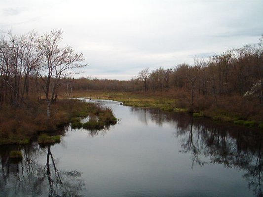
image_caption =Tobyhanna Creek just upstream of Tobyhanna Lake. This area of the park is open to hunters.
etymology_type =
etymology =
country = United States
state = Pennsylvania
region_type = Counties
region = Monroe
region1 = Wayne
district_type = Townships
district = Coolbaugh
district1 = Dreher
district2 = Lehigh
city =
location =
lat_d = 41
lat_m = 14
lat_s = 20
lat_NS = N
long_d = 75
long_m = 22
long_s = 21
long_EW = W
location_note = cite web
url=Gnis3|1190999
title="Tobyhanna State Park"
date =August 2 1979
work=Geographic Names Information System
publisher=United States Geological Survey
accessdate=2007-12-16]
elevation_imperial = 2005
elevation_round = 1
elevation_note =
area_unit = acre
area_imperial = 5440
area_round = 1
area1_imperial =
area1_type =
length_imperial =
length_orientation =
width_imperial =
width_orientation =
highest =
highest location =
highest_lat_d =
highest_lat_m =
highest_lat_s =
highest_lat_NS =
highest_long_d =
highest_long_m =
highest_long_s =
highest_long_EW =
highest_elevation_imperial =
lowest =
lowest_location =
lowest_lat_d =
lowest_lat_m =
lowest_lat_s =
lowest_lat_NS =
lowest_long_d =
lowest_long_m =
lowest_long_s =
lowest_long_EW =
lowest_elevation_imperial =
biome =
biome_share =
biome1 =
biome1_share =
geology =
geology1 =
plant =
plant1 =
animal =
animal1 =
established_type =
established = 1949
management_body = Pennsylvania Department of Conservation and Natural Resources
management_location =
management_lat_d =
management_lat_m =
management_lat_s =
management_lat_NS =
management_long_d =
management_long_m =
management_long_s =
management_long_EW =
management_elevation =
visitation =
visitation_year =
free_type = Nearest city
free =Mount Pocono, Pennsylvania
free1_type =
free1 =

map_caption = Location of Tobyhanna State Park in Pennsylvania
map_locator = Pennsylvania
map_first =
website = [http://www.dcnr.state.pa.us/stateparks/parks/tobyhanna.aspx Tobyhanna State Park]Tobyhanna State Park is a Pennsylvania state park on convert|5440|acre|km2|2 mostly in Coolbaugh Township, Monroe County, with a small portion of the park in Dreher and Lehigh townships in Wayne County, all in
Pennsylvania in the United States. The park includes the convert|170|acre|km2|2Tobyhanna Lake and a portion ofTobyhanna Creek . It is located convert|2.1|mi|km|1 north of the town of Tobyhanna, with the main park entrance onPennsylvania Route 423 , and a portion (Yellow hiking trail) that borders onPennsylvania Route 196 . The park lies immediately adjacent toGouldsboro State Park ,Pennsylvania State Game Lands 312, and State Game Land 127.History
Former Artillery Range
Tobyhanna State Park is one of the state lands carved from a large artillery training range that preceded
Tobyhanna Army Depot . According to the Pennsylvania DCNR, cquote|Visitors using more remote and undeveloped areas of Tobyhanna State Park should be aware that they may encounter old, unexploded artillery shells. Three types of shells have been found in the park. The largest projectile is 18 to convert|24|in|mm in length and about 6 inches in diameter. The medium projectile is convert|2.5|in|mm in diameter and about 10 to convert|14|in|mm in length. The smallest projectile is convert|3|in|mm long and convert|1.25|in|mm in diameter. Shells are found in severely rusted condition without any recognizable markings or imprints. Their overall appearance is that of a pointed cylinder of rusted steel. Visitors encountering such items should not touch, attempt to move or otherwise disturb the items, and should call the park office and report the location to ensure proper disposal.cite web
url = http://www.dcnr.state.pa.us/stateparks/parks/tobyhannagouldsboro_history.aspx
title = Tobyhanna and Gouldsboro
accessdate = 2007-02-13
publisher =Pennsylvania Department of Conservation and Natural Resources "Note: Histories of both state parks"]Rail line
The western boundary of Tobyhanna State Park is formed by a rail line once owned by
Jay Gould (1836 - 1892). Gould, a native ofNew York , acquired an immense fortune during theIndustrial Revolution , part of which included ownership of ten percent of all therail tracks in the United States at the time of his death. One of hisrailroad s passed by what is now the western boundary of the park. Gould was also the co-owner of a tannery in nearby Thornhurst. Raw hides were shipped from the western United States andAustralia on the railroads owned by Gould to the village of Gouldsboro (just west of the park in Wayne County). The hides were then sent to Thornhurst by way of wagons traversing aplank road .As of 2006, this rail line forms the dividing line between Tobyhanna State Park and
Gouldsboro State Park in Monroe County. It is owned by the Lackawanna County Railroad Authority and operated by the Delaware-Lackawanna Railroad Co. Inc. Tourist excursions on this line are operated bySteamtown National Historic Site , and run from Steamtown's yard in Scranton to Tobyhanna. [cite web | url = http://www.nps.gov/stea/planyourvisit/tour30.htm | title = Steamtown: Tobyhanna, PA Excursion | accessdate = 2006-12-30
publisher =National Park Service ,US Department of the Interior ] [cite web | url = ftp://ftp.dot.state.pa.us/public/pdf/BPR_pdf_files/MAPS/Statewide/parail.PDF | title = 2006 Railroad Map of Pennsylvania | accessdate = 2006-12-30 | publisher = Pennsylvania Department of Transportation (shows owners and operators)]Facilities
Rowboat s andcanoe s can be rented at Tobyhanna Lake daily fromMemorial Day Weekend toLabor Day , except in inclement weather. 60 overnight mooring spaces are available under permit. Boats must be registered and can only use electric motors. A sand beach is open from 8 a.m. to sunset from late May to mid-September. Beginning in 2008 lifeguards will not be posted at the beach. [cite web | url = http://www.timesleader.com/news/ap?articleID=384046 | title = Pa. state parks going without life guards at beaches in 2008 | accessdate = 2008-02-19 | publisher =The Times Leader ] 300 picnic tables and a reservable picnic pavilion are available throughout the year.cite web
url = http://www.dcnr.state.pa.us/stateparks/parks/tobyhanna.aspx
title = Tobyhanna State Park | accessdate = 2007-02-13 | publisher =Pennsylvania Department of Conservation and Natural Resources ]Hiking trails
The trails in the park are well-marked; often half a dozen bright blazes of paint are visible at once. A convert|5.1|mi|km|1 blue-blazed trail circles the lake; it is level, well-cleared and generally gravelled; "Although not recommended for persons with disabilities, wheelchair users have completed the trail" A convert|3.3|mi|km|1 yellow-blazed trail extending northeast to
Pennsylvania Route 196 and a convert|3.2|mi|km|1 red-blazed trail linking the park to Gouldsboro State Park to the northwest are more difficult to pass due to tree roots and stones.oundscape
The park is close to Interstate Route 380 to the west-southwest, and the western portion of the park suffers frequent vehicular noise. Some vehicle noise is also present to the south of the lake from
Pennsylvania Route 423 . (Light plane traffic emanates from the Mount Pocono Municipal Airport, approximately convert|4|mi|km|0 to the south. Other noise from park maintenance, constant restroom fans, vending machines, and residential neighbors affect the southern margin of the lake. The quietest portion of the park on marked trails is partway along the yellow trail north of its crossing of the Tobyhanna Creek, where natural sounds prevail a majority of the time.Winter facilities
A convert|1.2|acre|km2|2
ice skating area and a convert|5.5|mi|km|1 one-waysnowmobile trail are designated during the winter.Ice fishing is popular, but ice thickness must be monitored by the user.Hunting
Hunting is permitted on the park land and adjacent game lands except on Tobyhanna Lake and a small crescent of land to the east of Tobyhanna Lake. Signs demarcate the regions of the park where hunting is permitted, and admonish visitors to wear orange to be seen.
Accommodations
Five sites are available for organized group tenting of 20-40 people each. A 140-site camping area is available with hand-operated water pumps, open pit toilets, and a dump station for trailers. There are several pet friendly sites. There is a pavilion and a separate picnic area, sandbeach, volleyball net as well as swimming in the Tobyhanna Lake.
Nearby state parks
The following state parks are within convert|30|mi|km|0 of Tobyhanna State Park: [cite map |scale = 1:65,000| publisher= Pennsylvania Department of Transportation, Bureau of Planning and Research, Geographic Information Division | url= ftp://ftp.dot.state.pa.us/public/pdf/BPR_pdf_files/Maps/GHS/Roadnames/monroe_GHSN.PDF | title= 2007 General Highway Map Monroe County Pennsylvania | accessdate= 2007-07-27 "Note: shows Tobyhanna State Park"] [cite map |scale = 1:65,000| publisher= Pennsylvania Department of Transportation, Bureau of Planning and Research, Geographic Information Division | url= ftp://ftp.dot.state.pa.us/public/pdf/BPR_pdf_files/Maps/GHS/Roadnames/wayne_GHSN.pdf | title= 2007 General Highway Map Wayne County Pennsylvania | accessdate= 2007-07-27 "Note: shows Tobyhanna State Park"] cite web
last = Michels
first = Chris
year = 1997
url = http://www2.nau.edu/~cvm/latlongdist.html
title = "Latitude/Longitude Distance Calculation"
publisher =Northern Arizona University
accessdate = 2008-04-23]
*Archbald Pothole State Park (Lackawanna County)
*Beltzville State Park (Carbon County)
*Big Pocono State Park (Monroe County)
*Frances Slocum State Park (Luzerne County)
*Gouldsboro State Park (Monroe and Wayne Counties)
*Jacobsburg Environmental Education Center (Northampton County)
*Hickory Run State Park (Carbon County)
*Lackawanna State Park (Lackawanna County)
*Lehigh Gorge State Park (Carbon and Luzerne Counties)
*Nescopeck State Park (Luzerne County)
*Promised Land State Park (Pike County)
*Prompton State Park (Wayne County)
*Varden Conservation Area (Wayne County)References
External links
*
Wikimedia Foundation. 2010.