- Schilde
-
Schilde 
Flag
Coat of armsLocation in Belgium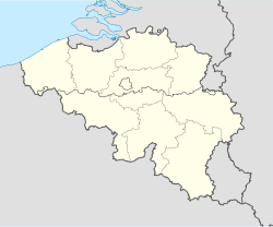
 Schilde
Coordinates: 51°14′N 04°34′E / 51.233°N 4.567°E Country Belgium Region Flemish Region Community Flemish Community Province Antwerp Arrondissement Antwerp Government – Mayor Yolande Avontroodt (VLD) – Governing party/ies VLD, CD&V Area – Total 35.99 km2 (13.9 sq mi) Population (1 January 2010)[1] – Total 19,496 – Density 541.7/km2 (1,403/sq mi) Postal codes 2970 Area codes 03 Website www.schilde.be Map of Schilde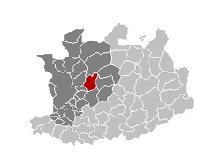
Schilde is a municipality located in the Belgian province of Antwerp. The municipality comprises the towns of Schilde proper and 's Gravenwezel. On January 1, 2006 Schilde had a total population of 19,575. The total area is 35.99 km² which gives a population density of 544 inhabitants per km². It has one of the highest per capita income levels in Flanders.
References
- ^ Population per municipality on 1 January 2010 (XLS; 221 KB)
External links
- (Dutch) Official website
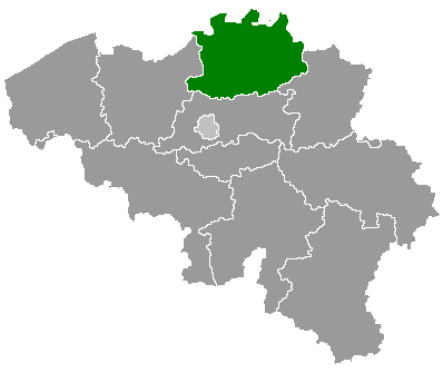
Antwerp Aartselaar · Antwerp · Boechout · Boom · Borsbeek · Brasschaat · Brecht · Edegem · Essen · Hemiksem · Hove · Kalmthout · Kapellen · Kontich · Lint · Malle · Mortsel · Niel · Ranst · Rumst · Schelle · Schilde · Schoten · Stabroek · Wijnegem · Wommelgem · Wuustwezel · Zandhoven · Zoersel · Zwijndrecht
Mechelen Berlaar · Bonheiden · Bornem · Duffel · Heist-op-den-Berg · Lier · Mechelen · Nijlen · Putte · Puurs · Sint-Amands · Sint-Katelijne-Waver · WillebroekTurnhout Arendonk · Baarle-Hertog · Balen · Beerse · Dessel · Geel · Grobbendonk · Herentals · Herenthout · Herselt · Hoogstraten · Hulshout · Kasterlee · Laakdal · Lille · Meerhout · Merksplas · Mol · Olen · Oud-Turnhout · Ravels · Retie · Rijkevorsel · Turnhout · Vorselaar · Vosselaar · WesterloCategories:- Municipalities of Antwerp
- Antwerp geography stubs


Wikimedia Foundation. 2010.