- Ohio State Route 558
-
State Route 558
Route information Maintained by ODOT Length: 15.74 mi[1] (25.33 km) Existed: 1938 – present Major junctions West end:  SR 45 near Salem
East end:  SR 170 in East Palestine
Location Counties: Columbiana Highway system Ohio highways
Interstates • U.S. Routes • State Routes←  SR 557
SR 559  →
→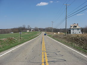 State Route 558 in Unity Township
State Route 558 is an approximately 16-mile (26 km) long, east–west running State highway located entirely in Columbiana County in northeast Ohio. The route runs through primarily rural sections of east-central Columbiana County. The western terminus is at State Route 45 between Salem and Lisbon, and the eastern terminus at State Route 170 in East Palestine. The eastern terminus is also the southern terminus of State Route 46.
Major intersections
The entire route is in Columbiana County.
Location Mile Destinations Notes Salem Township 0.00 SR 45Fairfield Township 4.94  SR 164
10.15  SR 517
SR 517 briefly joins from the southwest. 10.47  SR 7
SR 7
SR 517Western terminus of SR 517 Unity Township 12.56  SR 46
SR 46SR 46 joins from the north. East Palestine 15.74 SR 46
SR 170Southern terminus of SR 46 1.000 mi = 1.609 km; 1.000 km = 0.621 mi History
- 1938 – Original route established[2]; Originally routed from Salem to East Palestine along current Route 344 from Salem to 3 miles (4.8 km) east of Salem, an unnumbered road from 3 miles (4.8 km) east of Salem to 4 miles (6.4 km) east of Salem, and Route 558 from 4 miles (6.4 km) east of Salem to East Palestine[3].
- 1946 – Truncated at 3 miles (4.8 km) west of East Palestine[3].
- 1947 - Extended to East Palestine along Route 46[3].
- 1981 - Rerouted from 3 miles (4.8 km) east of Salem to 6 miles (9.7 km) north of Lisbon along previous Route 344[3].
References
- ^ Ohio Department of Transportation. "Technical Services Straight Line Diagrams". http://www.odotonline.org/techservapps/SLD/default.htm. Retrieved April 30, 2010.
- ^ Explanation of the Ohio State Highway System (The Unofficial Ohio State Highways Web Site) by John Simpson
- ^ a b c d Route 558 (The Unofficial Ohio State Highways Web Site) by John Simpson
Categories:- State highways in Ohio


Wikimedia Foundation. 2010.