Commercial Road (disambiguation) — Commercial Road is a road in London. Commercial Road may also refer to: Commercial road, Ooty, a roadway in Ooty, Tamil Nadu, India Commercial Road Primary School, a primary school in Morwell, Victoria, Australia Commercial Road, a roadway in… … Wikipedia
Lock (water transport) — Canal lock and lock keeper s cottage on the Aylesbury Arm of the Grand Union Canal at Marsworth in Hertfordshire, England … Wikipedia
Commercial Utility Cargo Vehicle — The Commercial Utility Cargo Vehicle or CUCV Program was instituted to provide the United States military with a cheaper Light Utility Vehicle to augment the purpose built, but expensive, Gama Goats and M151 series Jeeps approaching the end of… … Wikipedia
Camden Lock — Infobox Waterlock lock name = Hampstead Road Lock No 1 (Camden Lock) caption= Camden Lock waterway = Regent s Canal county = Camden Greater London maint = British Waterways operation = Manual first = latest = length = width = fall =… … Wikipedia
Frick's Lock, Pennsylvania — Frick s Lock is an abandoned village, along the also abandoned Schuylkill Canal, in the northeast portion of East Coventry Township, Chester County, Pennsylvania. This 18th century village outlasted the canal, being abandoned in the late 20th… … Wikipedia
Ice Road Truckers — Genre … Wikipedia
History of road transport — The history of road transport started with the development of tracks by humans and their beasts of burden. Early roads The first forms of road transport were horses, oxen or even humans carrying goods over tracks that often followed game trails,… … Wikipedia
Florida State Road 52 — Infobox road state=FL name notes= type=FL route=52 alternate name=Schrader Memorial Highway 21st Street Meridian Avenue length mi= length round= length ref= [http://www.dot.state.fl.us/planning/statistics/pdfs/fedaidreport.pdf FDOT Federal Aid… … Wikipedia
Marple Lock Flight — is a flight of sixteen canal locks, situated on the Peak Forest Canal in Marple, near Stockport. History Whilst the rest of the canal was opened to navigation by 1796, insufficient money was available to complete the necessary flight of locks to… … Wikipedia
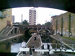
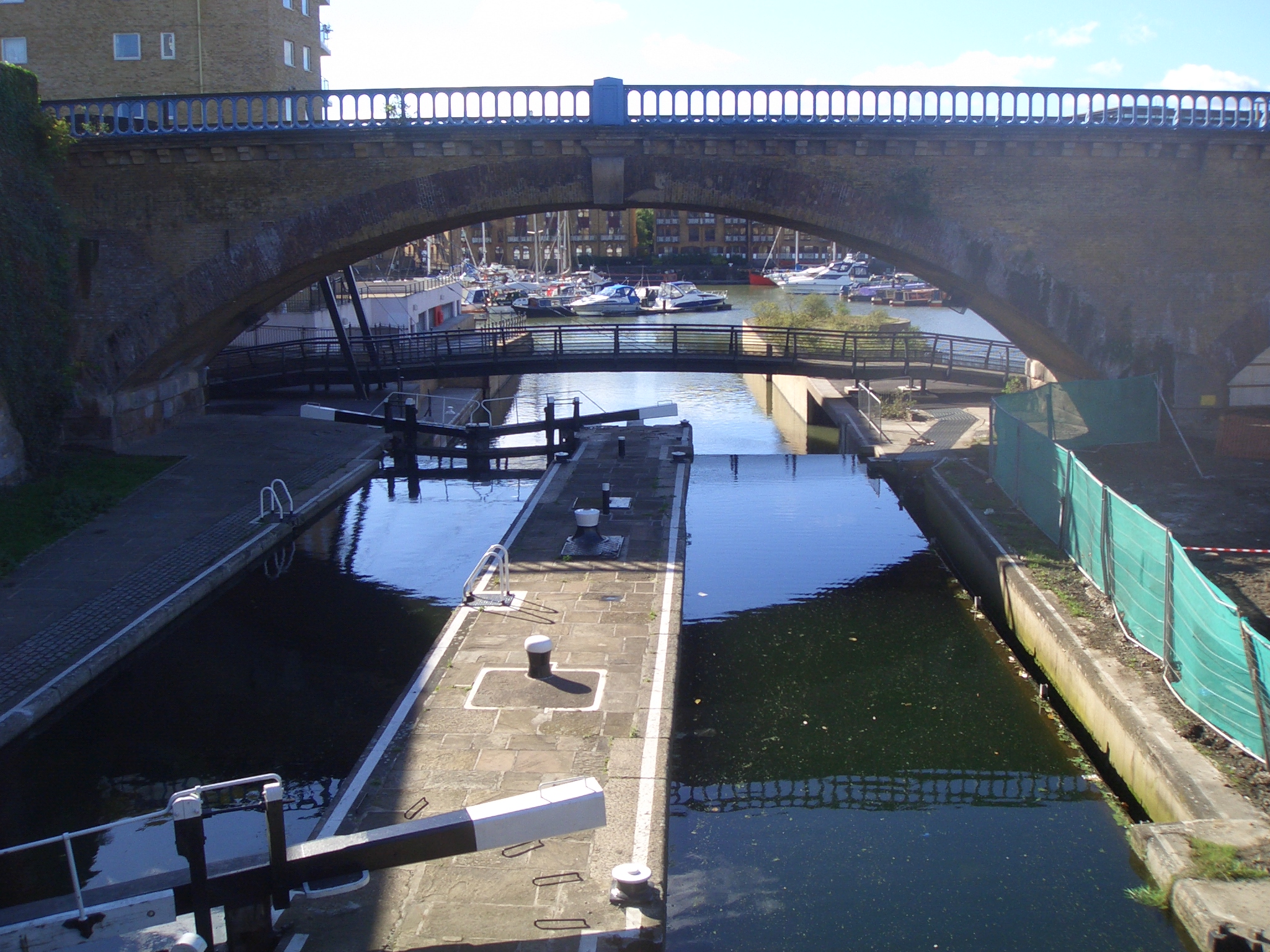
Limehouse Basin — The Limehouse Basin in Limehouse, in the London Borough of Tower Hamlets provides a navigable link between the Regent s Canal and the River Thames, through the Limehouse Basin Lock. A basin in the north of Mile End, near Victoria Park connects… … Wikipedia