- Oregon Route 210
-
For the unsigned Highway 210, see Corvallis-Lebanon Highway.
Oregon Route 210
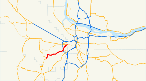
Route information Maintained by ODOT Length: 9.60 mi[citation needed] (15.45 km) Major junctions West end:  OR 219 in Scholls
 OR 217 in Beaverton
East end:  OR 141 in Beaverton
Highway system Oregon highways
Routes • Highways←  OR 207
OR 211  →
→Oregon Route 210 (also known as Scholls Ferry Road, or, more formally, the Scholls Highway No. 143 (see Oregon highways and routes)) is a state highway which runs between the community of Scholls, Oregon and the Raleigh Hills neighborhood west of Portland. It has become an important route for both commuters and agriculture through Washington County. Oregon Route 210 is signed from east-to-west; though in actuality it runs in a northeast-to-southwest direction.
Description
Oregon Route 210's western terminus is at the junction with Oregon Route 219 in the town of Scholls. The highway leaves Scholls headed due north-northeast (on a 2-lane, unlimited-access alignment), crossing the Tualatin River over a bridge which replaced the historic Scholls Ferry (for which the road is still named). Soon after, the route enters the town of Kinton. In Kinton there is a T-intersection with River Road; with Oregon Route 210 leaving the town towards the south and east, and River Road heading towards Hillsboro to the west. Heading east, the road winds through farmland (as well as a few wineries) in the fertile Tualatin Valley for several miles until its intersection with Roy Rogers Road.
Near the intersection with Roy Rogers Road (named for a Washington County official, not for the famous cowboy) which heads south towards Sherwood, Oregon Route 210 enters Portland's Urban Growth Boundary, and the farms and wineries are suddenly replaced with townhouses and subdivisions, and OR 210 transforms instantly into a suburban thoroughfare. A short distance further east, the highway passes on the edge of the Murrayhill neighborhood of Beaverton and becomes a four-lane divided expressway (one which is frequently clogged with rush-hour traffic). At this point, Oregon Route 210 becomes the boundary between Beaverton and the city of Tigard, with Beaverton to the north and Tigard to the south.
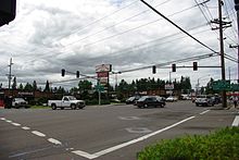
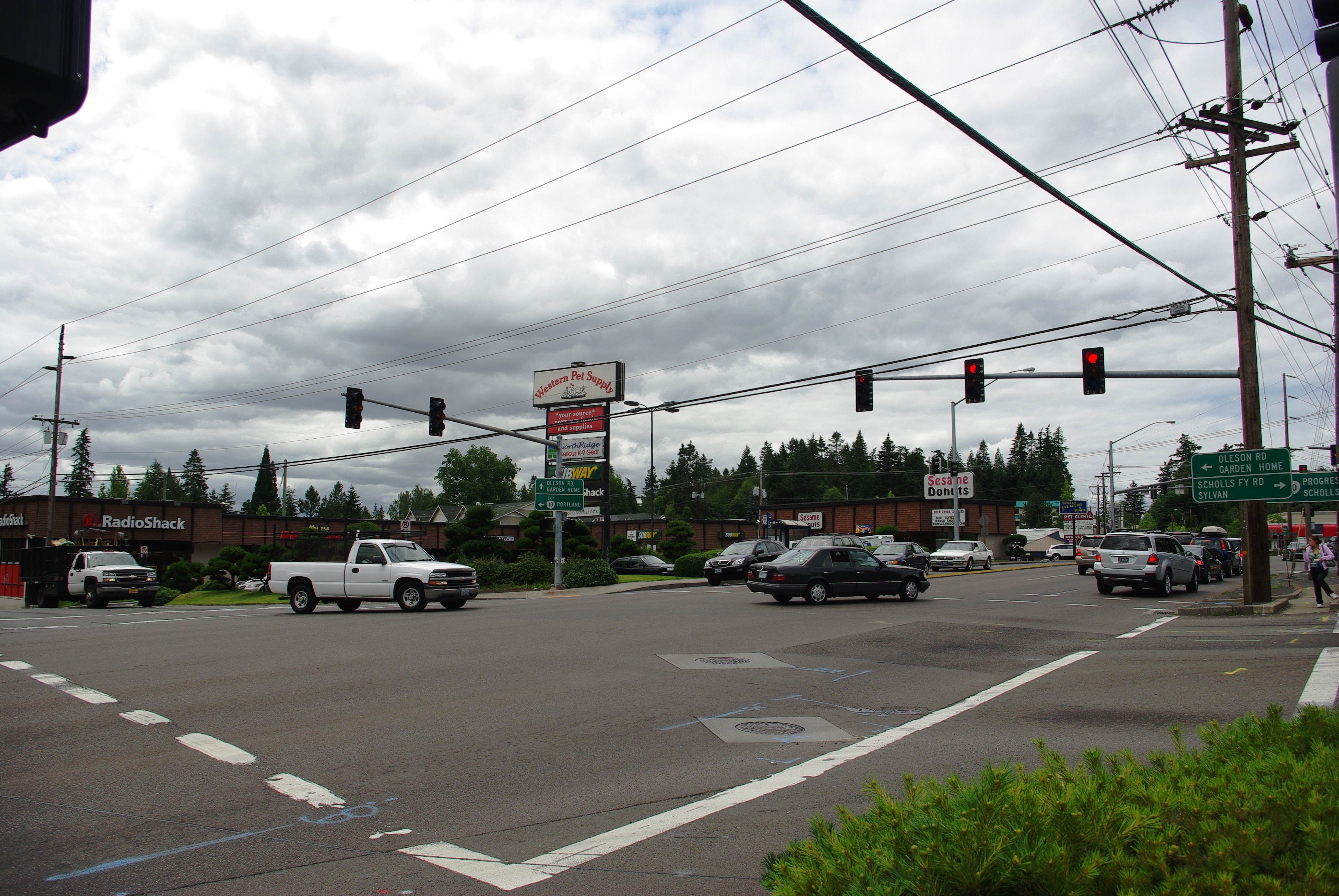
The highway continues east for several more miles in this fashion until its intersection with Oregon Route 217, a freeway serving Portland's southwestern suburbs. This intersection is frequently congested, as most traffic leaves OR 210 to get on OR 217 (generally heading north towards downtown Beaverton and Portland). Also nearby is the community of Progress and the Washington Square shopping mall, as well as Hall Boulevard, a major thoroughfare through Beaverton and Tigard.
North of Hall Boulevard, the road once again becomes a two-lane route as it ambles through several neighborhoods in unincorporated Washington County. It heads in a north-northeasterly direction until it reaches the Raleigh Hills neighborhood, where Oregon Route 210 ends at an intersection with Oregon Route 10, the Beaverton-Hillsdale Highway. Scholls Ferry Road continues in a northeasterly direction for several more miles until it intersects with Oregon Route 8 and U.S. Route 26 in the Sylvan neighborhood. This stretch used to be signed as Oregon Route 210 as well; but that designation was removed some years ago.
There are two other notable alignment changes over the years. In the segment between Raleigh Hills and Progress one can find a residential street called "Old Scholls Ferry Road"; this was an older alignment of the highway. South of the Murrayhill neighborhood is a street called Barrows Road; this also was an old alignment of OR 210 before the new alignment through Murrayhill was constructed in the late 80s or early 90s. (For a while after the new roadway was built, Barrows Road continued to be signed as 210; however it no longer carries this designation). The current alignment, which goes over a hill, was actually the original alignment of the highway; sometime before 1960 the highway was rerouted to a longer but more level route along what is now called Barrows Road. At that time the "new" level route became Scholls Ferry Road, signed as OR 210, and the original route was renamed Old Scholls Ferry Road. In the 1990s Old Scholls Ferry Road regained its designation as OR 210 and the Barrows Road name was applied to the former route.
 Highway at Oregon Route 10 in Raleigh Hills
Intersections with other highways
- Oregon Route 219 in Scholls
- Oregon Route 217 at the boundary between Beaverton and Tigard
- Oregon Route 10 in Raleigh Hills.
Categories:- State routes in Oregon
- Transportation in Washington County, Oregon


Wikimedia Foundation. 2010.