Nahapetavan

Nahapetavan

Coordinates: 40°36′N 44°01′E / 40.6°N 44.017°E / 40.6; 44.017

Nahapetavan
Նահապետավան
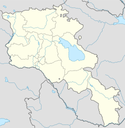
Nahapetavan is located in Armenia
Nahapetavan
Coordinates: 40°36′N 44°01′E / 40.6°N 44.017°E / 40.6; 44.017
Country Armenia
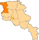
Marz (Province) Shirak
Population (2001)
 - Total 817
Time zone   (UTC+4)
 - Summer (DST)   (UTC+5)

Nahapetavan (Armenian: Նահապետավան, also Romanized as Nagapetavan; until 1935, Khachakilisa, from 1935 to 1961, Paros) is a town in the Shirak Province of Armenia. The town was renamed in 1961 in honor of Nagapet (or Nahapet) Kurghinian, a participant in the Bolshevik uprising in May 1920.[1]

References

  1. ^ Kiesling, Rediscoving Armenia, p. 77, available online at the US embassy to Armenia's website

Wikimedia Foundation. 2010.

Игры ⚽ Нужно сделать НИР?

Look at other dictionaries:

  • Nahapetavan — 40° 36′ 00″ N 44° 01′ 00″ E / 40.6, 44.016667 …   Wikipédia en Français

  • Artik — Coordinates: 40°37′02″N 43°58′33″E / 40.61722°N 43.97583°E / 40.61722; 43.97583 …   Wikipedia

  • Maralik — For the village in Azerbaijan, see Mərəlik. Maralik Մարալիկ Rublyovka quarter in Maralik …   Wikipedia

  • Akhuryan — For the river of Armenia and Turkey, see Akhurian River. Akhuryan Ախուրյան   community   …   Wikipedia

  • Pemzashen — Coordinates: 40°35′36″N 43°56′24″E / 40.59333°N 43.94°E / 40.59333; 43.94 …   Wikipedia

  • Arapi, Armenia — Arapi Առափի   community   …   Wikipedia

  • Beniamin — Բենիամին   community   …   Wikipedia

  • Berdashen — For the village in Nagorno Karabakh, see Berdashen (Nagorno Karabakh). Berdashen Բերդաշեն   community   …   Wikipedia

  • Dzorashen — For the other town named Dzorashen in Shirak Province, see Dzorashen (Maralik); for the town in Syunik Province, see Hartashen, Syunik. Coordinates: 40°55′53″N 44°04′09″E / 40.9313 …   Wikipedia

  • Getk — For the villages in Azerbaijan, see Chaylu. Getk Գետք   community   …   Wikipedia

Share the article and excerpts

Direct link
Do a right-click on the link above
and select “Copy Link”