Mets Sariar

Mets Sariar

Coordinates: 40°53′36″N 43°57′09″E / 40.89333°N 43.9525°E / 40.89333; 43.9525

Mets Sariar
Մեծ Սարիար
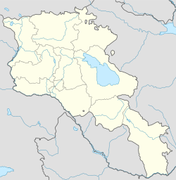
Mets Sariar is located in Armenia
Mets Sariar
Coordinates: 40°53′36″N 43°57′09″E / 40.89333°N 43.9525°E / 40.89333; 43.9525
Country Armenia
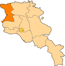
Marz (Province) Shirak
Population (2001)
 – Total 379
Time zone   (UTC+4)
 – Summer (DST)   (UTC+5)

Mets Sariar (Armenian: Մեծ Սարիար; also Russified as Sariar Bol’shoy) is a town in the Shirak Province of Armenia.

References


Wikimedia Foundation. 2010.

Игры ⚽ Поможем решить контрольную работу

Look at other dictionaries:

  • Mets Sariar — 40° 53′ 36″ N 43° 57′ 09″ E / 40.893333, 43.9525 …   Wikipédia en Français

  • Sariar — may refer to: *Apaven, Armenia *Mets Sariar, Armenia *Pokr Sariar, Armenia …   Wikipedia

  • Mets Mantash — Coordinates: 40°38′58″N 44°03′03″E / 40.64944°N 44.05083°E / 40.64944; 44.05083 …   Wikipedia

  • Mets Sepasar — Coordinates: 41°02′57″N 43°49′24″E / 41.04917°N 43.82333°E / 41.04917; 43.82333 …   Wikipedia

  • Mets Sepasar — 41° 02′ 57″ N 43° 49′ 24″ E / 41.049167, 43.823333 …   Wikipédia en Français

  • Pokr Sariar — 40° 55′ 33″ N 44° 01′ 07″ E / 40.925833, 44.018611 …   Wikipédia en Français

  • List of municipalities of Armenia — Map of Armenia The Municipalities of Armenia are referred to as communities (համայնքներ hamaynkner, singular համայնք hamaynk ). Each community is self governing and consists of one or more settlements (bnakavayrer, singular bnakavayr).… …   Wikipedia

  • Akhuryan — For the river of Armenia and Turkey, see Akhurian River. Akhuryan Ախուրյան   community   …   Wikipedia

  • Berdashen — For the village in Nagorno Karabakh, see Berdashen (Nagorno Karabakh). Berdashen Բերդաշեն   community   …   Wikipedia

  • Keti, Armenia — Coordinates: 40°53′03″N 43°50′56″E / 40.88417°N 43.84889°E / 40.88417; 43.84889 …   Wikipedia

Share the article and excerpts

Direct link
Do a right-click on the link above
and select “Copy Link”