- Nastapoka arc
-
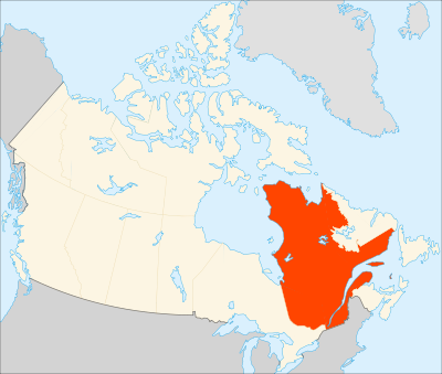 The Nastapoka arc is shown near the top, left portion of the province of Quebec (in red).
The Nastapoka arc is a geological feature located on the southeastern shore of Hudson Bay, Canada. It is a near-perfectly circular arc, covering more than 160° of a 450 km diameter circle. Due to its shape, the arc has long been suspected as the remnant of an ancient impact crater.[1] In August 1972, Dr. Robert S. Deitz and J. Paul Barringer conducted extensive search of much of the Nastapoka arc by Indian and Eskimo canoes and fishing boat in an investigation of its impact origin. They examined the abundant and extensive rock exposures that occur within the region of the Nastapoka arc and found a complete lack of shatter cones, suevite-type or other unusual melt rocks, pseudotachylite or mylonite, radial faults or fractures, unusual injection breccias, or any other evidence of shock metamorphism.[2] More commonly, it is regarded to be an arcuate boundary, which was created during the Trans-Hudson orogeny, of tectonic origin between the Belcher Fold Belt and granitic rocks of the Superior Craton.[3][4]
References
- ^ Beals, C.S. (1968) On the possibility of a catastrophic origin for the great arc of eastern Hudson Bay. in C.S. Beals, ed., pp. 985-999, Science, history and Hudson Bay, vol. 2. Ottawa, Ontario, Canada Department of Energy, Mines and Resources.
- ^ Dietz, R.S., and J.P. Barringer (1973) Hudson Bay Arc as an Astrobleme: a Negative Search. Meteoritics. 8:28–29.
- ^ Eaton, D.W., and F. Darbyshire (2010) Lithospheric architecture and tectonic evolution of the Hudson Bay region. Tectonophysics. v. 480, pp. 1–22.
- ^ Hynes, A.J. (1991) The gravity field of eastern Hudson Bay: Evidence for a flexural origin for the Hudson Bay (Nastapoka) arc? Tectonics. 10:722–728.
Coordinates: 56°50′N 78°20′W / 56.833°N 78.333°W
Categories:- Hudson Bay
- Geology of Quebec
- Canadian geology stubs
- Quebec geography stubs

Wikimedia Foundation. 2010.