- Willard, Kansas
Infobox Settlement
official_name = Willard, Kansas
settlement_type =City
nickname =
motto =
imagesize =
image_caption =
image_
imagesize =
image_caption =
image_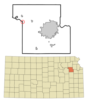
mapsize = 250px
map_caption = Location of Willard, Kansas
mapsize1 =
map_caption1 =subdivision_type = Country
subdivision_name =United States
subdivision_type1 = State
subdivision_name1 =Kansas
subdivision_type2 = Counties
subdivision_name2 = Shawnee, Wabaunsee
government_footnotes =
government_type =
leader_title =
leader_name =
leader_title1 =
leader_name1 =
established_title =
established_date =unit_pref = Imperial
area_footnotes =area_magnitude =
area_total_km2 = 0.3
area_land_km2 = 0.3
area_water_km2 = 0.0
area_total_sq_mi = 0.1
area_land_sq_mi = 0.1
area_water_sq_mi = 0.0population_as_of = 2000
population_footnotes =
population_total = 86
population_density_km2 = 311.4
population_density_sq_mi = 806.5timezone = Central (CST)
utc_offset = -6
timezone_DST = CDT
utc_offset_DST = -5
elevation_footnotes =
elevation_m = 281
elevation_ft = 922
latd = 39 |latm = 5 |lats = 38 |latNS = N
longd = 95 |longm = 56 |longs = 36 |longEW = Wpostal_code_type =
postal_code =
area_code =
blank_name = FIPS code
blank_info = 20-79250GR|2
blank1_name = GNIS feature ID
blank1_info = 0478649GR|3
website =
footnotes =Willard is a city in Shawnee and Wabaunsee counties in the
U.S. state ofKansas . The population was 86 at the 2000 census. It is part of theTopeka, Kansas Metropolitan Statistical Area.History
Before 1883, Willard was not much of a town but when the
Rock Island Railroad laid tracks through the community, Willard became the typical railroad town. In the early 1920s, Willard boasted a population of over 300 and was a major cattle shipping point for this region. During the 1930s many businesses closed, the railroad became less important and, finally, in 1951, a flood destroyed much of the town and caused the bridge over theKansas River collapsed isolating the town from surrounding communities.Geography
Willard is located at coor dms|39|5|38|N|95|56|36|W|city (39.093917, -95.943334)GR|1.
According to the
United States Census Bureau , the city has a total area of 0.1square mile s (0.3km² ).None of the area is covered with water.Demographics
As of the
census GR|2 of 2000, there were 86 people, 38 households, and 22 families residing in the city. Thepopulation density was 806.5 people per square mile (301.9/km²). There were 50 housing units at an average density of 468.9/sq mi (175.5/km²). The racial makeup of the city was 97.67% White, 1.16% Native American, 1.16% from other races. Hispanic or Latino of any race were 8.14% of the population.There were 38 households out of which 28.9% had children under the age of 18 living with them, 50.0% were married couples living together, 7.9% had a female householder with no husband present, and 42.1% were non-families. 36.8% of all households were made up of individuals and 10.5% had someone living alone who was 65 years of age or older. The average household size was 2.26 and the average family size was 3.09.
In the city the population was spread out with 27.9% under the age of 18, 2.3% from 18 to 24, 30.2% from 25 to 44, 24.4% from 45 to 64, and 15.1% who were 65 years of age or older. The median age was 44 years. For every 100 females there were 100.0 males. For every 100 females age 18 and over, there were 87.9 males.
The median income for a household in the city was $24,500, and the median income for a family was $35,000. Males had a median income of $22,813 versus $19,375 for females. The
per capita income for the city was $16,513. There were no families and 5.7% of the population living below thepoverty line , including no under eighteens and 9.1% of those over 64.References
"Faded Dreams: More Ghost Towns of Kansas" by Daniel Fitzgerald. University Press of Kansas, 1994. External links
Wikimedia Foundation. 2010.