- Dolores, Quezon
-
Dolores — Municipality — Map of Quezon showing the location of Dolores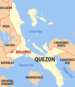 Location in the Philippines
 Dolores
Coordinates: 14°5′39″N 121°19′53″E / 14.09417°N 121.33139°ECoordinates: 14°5′39″N 121°19′53″E / 14.09417°N 121.33139°E Country  Philippines
Region CALABARZON (Region IV) Province Quezon District 2nd district of Quezon Founded Barangays 16 Government - Mayor Renato Alilio (LP) Area - Total 71.0 km2 (27.4 sq mi) Population (2007) - Total 26,312 - Density 370.6/km2 (959.8/sq mi) Time zone PST (UTC+8) ZIP code Income class 5th class Dolores is a 5th class municipality in the province of Quezon, Philippines. According to the 2007 census, it has a population of 26,312.[1]
Contents
Government
Barangays
Dolores is politically subdivided into 16 barangays.
- Antonino (Ayusan)
- Bagong Anyo (Pob.)
- Bayanihan (Pob.)
- Bulakin I
- Bungoy
- Cabatang
- Dagatan
- Kinabuhayan
- Maligaya (Pob.)
- Manggahan
- Pinagdanlayan
- Putol
- San Mateo
- Santa Lucia
- Silanganan (Pob.)
- Bulakin II
Notes
- ^ "2007 Census of Population". Philippine National Statistics Office. http://www.census.gov.ph/data/census2007/index.html. Retrieved 2008-10-04.
External links
- Philippine Standard Geographic Code
- 2000 Philippine Census Information
- newsinfo.inquirer.net, Army rescues 16 stranded mountaineers in Quezon 2 airlifted to Solcom hospital
Municipalities Agdangan • Alabat • Atimonan • Buenavista • Burdeos • Calauag • Candelaria • Catanauan • Dolores • General Luna • General Nakar • Guinayangan • Gumaca • Infanta • Jomalig • Lopez • Lucban • Macalelon • Mauban • Mulanay • Padre Burgos • Pagbilao • Panukulan • Patnanungan • Perez • Pitogo • Plaridel • Polillo • Quezon • Real • Sampaloc • San Andres • San Antonio • San Francisco • San Narciso • Sariaya • Tagkawayan • Tiaong • UnisanComponent city Highly urbanized city Lucena
(Administratively independent from the province, but grouped under Quezon by the National Statistics Office)Categories:- Municipalities of Quezon


Wikimedia Foundation. 2010.