- Central Nebraska Regional Airport
Infobox Airport
name = Central Nebraska Regional Airport
nativename =
nativename-a =
nativename-r =
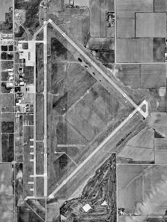
image-width =
caption =
IATA = GRI
ICAO = KGRI
type = Public
owner =
operator = Hall County Airport Authority
city-served =
location = Grand Island, Nebraska
elevation-f = 1,847
elevation-m = 563
coordinates = Coord|40|58|03|N|98|18|34|W|type:airport|display=inline,title
website =
metric-elev =
metric-rwy =
r1-number = 17/35
r1-length-f = 7,002
r1-length-m = 2,134
r1-surface =Asphalt
r2-number = 13/31
r2-length-f = 6,608
r2-length-m = 2,014
r2-surface =Concrete
stat-year =
stat1-header =
stat1-data =
stat2-header =
stat2-data =
footnotes =Central Nebraska Regional Airport Airport codes|GRI|KGRI is a public
airport located three miles (5 km) northeast of thecentral business district (CBD) of Grand Island, a city in Hall County,Nebraska , USA. The airport covers convert|2435|acre|ha|0|lk=on and has tworunway s. It is served by one commercial airline, with service subsidized by theEssential Air Service program.Air Midwest , operating asUS Airways Express , commenced service onOctober 29 ,2006 , with two daily flights to Omaha Eppley Airfield and one daily flight toKansas City International Airport . Air Midwest ended service in May 2008, andIsland Air planned to take over service, but then backed out. An airline has yet to be selected to replace the lost service.Central Nebraska Regional Airport was selected to be the site of a new Chinook Helicopter Base. The
Nebraska National Guard has been on site since 2004, with ground scheduled to be broken in 2006 and the base opening in 2008.History
During
World War II the airport was known as Grand Island Army Airfield, and it was one of elevenUnited States Army Air Force training bases inNebraska duringWorld War II . The base was under the command ofSecond Air Force Headquarters,Colorado Springs ,Colorado .The base's primary mission was to train pilots and aircrews of Boeing B-29 Superfortreses prior to their deployment to the South Pacific.
Known units that trained at Grand Island AAF were:
* 6th Bombardment Group (18 May -
19 November 1944 )
Deployed toTwentieth Air Force , Tinian (B-29)
* 502d Bombardment Group (26 September 1944 -7 April 1945 )
Deployed toTwentieth Air Force , Guam (B-29)
* 449th Bombardment Group (8 September 1945 -4 August 1946 )
B-29 Group assigned toStrategic Air Command at Grand Island. Deactivated.
* 28th Bombardment Group (4 August 1946 -6 October 1946 )
Redesignated from 449th Bomb Group, transferred to Elmendorf AAF Alaska.Wartime groups that deactivated at Grand Island AAF were:
* 376th Bombardment Group (25 June -
10 November 1945 )
Returned fromFifteenth Air Force , Italy (B-24)The 242nd (Operational Training Unit, Very Heavy) of the 17th Bombardment Training Wing commanded the support elements at Grand Island AAF as part of Air Technical Service Command.
With the departure of the B-29s in late 1946, the USAAF closed Grand Island Army Airfield and the facility was turned over to local authorities to develop as a civil airport. However the military use of the base did not end entirely. During the 1960s, Grand Island Regional Airport was utilized by Convair F-106 Delta Darts of the 328th Fighter Wing, 326th FIS (Air Defense) of
Aerospace Defense Command as a dispersal base. These aircraft were deployed fromRichards-Gebaur Air Force Base outside ofKansas City, Missouri . These dispersal flights ended in 1968.Airlines and destinations
*
Allegiant Air (Las Vegas)See also
*
Second Air Force
*United States Army Air Force
*Nebraska World War II Army Airfields References
* [http://www.flygri.com/ Central Nebraska Regional Airport] (official web site)
* [http://armyairforces.com ArmyAirForces.Com]
* Maurer Maurer, "Air Force Combat Units Of World War II", Office of Air Force History, 1983
*FAA-airport|ID=GRI|use=PU|own=PU|site=12743.*A
*Notes:External links
* [http://maps.google.com/maps?q=Grand+Island,+NE&ie=UTF8&z=14&ll=40.968234,-98.309011&spn=0.027868,0.082741&t=k&om=1 Central Nebraska Regional Airport on Google Earth]
*FAA-diagram|00173
Wikimedia Foundation. 2010.