- Cheadle Bulkeley
-
Coordinates: 53°23′36″N 2°12′41″W / 53.3933°N 2.2113°W
Cheadle Bulkeley 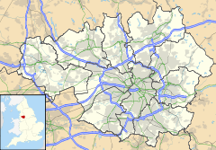
 Cheadle Bulkeley
Cheadle Bulkeley shown within Greater ManchesterMetropolitan borough Stockport Metropolitan county Greater Manchester Region North West Country England Sovereign state United Kingdom Police Greater Manchester Fire Greater Manchester Ambulance North West EU Parliament North West England List of places: UK • England • Greater Manchester Cheadle Bulkeley is a former township in Greater Manchester, England. It lay in the historic county of Cheshire.
Geography
Cheadle Bulkeley covered the rural area that includes parts of modern-day Cheadle.
It was bordered to the west by Stockport Etchells, to the north by Heaton Norris, to the east by Stockport and to the south by Cheadle Moseley and Bramhall.
A 19th century map shows Cheadle Bulkeley in two separate parts, with a northern spur of Cheadle Moseley cutting it in half.[1]
History
Cheadle Bulkeley existed as a township from the Middle Ages until 1894, when it was merged with the townships of Cheadle Moseley and Stockport Etchells to form the Cheadle and Gatley Urban District, finally becoming part of the Metropolitan Borough of Stockport in 1974.[2]
References
- ^ Arrowsmith, Peter (1997). Stockport : a history. Stockport: Stockport Metropolitan Borough Council. ISBN 0-905164-99-7.
- ^ Shercliff, W H (1974). Wythenshawe : A History of the Townships of Northenden, Northen Etchells and Baguley Volume 1 to 1926. Didsbury: E J Morten (Publishers). ISBN 0-85972-008-X.
Categories:- History of Cheshire
- Geography of Stockport
- Greater Manchester geography stubs

Wikimedia Foundation. 2010.