- Northen Etchells
-
Coordinates: 53°23′18″N 2°15′21″W / 53.3884°N 2.2558°W
Northen Etchells 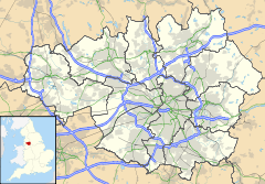
 Northen Etchells
Northen Etchells shown within Greater ManchesterMetropolitan borough City of Manchester Metropolitan county Greater Manchester Region North West Country England Sovereign state United Kingdom Police Greater Manchester Fire Greater Manchester Ambulance North West EU Parliament North West England List of places: UK • England • Greater Manchester Northen Etchells (sometimes spelled 'Northern Etchells' on maps) is a former township in Greater Manchester, England. It lay in the historic county of Cheshire.
In its name, "Northen" is an old name for Northenden, and "Etchells" came from Anglo-Saxon ēcels = "land added to an estate".
Geography
Northen Etchells covered the rural area that includes much of modern-day Wythenshawe. As late as 1872, Northen Etchells was a township of moderately-sized farms and clusters of labourers' cottages around Hey Head, Moss Nook, Poundswick, Sharston, Crossacres and Brownlow Green.
To the north of Northen Etchells was the township of Northenden. Stockport Etchells lay to the east, Styal to the south with Baguley and Altrincham townships to the west.[1]
History
Northen Etchells existed as a township from the Middle Ages until 1894.
Northen Etchells and Stockport Etchells were collectively called Etchells and often administered together from the 16th to 18th centuries.
Northen Etchells ceased to exist as an administrative body in 1894. Cheshire County Council was created (along with 61 others) in 1888. In 1894 Rural District Councils and Parish Councils replaced the old townships. Northen Etchells became part of Bucklow Rural District Council, electing one councillor to the council.[1]
References
Categories:- History of Cheshire
- History of Manchester
- Greater Manchester geography stubs

Wikimedia Foundation. 2010.