- Church Eaton
-
Coordinates: 52°45′26″N 2°13′18″W / 52.7573°N 2.2217°W
Church Eaton 
Church Eaton.
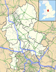
 Church Eaton shown within Staffordshire
OS grid reference SJ847175 Shire county Staffordshire Region West Midlands Country England Sovereign state United Kingdom Police Staffordshire Fire Staffordshire Ambulance West Midlands EU Parliament West Midlands List of places: UK • England • Staffordshire Church Eaton is a small English village in the west of Staffordshire lying some 6 miles (10 km) southwest of Stafford, 6 miles (10 km) northwest of Penkridge and just 4 miles (6 km) from the Shropshire border. It lies in gently rolling dairy farming countryside. The hamlet of Wood Eaton lies to its northwest.
Church
The village church dedicated to Saint Editha [1]largely dates from the 12th century, having a square west tower with a spire, a large '7-light' east window of fine stained glass depicting scenes from the life of Christ,[2] and "the broken and repaired remains of an elaborate early 12th century font, closely related to the font at Bradley,"[3] and that at Lilleshall, except that the font at Bradley[4] is in much better condition. Pevsner also states that these fonts were all made at Gnosall.
Church Eaton also has a successful cricket club. Playing in Division 2 of the Staffs Club Cricket Championship.
The one and only public house in the village is The Royal Oak[5].
References
- ^ Image of St Editha's, Church Eaton
- ^ The East window, St Editha's, Church Eaton
- ^ N. Pevsner, The Buildings of England: Staffordshire, Harmondsworth, 1974, p.104 & pp.135-36
- ^ Photograph of the Norman Font in Bradley Church
- ^ Church Eaton website
External links
 Media related to Church Eaton at Wikimedia CommonsCategories:
- Stafford
- Villages in Staffordshire
Wikimedia Foundation. 2010.

