- Ohtamış
-
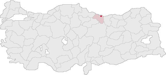
Ohtamış — Town — Location of Ohtamış within Turkey.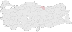
Coordinates: 40°52′N 37°44′E / 40.867°N 37.733°ECoordinates: 40°52′N 37°44′E / 40.867°N 37.733°E Country  Turkey
Region Black Sea Province Ordu Elevation 602 m (1,975 ft) Population – Total 1,570 Time zone EET (UTC+2) – Summer (DST) EEST (UTC+3) Postal code 52 Area code(s) 0452 Licence plate 52 Ohtamış is a village in the Ordu Province of Turkey. The village is located in the Ulubey district, approximately 21 km south of the Black Sea. The village had a population of 1,570 as of the year 2000.[1]
References
- ^ "Ohtamış Köyü". Local Government Research and Training Centre of The Public Administration Institute for Turkey and the Middle East. http://www.yerelnet.org.tr/iller/koy.php?koyid=257052. Retrieved 2008-06-05.[dead link](Turkish)
Categories:- Ordu Province
- Turkey geography stubs
Wikimedia Foundation. 2010.