- Crackpot, North Yorkshire
-
For Crackpot Hall, see Keld, North Yorkshire.
Coordinates: 54°21′54″N 2°02′33″W / 54.36503°N 2.04257°W
Crackpot 
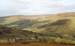
Looking down into Swaledale from above Crackpot
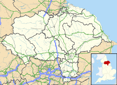
 Crackpot shown within North Yorkshire
OS grid reference SD973966 District Richmondshire Shire county North Yorkshire Region Yorkshire and the Humber Country England Sovereign state United Kingdom Post town RICHMOND Postcode district DL11 Police North Yorkshire Fire North Yorkshire Ambulance Yorkshire EU Parliament Yorkshire and the Humber List of places: UK • England • Yorkshire Crackpot is a village in Swaledale, North Yorkshire, England.
Its name derives from the Old English kraka (a crow) and the Viking word pot (usually a cavity or deep hole often in the bed of a river, but in Crackpot's case it refers to a rift in the limestone).[1]
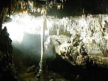
Crackpot Cave
Crackpot Cave is located south of Crackpot in Scurvey Scar. It contains a fine example of a column - where a stalactite has joined up with its stalagmite. To get to it you have to pass along the aptly named Knee-wrecker Passage.
References
- ^ Olmert, Michael (1996). Milton's Teeth and Ovid's Umbrella: Curiouser & Curiouser Adventures in History, p.238. Simon & Schuster, New York. ISBN 0684801647.
External links
This Richmondshire location article is a stub. You can help Wikipedia by expanding it. This caving-related article is a stub. You can help Wikipedia by expanding it.


