Puszcza Solska Landscape Park
- Puszcza Solska Landscape Park
-
| Puszcza Solska Landscape Park |
| Park Krajobrazowy Puszczy Solskiej |
|
IUCN Category V (Protected Landscape/Seascape)
|

Nad Tanwią nature reserve |
| Location |
Eastern Poland |
| Area |
289.80 km² |
| Established |
1988 |
Puszcza Solska Landscape Park (Park Krajobrazowy Puszczy Solskiej) is a protected area (Landscape Park) in eastern Poland, established in 1988, and covering an area of 289.80 square kilometres (111.89 sq mi).

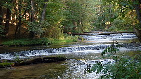
Szum River dam in Solska Wilderness
The Park is shared between two Polish voivodeships: Lublin and Subcarpathian Voivodeship. Within the Lublin Voivodeship it lies in Biłgoraj County (Gmina Aleksandrów, Gmina Józefów, Gmina Łukowa, Gmina Obsza) and Tomaszów Lubelski County (Gmina Susiec). Within the Subcarpathian Voivodeship it lies in Lubaczów County (Gmina Cieszanów, Gmina Narol).
Inside the Landscape Park are several nature reserves including: Czartowe Pole, Nad Tanwią, Szum, Bukowy Las, Obary, and Przecinka; as well as three separate and protected zones.
See also
- Special Protection Areas in Poland
References
Categories:
- IUCN Category V
- Landscape parks in Poland
- Lublin geography stubs
- Polish protected area stubs
Wikimedia Foundation.
2010.
Look at other dictionaries:
List of Landscape Parks of Poland — This is a list of the protected areas in Poland designated as Landscape Parks ( Parki Krajobrazowe ). They are listed here with their English and Polish names and with the names of the voivodeships in which they are situated.# Barlinek Gorzów… … Wikipedia
Lublin Voivodeship — Infobox Settlement name = Lublin Voivodeship native name=Województwo lubelskie settlement type= image shield = POL województwo lubelskie COA.svg map caption = Location within Poland map caption1 = Division into counties subdivision type=Country… … Wikipedia
Subcarpathian Voivodeship — Infobox Settlement name = Subcarpathian Voivodeship native name=Województwo podkarpackie settlement type= image shield = POL województwo podkarpackie COA.svg map caption = Location within Poland map caption1 = Division into counties subdivision… … Wikipedia
Gmina Józefów — Infobox Settlement name = Gmina Józefów other name = Józefów Commune settlement type = Gmina total type = Total image shield = POL Józefów COA.svg subdivision type = Country subdivision name = POL subdivision type1 = Voivodeship subdivision name1 … Wikipedia
Gmina Susiec — Infobox Settlement name = Gmina Susiec other name = Susiec Commune settlement type = Gmina total type = Total image shield = subdivision type = Country subdivision name = POL subdivision type1 = Voivodeship subdivision name1 = Lublin subdivision… … Wikipedia
Gmina Narol — Narol Commune Gmina … Wikipedia
Gmina Aleksandrów, Lublin Voivodeship — Infobox Settlement name = Gmina Aleksandrów other name = Aleksandrów Commune settlement type = Gmina total type = Total image shield = map caption = Location within the county and voivodeship subdivision type = Country subdivision name = POL… … Wikipedia
Gmina Łukowa — Infobox Settlement name = Gmina Łukowa other name = Łukowa Commune settlement type = Gmina total type = Total image shield = subdivision type = Country subdivision name = POL subdivision type1 = Voivodeship subdivision name1 = Lublin subdivision… … Wikipedia
Gmina Obsza — Obsza Commune Gmina Coordinates (Obsza) … Wikipedia
Gmina Cieszanów — Cieszanów Commune Gmina … Wikipedia


