Ashwell and Morden railway station — Infobox UK station name = Ashwell and Morden code = AWM manager = First Capital Connect locale = Odsey borough = South Cambridgeshire lowusage0405 = 98,481 lowusage0506 = 96,452 lowusage0607 = 108,013 platforms = 2 start = 6 February 1977Ashwell… … Wikipedia
Hertfordshire — Not to be confused with Herefordshire. Hertfordshire Flag of Hertfordshire Motto of County Council: Trust and fear not … Wikipedia
History of Hertfordshire — Hertfordshire was originally the area assigned to a fortress constructed at Hertford under the rule of Edward the Elder in 913. The name Hertfordshire appears in the Anglo Saxon Chronicle in 1011.Most English counties have nicknames for people… … Wikipedia
Therfield — infobox UK place country = England latitude= 52.0163 longitude= 0.0575 official name= Therfield population= 539 shire district= North Hertfordshire shire county = Hertfordshire region= East of England constituency westminster= North East… … Wikipedia
Ashwell, Hertfordshire — infobox UK place country = England latitude= 52.04217 longitude= 0.15699 official name= Ashwell population= 1,660 shire district= North Hertfordshire shire county = Hertfordshire region= East of England constituency westminster= North East… … Wikipedia
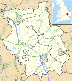
Guilden Morden — Infobox UK place official name= Guilden Morden country= England region= East of England os grid reference= TL279442 latitude= 52.081 longitude= 0.133 post town= postcode area= postcode district= dial code= shire county= Cambridgeshire population … Wikipedia
List of hundreds of England and Wales — This is a list of hundreds of England and Wales. Most English counties were divided into hundreds from the late Saxon period and they were effectively abolished under the Local Government Act of 1894.Fact|date=February 2007 In some areas,… … Wikipedia
Herbert Fordham — Sir Herbert George Fordham (9 May 1854 –1929), was a writer on cartography whose Carto Bibliography method of cataloging maps was widely adopted. He was the benefactor of the Fordham collection housed by the Royal Geographical Society one of the… … Wikipedia
List of Grade I listed buildings in Cambridgeshire — There are over 6000 Grade I listed buildings in England. This page is a list of these buildings in the county of Cambridgeshire, sub divided by district.Cambridge* Church of St Andrew, Cambridge * Little Trinity, Cambridge * Little Trinity:… … Wikipedia
Bontoc (Mountain Province) — Municipality of Bontoc Lage von Bontoc in der Provinz Mountain Province Basisdaten Bezirk … Deutsch Wikipedia
 Odsey
Odsey Media related to Odsey at Wikimedia CommonsCategories: