- U.S. Route 99
-
U.S. Route 99
Route information Existed: 1926 – 1964 Major junctions South end: U.S./Mexico border in Calexico, CA North end: U.S./Canada border in Blaine, WA (BC 99) Highway system United States Numbered Highways
List • Bannered • Divided • ReplacedUnited States Numbered Highways
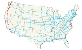
List • Bannered • Divided • ReplacedU.S. Route 99 was the main north–south highway on the West Coast of the United States until 1964, running from Calexico, California, on the U.S.-Mexico border to Blaine, Washington, on the U.S.-Canada border. It was a route of the United States Numbered Highways, assigned in 1926 and existing until it was replaced for the most part by Interstate 5. Known also as the "Golden State Highway", "The Main Street of California" and "US 66 turned the opposite way", US 99 was an important route in California throughout much of the 1930s as a route for Dust Bowl immigrant farm workers to traverse the state. Large portions are now California's State Route 99, Oregon Route 99, and Washington's State Route 99. The highway connected to British Columbia Highway 99 at the Canadian border.
Contents
Route description
California
Mexico to Los Angeles
The highway started at the border with Baja California in Calexico, California. It then continued north along the western shore of the Salton Sea. The stretch is now known as State Route 86. Highway 99 continued along present-day State Route 111 through Coachella to its intersection at Dillon Road with another major US route signed as both US 60 and US 70.
Now multiplexed as US 60/70/99, the highway continued north through Indio and turned west through the San Gorgonio Pass toward Los Angeles paralleling the route of modern Interstate 10. In Beaumont, Highway 60 split off on its own westward trek to Los Angeles. The highway through Banning and Beaumont (known as Ramsey Street in Banning and Sixth Street in Beaumont) was bypassed by the new superhighway version of routes 60/70/99 that would later wear Interstate 10 shields. The edges of the old US 60 shield at the replacement interchange's overhead sign are clearly visible today underneath the State Route 60 shield that covers it up.
US 70 ended in downtown LA while US 99 turned north once again more or less following the route of today's Interstate 5 (San Fernando Road in the San Fernando Valley before the construction of the 5 Freeway), up and over Grapevine Hill in the Tehachapi Mountains to the San Joaquin Valley. Highway 99's original alignment over the hill was known in its earliest days as the Ridge Route, the first highway directly linking the Los Angeles Basin to the San Joaquin Valley. Built in 1915, the alignment between Castaic and State Route 138 in Gorman is listed on the National Register of Historic Places. This section was bypassed in 1933 by the three-lane "Alternate Ridge Route" (now at the bottom of Pyramid Lake).
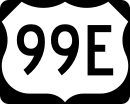
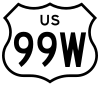
From the southern tip of the San Joaquin Valley at the foot of the Grapevine, US 99 then continued to Sacramento where it split into two highways, 99E and 99W. The two highways rejoined in Red Bluff and continued once again as US 99 through Oregon, Washington and to the border with British Columbia, becoming Highway 99.
Los Angeles
When it was first designated in late 1926, US 99 ran with U.S. Route 66 from San Bernardino via Pasadena to Los Angeles, turning north there to San Fernando.[1] The route was signed in 1928. This alignment remained through 1933,[2] but by 1942 it had moved to its own alignment (concurrent with U.S. Route 70, as well as U.S. Route 60 west of Pomona) from San Bernardino to Los Angeles. This alignment used Garvey Avenue from Pomona, turning onto Ramona Boulevard in Alhambra to reach Macy Street (now Cesar E. Chavez Avenue) near downtown Los Angeles. It turned north at Figueroa Street, running through the Figueroa Street Tunnels and turning off at Avenue 26 to reach San Fernando Road.[3][4] When the San Bernardino Freeway, Santa Ana Freeway and Pasadena Freeway were completed, it was routed onto them, continuing to exit at Avenue 26.[5] In 1962, with the completion of the Golden State Freeway northeast of downtown, US 99 was moved onto it, bypassing the Santa Ana Freeway, Four Level Interchange and Figueroa Street Tunnels.
Los Angeles to Oregon
From Los Angeles, US 99 followed San Fernando Road through Glendale and Burbank to Sylmar. From 1937 to 1964 it shared this routing with U.S. Route 6; the remaining stretch of the highway through the Santa Clarita Valley is named "The Old Road." The Old Road starts in near the Newhall Pass Interchange, just south of Santa Clarita, eventually crossing under present-day Interstate 5. As the noad now winds north, passing by Pico Canyon Road, it reaches Mc Bean Parkway near the California Institute of the Arts, College of the Canyons and Six Flags Magic Mountain. In Castaic The Old Road becomes a suburban street and ends at Oak Hill Court, just outside Castaic.
99 then headed up over the "Grapevine" into the San Joaquin Valley. Just north of the route's entry to the valley, Interstate 5 splits off from the route of US 99, and US 99 continued on the current route of State Route 99, to Bakersfield, Fresno, and Sacramento. Many older segments of the highway between the "Grapevine" and Sacramento still exist as local streets, many of them having "Golden State" in their names (such as Golden State Ave, Golden State Blvd, Golden State Hwy, etc.).
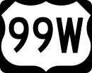
North of Sacramento, the route was divided into US 99W and US 99E. US 99W co-routed with US 40 west to Davis, in city as Olive Drive. The route continued as Richards Boulevard, 1st Street, B Street, and Russell Boulevard before turning north on what is now State Route 113 into Woodland to meet and parallel Interstate 5 near the town of Yolo. From there, the route parallels the current I-5, entering Corning from the South as Old Corning road, turning East onto Solano Street before turning North again on 3rd street continuing to Red Bluff, where it became Main Street. All of the old inter-town original roadway still exists, signed as 99W, CR99 or CR99W.
From Sacramento, US 99E followed Interstate 80 (first the current business route, then the actual route) to Roseville. From Roseville it headed north along State Route 65 to Olivehurst, from where it followed State Route 70 to Marysville. From Marysville it followed State Route 20 across the Feather River to Yuba City. From Yuba City it followed the current State Route 99 north to Red Bluff, where it rejoined 99W at the intersection of Main Street and Antelope Blvd.
From Red Bluff, US 99 continued north along the same route as Interstate 5, except that it went through Redding along present State Route 273, and also followed State Route 265 in Weed and State Route 263 from Yreka to near Black Mountain.
A 22.7-mile (36.5 km) long stretch of two-lane county road known as "Old 99 Highway" exists in Siskiyou County, California in the same form as it did when it was US 99, but is lightly traveled. It roughly parallels I-5, but at one point diverges from it by a distance of several miles. Old 99 Highway serves the tiny village of Gazelle, as well as local homes and ranches.
 U.S. Route 99 in Grants Pass, Oregon, 1939
Oregon
The former route of U.S. Route 99 in Oregon mostly follows routes currently signed as Oregon Route 99, 99E, and 99W. The primary exception is from the California-Oregon state border north to Ashland, Oregon, where U.S. 99 is currently named Old Highway 99 S from the state border to exit 6 of Interstate 5. The former route is coterminous with Interstate 5 from exit 6 to the junction of Oregon Route 99 in Ashland.
Washington
Unlike California and Oregon, much of the former route of U.S. Highway 99 in Washington exists as local roads and regular city streets; only the route from Fife, Washington to Everett, Washington still retains the official "99" moniker (as State Route 99). The following is a simplified list of Washington counties and cities that portions of the old route traverse, along with their local names.[6]
Former U.S. Highway 99 Route in Washington (North to South) Nearest City County Road or Street Names Blaine Whatcom 12th Street, D Street, Peace Portal Drive, Blaine Road Birch Bay Whatcom Blaine Road Ferndale Whatcom Bay Road, Vista Drive, 2nd Avenue, Main Street, Pacific Hwy. Bellingham Whatcom Pacific Hwy., W. Bakerview Road, Northwest Drive, Northwest Avenue, Elm Street, DuPont Avenue, Prospect Street, E. Holly Street, Ellis St., Maple St., Samish Way, Lake Samish Drive, Old Highway 99 North Rd. Burlington Skagit Old Highway 99 North Rd., S. Burlington Blvd. Mount Vernon Skagit Riverside Drive, N 4th St., S 3rd St., S 2nd St., Old Highway 99 S. Road Conway Skagit Conway Frontage Road, Pioneer Highway Stanwood Snohomish Old 99 N, Pioneer Highway E. (2.4 miles north of Stanwood, an older re-alignment exists following: Old Pacific Highway, 102nd Ave NW, 268th St. to Pioneer Highway) Arlington Snohomish Pioneer Highway E, State Route 530, Smokey Point Blvd. Marysville Snohomish State Avenue, Sunnyside Blvd. Everett Snohomish Sunnyside Blvd., 20th Street SE, Everett Avenue, Broadway Lynnwood, Edmonds, Shoreline, Seattle, Tukwila, SeaTac, Des Moines, Federal Way, Milton, Fife Snohomish, King, Pierce State Route 99 Tacoma Pierce Pacific Hwy. E, Eells Street, Puyallup Avenue, E. G St., E. 26th St., South Tacoma Way Lakewood Pierce South Tacoma Way, Pacific Hwy. SW DuPont Pierce Interstate 5 (exit 124 to exit 114) Nisqually Thurston Martin Way Lacey Thurston Old Pacific Hwy. SE, Pacific Avenue Olympia Thurston Pacific Avenue, 4th Ave. E (E) / State Ave. NE (W), Capitol Way Tumwater Thurston Capitol Blvd., Old Hwy. 99 NE Tenino Thurston Old Hwy. 99 NE, Sussex Avenue E, Wichman Street S, 6th Avenue W, Old Hwy. 99 SE Grand Mound, Tenino Thurston Old Hwy. 99 SW and SE Centralia Lewis Harrison Avenue, W. Main Street, Tower Avenue (N) / S. Pearl Street (S), Kresky Avenue NE (N) / S. Gold Street (S) Chehalis Lewis Kresky Avenue (N) / National Avenue (S), National Avenue, Market Blvd., Jackson Highway Toledo Lewis, Cowlitz Jackson Highway, State Route 505, Barnes Drive Castle Rock Cowlitz Barnes Drive, Old Pacific Hwy. N, Huntington Avenue S (Business Loop 5), Pleasant Hill Road Kelso Cowlitz Pleasant Hill Road, Pacific Avenue, Ash Street, Grade Street, Kelso Drive, Old Pacific Hwy. S, Carrolls Cowlitz Old Pacific Hwy. S, Old Hwy. 99 S Kalama Cowlitz Old Pacific Hwy. S, W.Kalama River Rd., Meeker Dr., S 1st St., Old Pacific Hwy. S, Interstate 5 (from exit 27 to exit 22) Woodland Cowlitz Old Pacific Hwy., Goerig St., Lewis River Rd., E CC St., NW Pacific Hwy., La Center Clark NW Pacific Hwy., NW Lacenter Rd., NE Timmen Road Vancouver Clark NE 10th Ave., NE 179th St., NE 15th Ave., NE Union Road, NE 20th Avenue, (NE 134th St. (optional)), Hwy. 99 NE, NE 117th Street, Hazel Dell Avenue, Main Street, Interstate 5 (exits 1A/1B) History
An extensive section of this highway (over 600 miles), from approximately Stockton, California to Vancouver, Washington, follows very closely the track of the Siskiyou Trail. The Siskiyou Trail was based on an ancient network of Native American footpaths connecting the Pacific Northwest with California's Central Valley. By the 1820s, trappers from the Hudson's Bay Company were the first non-Native Americans to use the route of U.S. Highway 99 to move between today's Washington state and California. During the second half of the 19th Century, mule train trails, stagecoach roads, and the path of the Central Pacific railroad (later the Southern Pacific railroad) also followed the route of the Siskiyou Trail. By the early 20th Century, pioneering automobile roads were built along the Siskiyou Trail, including most notably the Pacific Highway. The Pacific Highway ran from British Columbia to San Diego, California and is the immediate predecessor of much of U.S. Highway 99. The highway was continuous pavement by the middle 1930s.
Decommissioning
By 1968, US 99 was completely decommissioned with the completion of I-5, but the highway's phasing out actually began July 1, 1964 thanks to the passage of Collier Senate Bill No. 64 on September 20, 1963. The bill launched a major program designed to greatly simplify California's increasingly complicated highway numbering system and eliminate concurrent postings like the aforementioned 60/70/99. The highways that replaced it are:
- SR 111 and SR 86 between the Mexican border and Indio.
- I-10, replacing US 60 and US 70 between Indio and Los Angeles as well.
- U.S. Route 101 and SR 110 in downtown Los Angeles.
- I-5 from north of downtown all the way to its modern-day split in Wheeler Ridge before 99's final decommissioning in 1968.
State Highway 99
All three states have replaced some portions of US 99 with state highways of the same number:
- Washington: 50 miles (80 km) of US 99, from Fife to Everett, is now State Route 99. It is mostly a surface-level highway with the exception of the Alaskan Way Viaduct through downtown Seattle.
-
- Hazel Dell, Washington: Continues to use the old route as an arterial road while retaining the name Highway 99. The county street continues the connection between Main Street in Vancouver, Washington to Pacific Highway in Salmon Creek. While the area is quickly being rebuilt with chain businesses and shopping centers, a handful of buildings remain along the route in Hazel Dell and provide a glimpse into the pre-Interstate era of the region.
- Oregon: Most of former US 99 in Oregon now signed as Oregon Route 99 (OR 99). The route still provides surface-level access to many southern Oregon towns served by I-5. It also provides access to many towns in the Willamette Valley. Between Junction City and Portland, the highway splits into eastern and western routes known as OR 99E and OR 99W, respectively. For significant stretches, OR 99 shares an alignment with I-5. Officially, the highway is signed with both route numbers when this occurs; however, in practice, this is often not the case as the OR 99 designation is dropped in favor of I-5. One notable exception is a stretch of OR 99E that runs between Albany and Salem, where OR 99E is cosigned along the highway.
- California: The 424-mile (682 km) stretch between Wheeler Ridge and Red Bluff is signed as State Route 99 which makes it California's second-longest state highway behind SR 1. However, the newly enacted Historic U.S. Route 99 extends from Indio starting from Interstate 10 in the Coachella Valley all the way down the Imperial Valley to Calexico on the US-Mexican border with Mexicali, Baja California, Mexico.
Bannered route
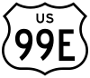
U.S. Route 99W was a short-lived alternate of U.S. Route 99 in the Central Valley of California, United States, running from north of Manteca via French Camp to Stockton. At the same time, from roughly 1929 to 1933,[7] U.S. Route 99E ran to the east, having the same termini as US 99W.
Route description
US 99W ran along French Camp Road and El Dorado Street, while US 99E used present State Route 99 and Mariposa Road.[citation needed] The northern end of each in Stockton is unclear; it may have been at Charter Way and Wilson Way or at Harding Way and Wilson Way.[8]
History
Prior to the establishment of the United States Numbered Highways in 1926, the main Los Angeles-Sacramento route, pre-1964 Legislative Route 4, ran from Manteca to Stockton via French Camp (later US 99W). At French Camp, pre-1964 Legislative Route 5 split to the southwest to reach the San Francisco Bay Area via Altamont Pass.[9][10][11] The Lincoln Highway used Route 4 from Sacramento to French Camp and Route 5 over Altamont Pass.
In November 1926, Route 4 was defined as part of U.S. Route 99 and Route 5 (to San Jose) became U.S. Route 48.[12] California's U.S. Routes were not marked until 1928,[13] and US 99 had not yet been split into US 99E and US 99W.[14]
Around 1929, Route 4 was realigned between north of Manteca and Stockton. This became US 99E, and the old route became US 99W. Route 5 was extended north from French Camp to Stockton, but US 48 continued to end at US 99W. US 48 became an extension of U.S. Route 50 ca. 1931, running concurrent with US 99 from Sacramento to Stockton and US 99W to French Camp.[15] Around 1933, US 99W was dropped, and US 99E became part of US 99. Most of former US 99E is now part of State Route 99 but former US 99W has been bypassed by Interstate 5.
See also
Related routes
- U.S. Route 99 Alternate (Bellingham, Washington)
- U.S. Route 199
- U.S. Route 299
- U.S. Route 399
External links
- Museum of the Siskiyou Trail
- Information on the Ridge Route
- "History of Hwy 99 in North Los Angeles County". Santa Clarita Valley Historical Society. http://www.scvhistory.com/scvhistory/ridge.htm. Retrieved 2002-02-04. (Photos, text, TV shows)
- Clark's Travel Center and Route 99 Museum, Indio, California
- Finding Historic Route 99
- Highways of Washington State - US 99
- Virtual Tour of US 99 in Southern California
- US-99 endpoint photos
- Old Highway 99 City of Bellingham
References
- ^ American Association of State Highway Officials, United States Numbered Highways, 1927
- ^ 1933 Rand McNally Los Angeles and vicinity map
- ^ 1942 Gousha Los Angeles and vicinity map
- ^ 1943 Los Angeles map
- ^ 1959 Los Angeles map
- ^ "Highways of Washington State - US 99 (Trunk)". http://www.angelfire.com/wa2/hwysofwastate/us099trunk.html. Retrieved 2 September 2010.
- ^ U.S. Highways: Divided (Split) Routes
- ^ Rand McNally, Stockton inset map, 1933
- ^ California Highways: Legislative Route 4
- ^ California Highways: Legislative Route 5
- ^ Rand McNally, San Francisco and Vicinity inset map, 1926
- ^ American Association of State Highway Officials, United States Numbered Highways, 1927
- ^ California Highways and Public Works, Route Renumbering (PDF), March-April 1964
- ^ California US Highways in 1928
- ^ east–west U.S. Highways
 Main U.S. Routes
1 2 3 4 5 6 7 8 9 10 11 12 13 14 15 16 17 18 19 20 21 22 23 24 25 26 27 28 29 30 31 32 33 34 35 36 37 38 40 41 42 43 44 45 46 48 49 50 51 52 53 54 55 56 57 58 59 60 61 62 63 64 65 66 67 68 69 70 71 72 73 74 75 76 77 78 79 80 81 82 83 84 85 87 89 90 91 92 93 94 95 96 97 98 99 101 163 400 412 425 Lists U.S. Routes • Bannered • Divided • Bypassed Browse numbered routes ←  US 97
US 97WA SR 99  → U.S. Routes in Washington
U.S. National Register of Historic Places Topics Lists by states Alabama • Alaska • Arizona • Arkansas • California • Colorado • Connecticut • Delaware • Florida • Georgia • Hawaii • Idaho • Illinois • Indiana • Iowa • Kansas • Kentucky • Louisiana • Maine • Maryland • Massachusetts • Michigan • Minnesota • Mississippi • Missouri • Montana • Nebraska • Nevada • New Hampshire • New Jersey • New Mexico • New York • North Carolina • North Dakota • Ohio • Oklahoma • Oregon • Pennsylvania • Rhode Island • South Carolina • South Dakota • Tennessee • Texas • Utah • Vermont • Virginia • Washington • West Virginia • Wisconsin • WyomingLists by territories Lists by associated states Other Categories:- U.S. Route 99
- Interstate 5
- Interstate 10
- U.S. Highways in California
- U.S. Highways in Oregon
- U.S. Highways in Washington (state)
- Roads on the National Register of Historic Places in California
- Former U.S. Highways
- Former state highways in California
- Former state highways in Oregon
- Former state highways in Washington (state)
- Transportation in Bakersfield, California


Wikimedia Foundation. 2010.