- U.S. Route 8
-
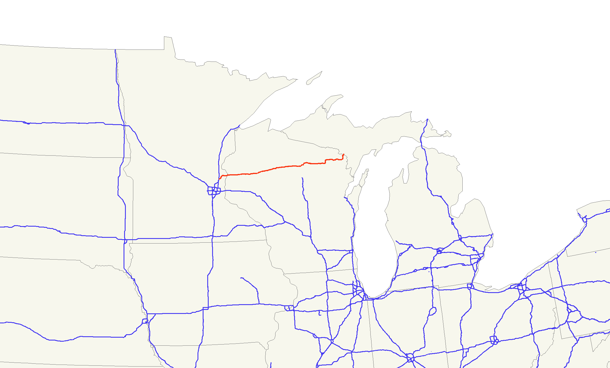
U.S. Route 8

US 8 highlighted in redRoute information Maintained by Mn/DOT, WisDOT, MDOT Length: 280.00 mi[a] (450.62 km) Existed: November 11, 1926[1] – present Major junctions West end:  I-35 in Forest Lake, MN
 US 61 in Forest Lake, MN
 US 63 at Turtle Lake, WI
 US 53 near Cameron, WI
 WIS 27 in Ladysmith, WI
 US 51 near Bradley, WI
 US 141 near Pembine, WI
East end:  US 2 in Norway, MI
Location States: Minnesota, Wisconsin, Michigan Counties: MN: Washington, Chisago
WI: Polk, Barron, Rusk, Price, Lincoln, Oneida, Forest, Marinette
MI: DickinsonHighway system United States Numbered Highways
List • Bannered • Divided • Replaced←  MN 7
MN 7MN MN 9  →
→← US 2WI US 10  →
→←  M-7
M-7MI M-8  →
→U.S. Highway 8 (US 8) is a United States Highway that runs primarily east–west for 280.00 miles (450.62 km), mostly within the state of Wisconsin. It runs from Interstate 35 (I-35) in Forest Lake, Minnesota to US 2 at Norway in the Upper Peninsula of Michigan near the border with Wisconsin. Except for the short freeway segment near Forest Lake, and a section near the St. Croix River bridge, it is all undivided surface road. As a state highway in the three states, US 8 is maintained by the Minnesota, Wisconsin and Michigan departments of transportation (Mn/DOT, WisDOT, MDOT, respectively).
The highway was originally commissioned on November 11, 1926 with the rest of the original US Highway System. Several changes have been made to the routing of the highway. The western end has been extended south to Minneapolis before being returned to Forest Lake. Other changes on the east end have moved that terminus from an original end location at Powers, Michigan to the current location in Norway. Plans have surfaced at various times in internal Wisconsin and Michigan DOT map files that show the route of the missing highway segment to Powers.
A bypass built by WisDOT around the city of Rhinelander in the 1990s created the opportunity for a business loop through the town. The loop was a locally maintained route through the central business district in Rhinelander. Currently the signage for the loop has been removed.
Contents
Route description
Forest Lake to St. Croix Falls
US 8 begins at an interchange with I-35 in Forest Lake. This interchange is incomplete: traffic can only access US 8 directly from northbound I-35, and westbound traffic on US 8 merges onto southbound I-35. The first one-mile (1.6 km) segment of US 8 to Forest Lake is a freeway, with an interchange at US 61. East of this junction, the route follows Lake Boulevard North around Forest Lake and continues northeasterly through the community to cross the Washington–Chisago county line.[7] The highway continues running to the northeast along farmland and the shore of Green Lake to Chisago City, where it meets up with County Road 22 (CR 22). US 8 follows Lake Boulevard through Chisago City along the isthmus between the larger Chisago Lake and the smaller Wallmark Lake on the eastern side of town. The highway turns along a more easterly path in Lindstrom between North and South Lindstrom Lakes.[8][9]
The highway continues east through Center Lake between North and South Center Lakes, curving around the north shore of South Center Lake. On the eastern edge of town, the highway turns due east and runs through Shafer. US 8 merges with State Highway 95 (MN 95) two miles (3 km) southwest of Taylors Falls. The two routes concurrently turn northeast along the St. Croix River entering Taylors Falls. At this point, MN 95 continues north along the river while US 8 turns east and exits the state of Minnesota into Wisconsin, crossing the St. Croix River.[8][9]
Legally, the Minnesota section of US 8 is defined as Constitutional Route 46 and Legislative Route 98 in the Minnesota Statutes §§161.114(2) and 161.115(29). The route is not marked with those numbers.[10][11] The section of US 8 in Chisago County is officially designated the Moberg Trail.[12]
St. Croix Falls to Ladysmith
US 8 enters Polk County at St. Croix Falls as a multilane highway. The highway joins State Highway 35 (WIS 35) at a diamond interchange located approximately one mile from the state line. The two highways run concurrently for four miles (6 km) before WIS 35 turns off to the north at a location in the Town of St. Croix Falls west of Deer Lake. US 8 continues east through forest lands, and WIS 46 joins the highway from the north for a four mile (6 km) conconcurrency before splitting off to the south. US 8 passes through Range and crosses into Barron County at Turtle Lake[13] U.S. Route 63 joins US 8 from the south west of Turtle Lake and departs to the north in the downtown area. US 8 passes through Poskin and junctions with WIS 25 in Barron. East of Barron, the highway meets U.S. Route 53 at a mixed diamond/cloverleaf interchange and turns north into Cameron, then turns east in downtown to leave Cameron. after a straight nine miles (14 km), the highway crosses into Rusk County[14]
US 8 continues due east for five miles (8 km) before turning northeast and passing through Weyerhaeuser and crossing WIS 40 in Bruce. US 8 meets WIS 27 in downtown Ladysmith[15]
Ladysmith to Rhinelander
Upon leaving Ladysmith, US 8 passes through the communities of Tony, Glen Flora, Ingram (where it meets the northern terminus of WIS 73 and Hawkins on its way out of Rusk county.[15] In Price County, US 8 passes through Kennan and Catawba. WIS 111 terminates at its south end on US 8 just east of Catawba. US 8 meets WIS 13 at a diamond interchange northwest of Prentice and passes north of the city. The highway passes through Brantwood and enters Lincoln County at Clifford[16] US 8 passes through Tripoli and McCord and passes north of Tomahawk as it passes through the Lake Nokomis area. U.S. Route 51 crosses US 8 northeast of Tomahawk.[17] US 8 turns northeast into Oneida County and on a twisting northeastward road passes through Woodboro and expands to a divided highway into Rhinelander. It collects WIS 47 south on the southwest side of Rhinelander. WIS 17 north joins the highways a half of a mile to the southeast, creating a wrong-way concurrency with WIS 47. WIS 17 turns to the north two miles (3 km) southeast of there and US 8 and WIS 47 head eastbound out of the Rhinelander area.[18]
Rhinelander to Norway
 Eastern terminus in Norway, Michigan
US 8 intersects with US 45 south in Monico and WIS 47 follows US 45 south while US 45 North follows US 8 for 1-mile (1.6 km) before splitting north. US 8 enters Forest County five miles (8 km) east of Monico.[18] Seven miles in, the highway collects WIS 32 from the north in Crandon and the two routes head east to Laona where US 8 turns north and WIS 32 turns south. US 8 turns east again at Cavour and passes through Armstrong Creek one mile (1.6 km) from the Marinette County line.[19] The highway passes through Goodman and Dunbar as it meanders through the county and joins U.S. Route 141 at Pembine. The two routes split ten miles (16 km) north near Niagara, and with US 8 heading east. the highway takes a northward turn and heads across the Menominee River into Michigan near Pier's Gorge Park [20]
US 8 enters Michigan south of Norway at the Menominee River crossing in Norway Township and proceeds north into the city where it ends at US 2. US 8 in Michigan is 2.322 miles (3.737 km) long. In this segment, the road passes by the Dickinson County fairgrounds and Norway Speedway.[6][21]
History
20th century
US 8 was created with the beginnings of the United States Numbered Highway System on November 26, 1926.[1] The highway was originally shown on maps running between Forest Lake, Minnesota and Powers, Michigan.[22] In Minnesota, US 8 followed Constitutional Route 46, which was designated in a constitutional amendment adopted on November 2, 1920.[10] Route 46 originally ran between Forest Lake and Chisago City through Wyoming.[23] The Wisconsin section of the highway was previously designated WIS 14 from the Minnesota–Wisconsin state line east to Armstrong Creek.[24]
Although originally designated in November 1926, US 8 was not designated as part of the state trunkline highway system in Michigan at that time. The highway connection from Quinnesec south into Wisconsin was part of M-57 which connected with WIS 57. US 8 ended at WIS 57 in Pembine at the time, with no connection into Michigan shown on official maps.[25] A map by the American Automobile Association does show the highway continuing east through Faithorn and Hermansville in Michigan to end at US 2.[26] A later extension in 1928 moved US 8 to run along US 141, which had replaced WIS 57 and M-57, ending in Quinnesec at US 2.[27] By the next year, the highway was shifted to end in Norway.[28]
In 1931, US 8 was extended south from Forest Lake into downtown Minneapolis to the intersection of 3rd Avenue South and Washington Avenue. At the time, US 12 and US 52 ran along Washington Avenue and US 65 ran on the other side of 3rd Avenue and also ended at this intersection.[29][30] US 8 in Minnesota was paved in its entirety by 1940.[31] Starting around the year 1955, US 8 was moved to a more direct routing between Forest Lake and Chisago City. US 8 replaced MN 98 along Legislative Route 98.[32][33] The former routing between Wyoming and Chisago City along Constitutional Route 46 was then redesignated MN 98 until 1998.[34]
As late as 1959, the Michigan State Highway Department still had plans on their books to build the section of US 8 west of Hermansville to the Menominee River. The control section atlas published on January 1, 1959 showed this segment of highway on the Menominee County map, complete with a control section number. The section of highway is shown as "proposed" or "under construction".[35] However, a new bridge was built over the Menominee River to carry the highway across the Michigan–Wisconsin state line near Norway in 1966.[36] WisDOT still shows the section of highway needed in their state to extend US 8 to the original eastern terminus in Michigan on internal maps. The December 31, 2004 edition of their Official State Trunk Highway System Maps shows this section as a "mapped corridor".[37]
In 1978, with ongoing construction and completion of the I-35W freeway in Minnesota, US 8 was truncated to end at the I-35W / New Brighton Boulevard interchange.[38][39] In 1981, US 8 was truncated again to its current terminus in Forest Lake.[40][41] The section in New Brighton is currently known as Old Highway 8.[42]
WisDOT built a bypass of the city of Rhinelander during the 1990s. The new highway was constructed south of town as a new two-lane highway. The former route through downtown Rhinelander and near Clear and George lakes was redesignated as Business US 8 (BUS US 8).[43][44]
21st century
In 2002, US 8 was widened from two lanes to four lanes with a grass median between North Rifle Road and WIS 47. At the time, officials with WisDOT had plans to extend the four-lane divided highway as far west as US 51 near Tomahawk.[45] Problems related to wetlands in the construction area and bad weather pushed completion of the project back almost a year. Contractors had install metal sheeting to stabilize the marshy ground. Originally scheduled to end November 1, 2002, the project did not finish until August 2003. The delays and additional work increased the price tag of the project from the original $4.5 million (equivalent to $5.4 million in 2011) to $6.0 million (equivalent to $7.2 million in 2011).[46][47] A section of the project was only designed for 45-mile-per-hour (72 km/h) speeds for safety reasons. The design also allowed planners to limit the amount of land needed for the expansion.[48]
Bill and Jerri Osberg sued the state and seven other parties over runoff from the construction in April 2003. They claimed that the runoff killed hundreds of trees and polluted ponds on their property.[49] Later investigation uncovered damage to wildlife habitat in the Wisconsin River.[50] Included in the original lawsuit were six individual WisDOT employees, the primary contractor and a local pet supply company. The court of appeals partially upheld a ruling by the district court dismissing the employees and the contractor from the lawsuit in March 2006. The pet supply company was reinstated in the case by the appeals court. [51] The couple settled their claims, and the state pursued the matter against Pagel Construction in a related lawsuit. WisDOT alleged that the contractor did not follow proper erosion controls and failed to remediate the erosion damage to the Osbergs' property. The state wanted the construction company to forfeit their $70,000 retainer (equivalent to $84,000 in 2011) and pay damages of $150,000 (equivalent to $159,000 in 2011).[46][52] Pagel Construction faulted WisDOT's erosion control plan and said that the state's engineers controlled the project. The contractor was seeking the return of its retainer. In September 2007, a jury found in favor of Pagel Construction and awarded them $70,898.13 in damages(equivalent to $75,135.8 in 2011).[46][52]
Imitating the Highway 127 Corridor Sale, a Northern Wisconsin woman started the "The Great Eight Sale" in 2010. Her goal is to promote the area with a rummage sale that runs from the Minnesota state line to Norway, Michigan. Towns along the length of the highway participated in the first event on Labor Day weekend. Some groups planned to use the opportunity to raise money, while the original event planner was not charging participants for booths.[53]
Future
WisDOT has completed the environmental studies on bypasses of Barron and Cameron in Barron County. These bypasses would form a continuous expressway through the area. No funding has been identified to complete the projects.[54] The entire length of US 8 in the state has been classified as a the North Country Corridor in the Connections 2030 Plan by the department. [55] This designation marks the highway as a priority in "continued safety, enhanced mobility and efficiency" as well as "modernization to correct outdated infrastructure design".[56]
Major intersections
State County Location Mile[b] Destinations Notes Minnesota Washington Forest Lake 0.000 I-35 – Minneapolis, St. PaulExit 132 on I-35; northbound exit to US 8 only 1.054 US 61 – St. PaulChisago Chisago City 7.313 
 CSAH 36 / CR 22
Former MN 98 Franconia Township –
Shafer Township18.745  MN 95 south
Western end of MN 95 concurrency Taylors Falls 22.029 MN 95 northEastern end of MN 95 concurrency St. Croix River 22.129
0.00Minnesota–Wisconsin state line Wisconsin Polk St. Croix Falls 0.27  WIS 87
0.77  WIS 35 south
Western end of WIS 35 concurrency; diamond interchange Town of St. Croix Falls 4.72 WIS 35 northEastern end of WIS 35 concurrency Town of Balsam Lake 7.92  WIS 65 south
10.02  WIS 46 north
Western end of WIS 46 concurrency Town of Apple River 14.40 WIS 46 southEastern end of WIS 46 concurrency Town of Beaver 23.63 US 63 southWestern end of US 63 concurrency Barron Turtle Lake 24.90 US 63 northEastern end of US 63 concurrency Barron 38.89  WIS 25 south
Western end of WIS 25 concurrency 39.28 WIS 25 northEastern end of WIS 25 concurrency Town of Stanley 43.94 US 53Rusk Bruce 68.43  WIS 40 north
Western end of WIS 40 concurrency 69.04 WIS 40 southEastern end of WIS 40 concurrency Ladysmith 77.33 WIS 27Town of Richland 92.80  WIS 73 south
Price Town of Catawba 109.00  WIS 111
Town of Prentice 117.76  WIS 13
Lincoln Town of Bradley 149.94 US 51Diamond interchange Oneida Rhinelander 164.13  WIS 47 north
Kemp StreetWestern end of WIS 47 concurrency; Kemp Street is former BUS US 8 164.31  WIS 17 south
Western end of WIS 17 concurrency 164.42 WIS 17 northEastern end of WIS 17 concurrency Town of Pelican 170.19  CTH P west
Former BUS US 8 Town of Monico 178.34  US 45 south / WIS 47 south
Eastern end of WIS 47 concurrency; western end of US 45 concurrency 179.12 US 45 northEastern end of US 45 concurrency Forest Crandon 191.11 
 WIS 32 north / WIS 55 north
Northern end of WIS 32 / WIS 55 concurrency 191.61 WIS 55 southSouthern end of WIS 55 concurrency Town of Laona 202.98 WIS 32 southEastern end of WIS 32 concurrency Town of Caswell 210.51  WIS 139 north
Southern terminus of WIS 139 Town of Armstrong Creek 220.28  WIS 101
Marinette Town of Pembine 243.89 US 141 southSouthern end of US 141 concurrency Town of Niagara 253.41 US 141 northNorthern end of US 141 concurrency Menominee River 255.55
0.000Wisconsin–Michigan state line Michigan Dickinson Norway 2.322 US 2 – Iron Mountain, Escanaba1.000 mi = 1.609 km; 1.000 km = 0.621 mi
Concurrency terminus • Closed/Former • Incomplete access • UnopenedBusiness route

BUS US 8
Location: Rhinelander, Wisconsin Length: 7.1 mi[58] (11.4 km) Existed: 1990s[43][44]–July 1, 2005[57] The U.S. Highway 8 Business Route (BUS US 8) in Rhinelander, Wisconsin was a locally-maintained business loop highway routing through the central business district of the city. The route was designated when US 8 was shifted to a bypass of town in the 1990s. The former routing of US 8 through town was turned over to the city and county for maintenance. The local authorities erected signs along this route to designate it as a business loop of the main highway south of town.[43][44] The signs along the road were removed on July 1, 2005 when the business loop was redesignated County Highway P.[57]
Before the signage was removed, BUS US 8 started at the western junction of US 8 and WIS 47. The business loop ran east from this intersection along Kemp Street, crossing the Wisconsin River north of the convergence with the Pelican River. The loop jogged north along Oneida Street for 3 blocks and turned east again on Lincoln Street. East of town, BUS US 8 intersected WIS 17 and turned to the southeast. Outside of town, the business loop ran through wooded terrain and turned south near Clear Lake. Near the larger George Lake, the roadway curved back east along the lake's southern shore, running parallel to the main highway before turning south to connect to the main highway. At this intersection with US 8/WIS 47, the business loop ended after a total run of 7.1 miles (11.4 km).[58]
See also
- U.S. Highway 208
Footnotes
References
- ^ a b Weingroff, Richard F. (January 9, 2009). "From Names to Numbers: The Origins of the U.S. Numbered Highway System". Federal Highway Administration. http://wwwcf.fhwa.dot.gov/infrastructure/numbers.cfm. Retrieved April 21, 2009.
- ^ a b "Metro Division Trunk Highway Log Point" (PDF). Minnesota Department of Transportation. September 9, 2009. pp. 51–3. http://www.dot.state.mn.us/roadway/data/reports/thlogpoint.html#. Retrieved May 2, 2010.
- ^ a b State Trunk Highway Log for Region 3. Green Bay, WI: Wisconsin Department of Transportation. May 14, 2009. pp. 1–4.
- ^ a b State Trunk Highway Log for Region 4. Rhinelander, WI: Wisconsin Department of Transportation. December 31, 2008.
- ^ a b State Trunk Highway Log for Region 5. Eau Claire, WI: Wisconsin Department of Transportation. May 14, 2009. pp. 30–50.
- ^ a b c Michigan Department of Transportation (2009). Control Section Atlas: Dickinson County (Map). http://mdotwas1.mdot.state.mi.us/public/maps_pr/pdfs/Dickinson_CS.pdf. Retrieved July 26, 2009.
- ^ Minnesota Department of Transportation (2009) (PDF). General Highway Map: Washington County, Minnesota (Map). http://www.dot.state.mn.us/maps/cadd/county/washington.pdf.
- ^ a b Minnesota Department of Transportation (2009) (PDF). General Highway Map: Chisago County, Minnesota (Map). http://www.dot.state.mn.us/maps/cadd/county/chisago.pdf.
- ^ a b Google, Inc. Google Maps – Overview Map of US 8 in Minnesota (Map). Cartography by Google, Inc. http://maps.google.com/maps?f=q&source=s_q&hl=en&geocode=&q=forest+lake,+mn&sll=37.0625,-95.677068&sspn=64.409204,65.654297&ie=UTF8&hq=&hnear=Forest+Lake,+Washington,+Minnesota&ll=45.318116,-92.840309&spn=0.228136,0.387268&z=12.
- ^ a b Minnesota State Legislature (2009). "§ 161.114, Constitutional Trunk Highways". Minnesota Statutes. Minnesota Office of the Revisor of Statutes. https://www.revisor.mn.gov/statutes/?id=161.114. Retrieved May 11, 2010.
- ^ Minnesota State Legislature (2009). "§ 161.115, Additional Trunk Highways". Minnesota Statutes. Minnesota Office of the Revisor of Statutes. https://www.revisor.mn.gov/statutes/?id=161.115. Retrieved May 11, 2010.
- ^ Minnesota State Legislature (2009). "§ 161.14, Names and Designations of Certain Highways". Minnesota Statutes. Minnesota Office of the Revisor of Statues. https://www.revisor.mn.gov/statutes/?id=161.14. Retrieved May 11, 2010.
- ^ Wisconsin Department of Transportation (January, 2010) (PDF). Polk County (Map). http://www.dot.wisconsin.gov/travel/maps/docs/counties/polk.pdf. Retrieved May 11, 2010.
- ^ Wisconsin Department of Transportation (2010) (PDF). Barron County (Map). http://www.dot.wisconsin.gov/travel/maps/docs/counties/barron.pdf. Retrieved May 11, 2010.
- ^ a b Wisconsin Department of Transportation (January, 2010) (PDF). Rusk County (Map). http://www.dot.wisconsin.gov/travel/maps/docs/counties/rusk.pdf. Retrieved May 11, 2010.
- ^ Wisconsin Department of Transportation (January, 2010) (PDF). Price County (Map). http://www.dot.wisconsin.gov/travel/maps/docs/counties/price.pdf. Retrieved May 11, 2010.
- ^ Wisconsin Department of Transportation (January, 2010) (PDF). Lincoln County (Map). http://www.dot.wisconsin.gov/travel/maps/docs/counties/lincoln.pdf. Retrieved May 11, 2010.
- ^ a b Wisconsin Department of Transportation (January, 2010) (PDF). Oneida County (Map). http://www.dot.wisconsin.gov/travel/maps/docs/counties/oneida.pdf. Retrieved May 11, 2010.
- ^ Wisconsin Department of Transportation (January, 2010) (PDF). Forest County (Map). http://www.dot.wisconsin.gov/travel/maps/docs/counties/forest.pdf. Retrieved May 11, 2010.
- ^ Wisconsin Department of Transportation (January, 2010) (PDF). Marinette County (Map). http://www.dot.wisconsin.gov/travel/maps/docs/counties/marinette.pdf. Retrieved May 11, 2010.
- ^ Google, Inc. Google Maps – Overview Map of US 8 in Michigan (Map). Cartography by Google, Inc. http://maps.google.com/maps?f=d&hl=en&geocode=11907673563299870445,45.758171,-87.921684%3B15376556712785589671,45.787300,-87.909860&time=&date=&ttype=&saddr=45.757044,-87.921782&daddr=Brown+Ave%2FUS-8+%4045.787300,+-87.909860&mra=dme&mrcr=0&mrsp=0&sz=14&sll=45.771175,-87.904444&sspn=0.040232,0.080338&ie=UTF8&z=14&om=1. Retrieved December 27, 2007.
- ^ Bureau of Public Roads (1926) (PDF). United States System of Highways (Map). http://www.okladot.state.ok.us/hqdiv/p-r-div/maps/misc-maps/1926us.pdf. Retrieved May 10, 2008.
- ^ Minnesota Highway Department (April 1, 1926). Map of Trunk Highway System, State of Minnesota (Map). Cartography by McGill-Warner. Section M16–N17. http://reflections.mndigital.org/cdm4/item_viewer.php?CISOROOT=/mdt&CISOPTR=218&CISOBOX=1&REC=1. Retrieved September 28, 2010.
- ^ Wisconsin Highway Commission (1918). Official Map of the State Trunk Highway System of Wisconsin (Map). Section A6–N6. http://www.wisconsinhistory.org/whi/fullRecord.asp?id=40972. Retrieved November 14, 2010.
- ^ Michigan State Highway Department (December 1, 1927). Official Highway Service Map (Map). Cartography by MSHD.
- ^ Detroit Automobile Club, American Automobile Association (1927). Official Highway Map of Michigan (Map). Section I6–J6.
- ^ H.M. Gousha (1928). Michigan (Map).
- ^ Michigan State Highway Department (May 1, 1929). Official Highway Service Map (Map). Cartography by MSHD.
- ^ Minnesota Department of Highways (April 1, 1931). Map of Trunk Highway System, State of Minnesota (Map). Cartography by McGill-Warner. Section M16–N17. http://reflections.mndigital.org/cdm4/item_viewer.php?CISOROOT=/mdt&CISOPTR=223&CISOBOX=1&REC=16. Retrieved September 28, 2010.
- ^ Minnesota Department of Highways (April 1, 1932). Map of Trunk Highway System, State of Minnesota (Map). Cartography by McGill-Warner. Section M16–N17. http://reflections.mndigital.org/cdm4/item_viewer.php?CISOROOT=/mdt&CISOPTR=224&CISOBOX=1&REC=15. Retrieved September 28, 2010.
- ^ Minnesota Department of Highways (January 1, 1940). Official Map (Map). Cartography by Minnesota Department of Highways (Advance ed.). Section M16–N17. http://reflections.mndigital.org/cdm4/document.php?CISOROOT=/mdt&CISOPTR=252&REC=5. Retrieved September 28, 2010.
- ^ Minnesota Department of Highways (1954). Official Highway Map (Map). Cartography by H.M. Gousha. Section M16–N17. http://reflections.mndigital.org/cdm4/document.php?CISOROOT=/mdt&CISOPTR=1183&REC=15. Retrieved November 14, 2010.
- ^ Minnesota Department of Highways (1956). Official Highway Map (Map). Cartography by H.M. Gousha. Section M16–N17. http://reflections.mndigital.org/cdm4/document.php?CISOROOT=/mdt&CISOPTR=1186&REC=16. Retrieved November 14, 2010.
- ^ Minnesota Department of Transportation (1997-98). Official State Highway Map (Map). Cartography by Minnesota Department of Transportation. Section J15–K16. http://reflections.mndigital.org/cdm4/document.php?CISOROOT=/mdt&CISOPTR=1279&REC=7. Retrieved November 14, 2010.
- ^ Michigan State Highway Department (January 1, 1959). Control Section Atlas (Map). Menominee County inset.
- ^ "NBI Structure Number: 22122051000B020". National Bridge Inventory. May 11, 2010. http://nationalbridges.com/nbi_record.php?StateCode=26&struct=22122051000B020.
- ^ Wisconsin Department of Transportation (December 31, 2004). Official State Trunk Highway System Maps (Map). Marinette County inset.
- ^ Minnesota Department of Transportation (1977-78). Official Transportation Map (Map). Cartography by Minnesota Department of Transportation. Metropolitan St. Paul – Minneapolis inset. http://reflections.mndigital.org/cdm4/document.php?CISOROOT=/mdt&CISOPTR=1249&REC=17. Retrieved November 14, 2010.
- ^ Minnesota Department of Transportation (1979-80). Official Transportation Map (Map). Cartography by Minnesota Department of Transportation. Metropolitan St. Paul – Minneapolis inset. http://reflections.mndigital.org/cdm4/document.php?CISOROOT=/mdt&CISOPTR=1252&REC=18. Retrieved November 14, 2010.
- ^ Minnesota Department of Transportation (1979-80). Official Transportation Map (Map). Cartography by Minnesota Department of Transportation. Section K14–J165. http://reflections.mndigital.org/cdm4/document.php?CISOROOT=/mdt&CISOPTR=1252&REC=18. Retrieved November 14, 2010.
- ^ Minnesota Department of Transportation (1981-82). Official Transportation Map (Map). Cartography by Minnesota Department of Transportation. Section K14–J165. http://reflections.mndigital.org/cdm4/document.php?CISOROOT=/mdt&CISOPTR=1255&REC=19. Retrieved November 14, 2010.
- ^ Google, Inc. Google Maps – New Brighton, MN (Map). Cartography by Google, Inc. http://maps.google.com/maps?f=q&source=s_q&hl=en&geocode=&q=new+brighton,+mn&sll=37.0625,-95.677068&sspn=64.409204,65.654297&ie=UTF8&hq=&hnear=New+Brighton,+Ramsey,+Minnesota&z=14. Retrieved September 28, 2010.
- ^ a b c Wisconsin Department of Transportation (January 1990). Oneida County (Map). 1:100,000.
- ^ a b c Wisconsin Department of Transportation (January 2002). Oneida County (Map). 1:100,000.
- ^ Youngstrum, Daryl (April 27, 2002). "Highway 8, Highway 47 Targeted for Improvements this Summer". The Rhinelander Daily News. http://www.rhinelanderdailynews.com/articles/2002/04/27/news/export4789.txt. Retrieved November 15, 2010.
- ^ a b c Consumer Price Index (estimate) 1800–2008. Federal Reserve Bank of Minneapolis. Retrieved December 7, 2010.
- ^ Acheson, Dean S. (August 2, 2003). "Highway 8 Project Basically Complete". The Rhinelander Daily News. http://www.rhinelanderdailynews.com/articles/2003/08/02/news/export8403.txt. Retrieved November 15, 2010.
- ^ "Reduced Speed Limit Based on Traffic Safety". The Rhinelander Daily News. August 21, 2003. http://www.rhinelanderdailynews.com/articles/2003/08/21/news/export8577.txt. Retrieved November 15, 2010.
- ^ Schaefer, Heather (August 25, 2007). "Contamination Lawsuit Trudges Forward". The Rhinelander Daily News. http://www.rhinelanderdailynews.com/articles/2007/08/25/news/news1.txt. Retrieved November 15, 2010.
- ^ Schaefer, Heather (July 29, 2004). "Judge Wants Parties to Negotiate Alleged Contamination Case". The Rhinelander Daily News. http://www.rhinelanderdailynews.com/articles/2004/07/29/news/local_news/news1.txt. Retrieved November 15, 2010.
- ^ Schaefer, Heather (August 19, 2006). "Land Dispute Goes to Trial Next Year". The Rhinelander Daily News.
- ^ a b "Jury Rules State Breached Agreement with Contractor on Highway 8 Project". The Rhinelander Daily News. September 29, 2007. http://www.rhinelanderdailynews.com/articles/2007/09/29/news/news04.txt. Retrieved November 15, 2010.
- ^ Hollister, Vern (August 18, 2010). "Woman Hopes to Create Rummage Sale the Length of Hwy. 8". The Rhinelander Daily News. http://www.rhinelanderdailynews.com/articles/2010/08/18/forest_republican/news/doc4c6beced12442652199193.txt. Retrieved November 15, 2010.
- ^ "US 8 Environmental Impact Statement". Superior, WI: Wisconsin Department of Transportation Northwest Transportation Region. March 5, 2010. http://www.dot.wisconsin.gov/projects/d8/eis/. Retrieved November 14, 2010.
- ^ "Appendix A: Finding Your Way with the Connections 2030 Statewide System-Level Priority Corridors". Connections 2030 Statewide Long-Range Transportation Plan. Madison, WI: Wisconsin Department of Transportation. October 2009. p. A-2. http://www.dot.wisconsin.gov/projects/state/docs/2030-appendix-a.pdf.
- ^ "Chapter 1: Introduction". Connections 2030 Statewide Long-Range Transportation Plan. Madison, WI: Wisconsin Department of Transportation. October 2009. pp. 1-1, 1-2. http://www.dot.wisconsin.gov/projects/state/docs/2030-chapter1.pdf.
- ^ a b "Business Highway 8 To Be Renamed County Highway P". The Rhinelander Daily News. August 30, 2004. http://www.rhinelanderdailynews.com/articles/2004/08/30/news/local_news/news1.txt. Retrieved November 15, 2010.
- ^ a b Google, Inc. Google Maps – Overview Map of U.S. Route 8 Business in Rhinelander, Wisconsin (Map). Cartography by Google, Inc. http://maps.google.com/maps?f=d&source=s_d&saddr=US-8+%26+West+Kemp+Street,+Rhinelander,+WI&daddr=45.633246,-89.379101+to:US-8+E%2FWI-47+S&hl=en&geocode=FWBGuAIdNUir-imnuOzLTqpVTTHwO9NrdXs-wQ%3B%3BFaTJtwIddgWt-g&mra=dpe&mrcr=0&mrsp=1&sz=13&via=1&sll=45.611876,-89.382534&sspn=0.113475,0.128231&ie=UTF8&t=h&z=13. Retrieved May 11, 2008.
External links
- US 8 at US Highways
- US 8 at The Unofficial Minnesota Highways Page
- US 8 at Historic Minnesota Highways
- US 8 at Wisconsin Highways
- US 8 at Michigan Highways
- US 8 at US Ends
- US at Minnesota State Highway Endings
- US 8 at Michigan Highway Ends
- BUS US 8 on the Master List at Wisconsin Highways
- US 8 at CanHighways
 Main U.S. Routes
1 2 3 4 5 6 7 8 9 10 11 12 13 14 15 16 17 18 19 20 21 22 23 24 25 26 27 28 29 30 31 32 33 34 35 36 37 38 40 41 42 43 44 45 46 48 49 50 51 52 53 54 55 56 57 58 59 60 61 62 63 64 65 66 67 68 69 70 71 72 73 74 75 76 77 78 79 80 81 82 83 84 85 87 89 90 91 92 93 94 95 96 97 98 99 101 163 400 412 425 Lists U.S. Routes • Bannered • Divided • Bypassed Categories:- U.S. Highway System
- U.S. Highways in Michigan
- U.S. Highways in Minnesota
- U.S. Highways in Wisconsin
- State highways in Wisconsin


Wikimedia Foundation. 2010.