County of Fitzroy, Queensland
- County of Fitzroy, Queensland
-
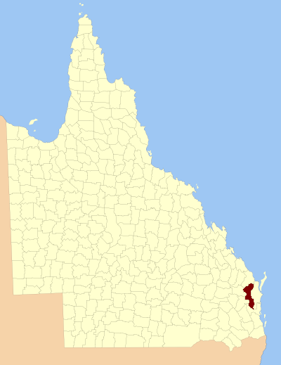
The County of Fitzroy is a county in Queensland, Australia. Like all counties in Queensland, it is a non-functional administrative unit, that is used mainly for the purpose of registering land titles.
Fitzroy includes the eastern and central parts of the South Burnett Region and part of the former Shire of Kilkivan in the Gympie Region.[1] It was named by the Surveyor-General of New South Wales in the 1850s after Charles Augustus FitzRoy, who served as the Governor of New South Wales from 1848 to 1855. The county was officially named and bounded by the Governor in Council on 7 March 1901 under the Land Act 1897.[2] The county is unrelated to the Fitzroy River, which is centred on the County of Livingstone.
Parishes
Fitzroy is divided into parishes, as listed below:
References
Coordinates: 26°40′S 152°00′E / 26.667°S 152°E / -26.667; 152
Categories:
- Queensland geography stubs
- Counties of Queensland
Wikimedia Foundation.
2010.
Look at other dictionaries:
County of Canning, Queensland — Infobox Australian cadastral name = Canning state = Queensland imagesize= 180px caption = Location within Queensland near nw = Fitzroy near n = Lennox near ne = March near e = Pacific Ocean near se = Pacific Ocean near s = Stanley near sw =… … Wikipedia
Cadastral divisions of Queensland — refers to the divisions of Queensland used for the registration of land titles. There are 322 counties, and 5,319 parishes within the state. [http://www.nrw.qld.gov.au/museum/articles complete/mapping/cad.html] . They are part of the cadastral… … Wikipedia
County of Cavendish — Cavendish Queensland Location within Queensland Lands administrative divisions around … Wikipedia
County of Aubigny — Aubigny Queensland Location within Queensland Lands administrative divisions around Aubigny … Wikipedia
County of Lennox — Lennox Queensland Location within Queensland Lands administrative divisions around Lennox … Wikipedia
County of Canning — Canning Queensland Location within Queensland Lands administrative divisions around Canning … Wikipedia
Rockhampton, Queensland — Infobox Australian Place type = city name = Rockhampton state = qld imagesize = 250 caption = Quay Street pop = 74,530 pop footnotes = (June 2007 Resident Population Statistical District)Cite web|url=http://www.abs.gov.au/AUSSTATS/abs@.nsf/Details… … Wikipedia
Lands administrative divisions of Queensland — The 319 counties of Queensland in 1901. Lands administrative divisions of Queensland refers to the divisions of Queensland used for the registration of land titles. There are 322 counties, and 5,319 parishes within the state.[1]. They are part of … Wikipedia
Electoral districts of New South Wales — The New South Wales Legislative Assembly is elected from 93 single member electorates called districts. Current districts This is a list of districts for the 2011 state election. Albury Auburn Ballina Balmain (1880–1894: Balmain; 1904–1991:… … Wikipedia
New South Wales Legislative Assembly electoral districts — The New South Wales Legislative Assembly is elected from 93 single member electorates called districts. Current districts This is a list of districts for the 2007 general election.* Albury * Auburn * Ballina * Balmain (1880 1894: Balmain; 1894… … Wikipedia