- County of Aubigny
-
Aubigny
Queensland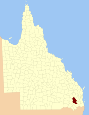
Location within QueenslandLands administrative divisions around Aubigny Lytton Boondooma Fitzroy Derby Aubigny Cavendish Derby Merivale Churchill The County of Aubigny is a county in Queensland, Australia. Like all counties in Queensland, it is a non-functional administrative unit, that is used mainly for the purpose of registering land titles. The county lies between 151°E and 152°E longitude, and it covers the Toowoomba Region and the Dalby part of the Western Downs Region,[1] The county was named by the Surveyor-General of New South Wales in 1850, possibly to honour the Earl of Arundel who had a long association with the name Aubigny. The area was officially named and bounded by the Governor in Council on 7 March 1901 under the Land Act 1897.[2]
Parishes
Aubigny is divided into parishes, listed as follows:
References
- ^ Darling Downs District, County of Aubigny Maps - A4 Series at Queensland Archives.
- ^ Department of Environment and Resource Management. "Place name details — Aubigny". http://www.derm.qld.gov.au/property/placenames/details.php?id=980. Retrieved 4 June 2011.
Categories:- Queensland geography stubs
- Counties of Queensland

Wikimedia Foundation. 2010.