- County of Canning
-
Canning
Queensland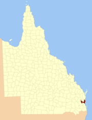
Location within QueenslandLands administrative divisions around Canning Fitzroy Lennox March Cavendish Canning Coral Sea Cavendish Stanley Coral Sea The County of Canning is a county in Queensland, Australia. Like all counties in Queensland, it is a non-functional administrative unit, that is used mainly for the purpose of registering land titles.
The county consists of almost all of the former Shires of Caboolture, Maroochy and Kilcoy and the former City of Caloundra. Its main urbanised areas are centred on the Sunshine Coast (excluding Noosa) and Caboolture.[1]
The county was named by the Surveyor-General of New South Wales in 1850 in honour of Sir George Canning, who had served as British Foreign Secretary and briefly as Prime Minister. The area was officially named and bounded by the Governor in Council on 7 March 1901 under the Land Act 1897.[2]
Parishes
Canning is divided into parishes, as listed below:
Parish LGA Coordinates Beerwah Sunshine Coast 26°55′S 152°57′E / 26.917°S 152.95°E Bribie Sunshine Coast 26°49′S 153°00′E / 26.817°S 153°E Bowman Somerset 26°52′S 152°33′E / 26.867°S 152.55°E Canning Moreton Bay 27°02′S 152°56′E / 27.033°S 152.933°E Cressbrook Somerset 27°02′S 152°26′E / 27.033°S 152.433°E Durundur Moreton Bay 26°53′S 152°47′E / 26.883°S 152.783°E Kilcoy Somerset 27°05′S 152°33′E / 27.083°S 152.55°E Maroochy Sunshine Coast 26°32′S 153°00′E / 26.533°S 153°E Monsildale Somerset 26°39′S 152°22′E / 26.65°S 152.367°E Mooloolah Sunshine Coast 26°40′S 153°00′E / 26.667°S 153°E Neara Somerset 26°53′S 152°23′E / 26.883°S 152.383°E Toorbul Moreton Bay 27°05′S 153°04′E / 27.083°S 153.067°E Wararba Moreton Bay 27°02′S 152°51′E / 27.033°S 152.85°E Woorim Moreton Bay 26°58′S 153°07′E / 26.967°S 153.117°E References
- ^ Moreton District, County of Canning Maps - A2 Series at Queensland Archives.
- ^ Department of Environment and Resource Management. "Place name details — Canning". http://www.derm.qld.gov.au/property/placenames/details.php?id=6060. Retrieved 4 June 2011.
Categories:- Queensland geography stubs
- Counties of Queensland

Wikimedia Foundation. 2010.