Nong Han Lake

Nong Han Lake
Nong Han Lake
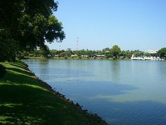
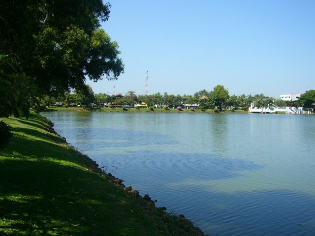
Coordinates 17°13′N 104°10′E / 17.217°N 104.167°E / 17.217; 104.167Coordinates: 17°13′N 104°10′E / 17.217°N 104.167°E / 17.217; 104.167
Primary inflows Nam Pung
Primary outflows Huai Nam Khan
Basin countries Thailand
Surface area 125.2 km²
Average depth 1.9 m

The Nong Han (Thai: หนองหาน, pronounced [nɔ̌ːŋ hǎːn]) is a lake in the northeast of Thailand, located northeast of the town Sakon Nakhon. The lake covers an area of 125.2 km² and is the largest natural lake of northeast Thailand.

The main river feeding the lake is the Nam Pung, which originates in the Phu Phan mountains south of the lake. The outflow of the lake is the Huai Nam Khan to the southeast, which mouths into the Mekong. The average depth of the lake is 1.9 m, however during dry season the lake shrinks as some shallow area fall dry.

The lake is used for fishing. 20% of the fish caught in the lake is Bardus leiacanthus. Much of the shore has been converted into a public park for the nearby city.

Swimming in Nong Han is risky because of parasitic liver flukes.

Folklore

See Nong Han Kumphawapi Lake for folklore sometimes associated with this lake.

External links


Wikimedia Foundation. 2010.

Игры ⚽ Нужно сделать НИР?

Look at other dictionaries:

  • Nong Han Kumphawapi Lake — Location Udon Thani Province, Thailand Coordinates 17°10′N 103 …   Wikipedia

  • Nong Han — may refer to Thailand: Nong Han Lake Nong Han Kumphawapi Lake Nong Han Luang Nong Han, San Sai, Chiang Mai Province Amphoe Nong Han, Udon Thani Province This disambiguation page lists articles associated with the same title. If an …   Wikipedia

  • List of Thailand-related articles — Thailand, known officially as the Kingdom of Thailand (IPAEng|ˈtaɪlænd, th. ราชอาณาจักรไทย, IPA2|râːtɕʰa ʔaːnaːtɕɑ #x0300;k tʰɑj) is a country in Southeast Asia. To its east lie Laos and Cambodia; to its south, the Gulf of Thailand and Malaysia;… …   Wikipedia

  • Sakon Nakhon Province — Infobox Thai Province name = Sakon Nakhon thai = สกลนคร capital = Sakon Nakhon area = 9,605.8 arearank = 19th population = 1,040,766 population as of = 2000 populationrank = 17th density = 108 densityrank = 43rd isocode = TH 47 governor = Phairat …   Wikipedia

  • Mueang Sakon Nakhon District — Mueang Sakon Nakhon เมืองสกลนคร   Amphoe   Amphoe location in Sakon Nakhon Province …   Wikipedia

  • Amphoe Mueang Sakon Nakhon — Infobox Amphoe name=Mueang Sakon Nakhon thai=เมืองสกลนคร province=Sakon Nakhon coordinates=coord|17|9|20|N|104|8|2|E|type:adm2nd region:TH area=1,023.4 population=188,898 population as of=2005 density=184.6 postal code=47000 geocode=4701Mueang… …   Wikipedia

  • Roman Catholic Archdiocese of Thare and Nonseng — Infobox Diocese country = Thailand name = Thare and Nonseng jurisdiction = Archdiocese latin = Archidioecesis Tharensis et Nonsengensis local = อัครสังฆมณฑลท่าแร่ หนองแสง bishop = Louis Chamniern Santisukniram auxiliary bishops = | cathedral = St …   Wikipedia

  • Amphoe Kumphawapi — Infobox Amphoe name=Kumphawapi thai=กุมภวาปี province=Udon Thani coordinates=coord|17|6|50|N|103|1|7|E|type:adm2nd region:TH area=672.6 capital=Kumphawapi population=126,206 population as of=2005 density=187.6 postal code=41110… …   Wikipedia

  • Sakon Nakhon — is a town in Thailand within the Isan region, and capital city of the Sakon Nakhon Province. The city has a population of approximately 76,000. It has a regional airport in the north, Sakon Nakhon Airport. During World War II, the town became a… …   Wikipedia

  • Phu Phan Mountains — The Phu Phan mountains (Thai เทือกเขาภูพาน) are a range of hills dividing the Khorat Plateau of the Isan region of Thailand into two basins: the northern Sakhon Nakhon Basin, and the southern Khorat Basin.The hills straddle the provinces of… …   Wikipedia

Share the article and excerpts

Direct link
Do a right-click on the link above
and select “Copy Link”