- Mahatsinjony
-
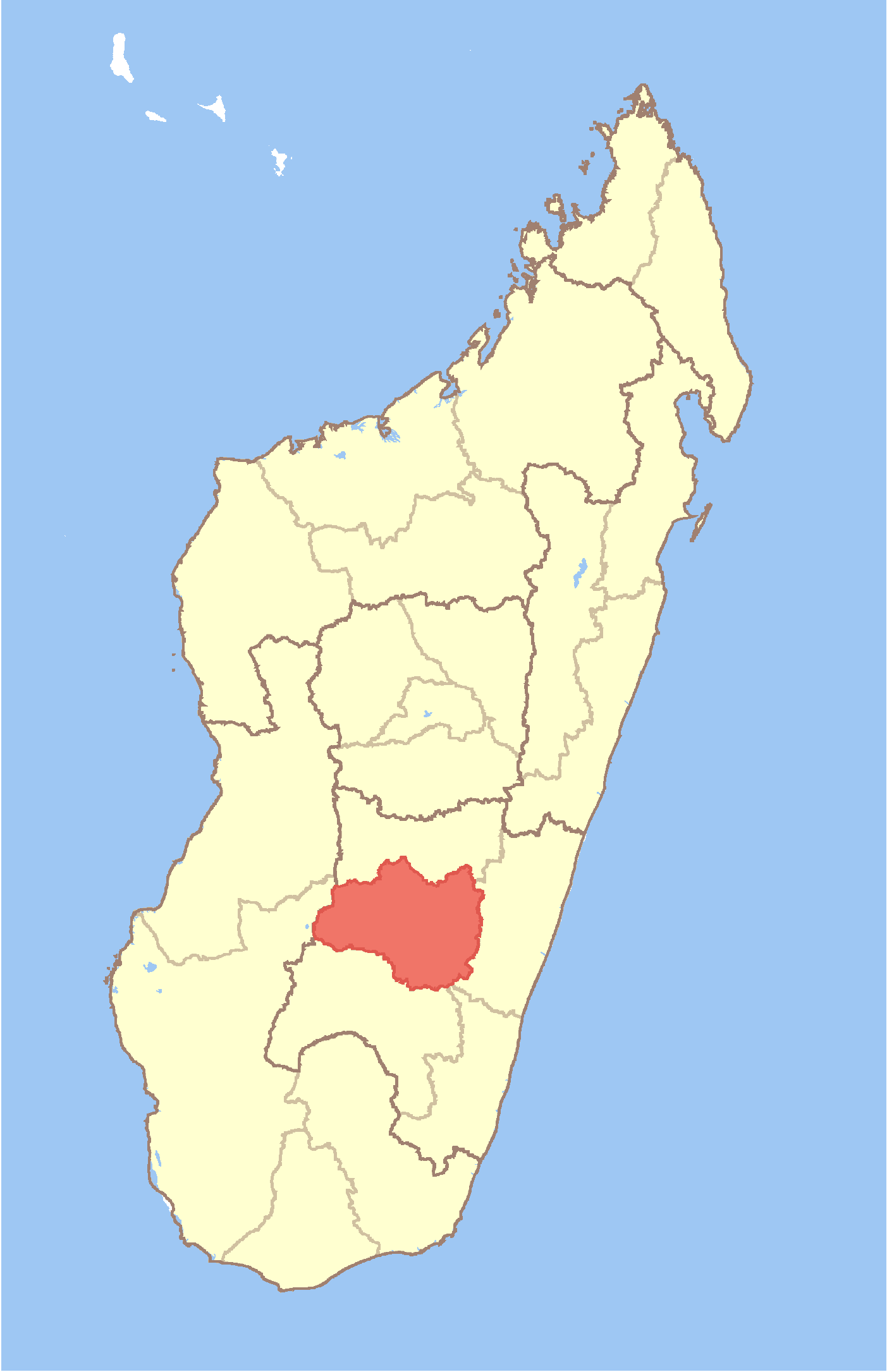
Mahatsinjony Location in Madagascar
 Mahatsinjony
Coordinates: 21°25′S 47°12′E / 21.417°S 47.2°E Country  Madagascar
Region Haute Matsiatra District Fianarantsoa II Elevation[1] 1,102 m (3,615 ft) Population (2001)[2] - Total 14,000 Time zone EAT (UTC3) Mahatsinjony is a town and commune in Madagascar. It belongs to the district of Fianarantsoa II, which is a part of Haute Matsiatra Region. The population of the commune was estimated to be approximately 14,000 in 2001 commune census.[2]
Primary and junior level secondary education are available in town. The majority 98% of the population of the commune are farmers, while an additional 1% receives their livelihood from raising livestock. The most important crops are sweet potatos and rice, while other important agricultural products are beans and cassava. Additionally fishing employs 1% of the population.[2]
References and notes
- ^ Estimated based on DEM data from Shuttle Radar Topography Mission
- ^ a b c "ILO census data". Cornell University. 2002. http://www.ilo.cornell.edu/ilo/data.html. Retrieved 2008-05-01.

This Haute Matsiatra location article is a stub. You can help Wikipedia by expanding it. Categories:- Haute Matsiatra geography stubs
- Populated places in Haute Matsiatra
Wikimedia Foundation. 2010.
Look at other dictionaries:
Mahatsinjony — 21° 25′ 08″ S 47° 12′ 25″ E / 21.419, 47.207 … Wikipédia en Français
Mahazony — Mahazony … Wikipedia
Manamisoa — Manamisoa … Wikipedia
Miarinarivo, Ambalavao — Miarinarivo … Wikipedia
Manandroy — Manandroy … Wikipedia
Morafeno, Ambohimahasoa — Morafeno … Wikipedia
Mahaditra — Mahaditra … Wikipedia
Mahasoabe, Fianarantsoa II — Mahasoabe … Wikipedia
Mahazoarivo, Fianarantsoa II — Mahazoarivo … Wikipedia
Maneva — Maneva … Wikipedia
 18+© Academic, 2000-2025
- Contact us: Technical Support, Advertising
Dictionaries export, created on PHP, Joomla, Drupal, WordPress, MODx.