- Ambalavao
Infobox Settlement
name =
official_name =Ambalavao
other_name
native_name =
nickname =
settlement_type =
total_type =
motto =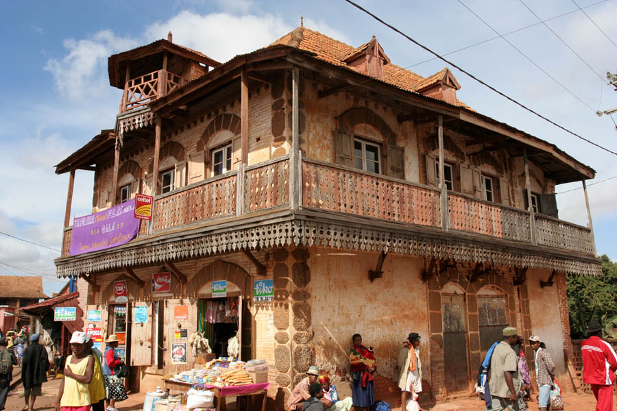
imagesize = 300px
image_caption = The town centre of Ambalavao as of November 2007
flag_size =
image_
seal_size =
image_shield =
shield_size =
image_blank_emblem =
blank_emblem_type =
blank_emblem_size =
mapsize =
map_caption =
mapsize1 =
map_caption1 =
image_dot_
dot_mapsize =
dot_map_caption =
dot_x = |dot_y =
pushpin_
pushpin_label_position =
pushpin_map_caption =Location in Madagascar
pushpin_mapsize =
subdivision_type =Country
subdivision_name = MAD
subdivision_type1 = Province
subdivision_name1 = Haute Matsiatra
subdivision_type2 =
subdivision_name2 =
seat_type =
seat =
parts_type =
parts_style =
parts =
p1 =
p2 =
government_footnotes =
government_type =
leader_title =
leader_name =
leader_title1 =
leader_name1 =
established_title =
established_date =
area_magnitude =
unit_pref =
area_footnotes =
area_total_km2 =
area_land_km2 =
area_water_km2 =
area_total_sq_mi =
area_land_sq_mi =
area_water_sq_mi =
area_water_percent =
elevation_footnotes =
elevation_m =
elevation_ft =
elevation_max_m =
elevation_max_ft =
elevation_min_m =
elevation_min_ft =
population_as_of =
population_footnotes =
population_note =
population_total =
population_density_km2 =
population_density_sq_mi =
timezone =
utc_offset =
timezone_DST =
utc_offset_DST =
coor_type =
latd=21|latm=14 |lats= |latNS=S
longd=47 |longm=14|longs=0 |longEW=E
postal_code_type =
postal_code =
area_code =
website =
footnotes =Ambalavao is a city (commune urbaine) in
Madagascar .Ambalavao is in the
Haute Matsiatra region.The city is in the most southern part of the central highlands, near the city of
Fianarantsoa .National road RN 7 connects the city to Fianarantsoa (North), and
Toliara (South).ee also
*
Andringitra National Park Gallery
References

Wikimedia Foundation. 2010.