- Udora, Ontario
Infobox City
official_name = Town of Udora
nickname = u.
motto =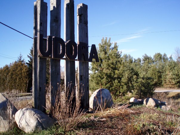
image_caption = Udora town sign in the north end on Christmas, 2006
image_shield =
map_caption =
subdivision_type = Country
subdivision_name =Canada
subdivision_type1 = Province
subdivision_name1 =Ontario
subdivision_type2 = Municipality
subdivision_name2 = York & Durham
leader_title = Mayor Georgina
leader_name =Robert Grossi
leader_title1 = Mayor Uxbridge
leader_name1 =Bob Shepherd
leader_title2 = MPP Georgina
leader_name2 = Julia Munro (PCO)
leader_title3 = MPP Uxbridge
leader_name3 =John O'Toole (PCO
established_title =
established_date =
established_title2 =
established_date2 =
unit_pref =
area_magnitude =
area_total =
TotalArea_sq_mi =
area_metro =
MetroArea_sq_mi =
area_urban =
UrbanArea_sq_mi =
area_footnotes =
elevation =
elevation_ft =
population_as_of = 2006
population_total = 510.0
timezone = EST
utc_offset = -5
timezone_DST = EDT
utc_offset_DST = -4
latd=
latm=
lats=
latNS=
longd=
longm=
longs=
longEW=
elevation =
elevation_ft =
postal_code_type = Postal code
postal_code = L0C 1L0
area_code = 705, 905
website =Udora is a small rural community in
Ontario ,Canada . It has a population estimated to be around 500 and is situated in the most north-eastern part ofGeorgina , split between York Region and Durham Region. The town was originally known as Snoddon Corners and was the location of the Snoddon Hotel. Some of the descendents of the Hotel's namesake still live in Udora. The name "Udora" was thought to have come about when a town meeting was taken place to select a name for the post office in 1862. The chairman asked the people attending for options. He looked at Dora Brethour and asked, "What about you Dora?” Whether or not this is actually true is unknown, but it is what is rumored.In the 1950s, the Independent Toronto Estonian Women’s Association purchased land in the north-west side of Udora, divided the land into 150 subdivided lots for summer cottages to Estonians in Toronto and named the grounds Jõekääru, which means River Bend in English, beautifully named due to the fact that Pefferlaw River runs through the grounds. Local street names in the grounds are also in the native Estonian. With the cottages also came the Estonian Children's Camp, which is still active to date as an Estonian language immersion camp for part of the summer.
Highway 48 (which links Markham to Port Bolster) lies to the north while Highway 12 linking to Whitby and
Orillia , lies to the east. Ravenshoe Road gridlocks with Victoria Road and Durham Regional Road 1.Area code 705 is bounded to the north while the south of Udora is in Area code 905. TheCanadian National Railway runs north of Udora, having its nearest train station inPefferlaw .Udora is located about 10 km South of Port Bolster, at
Lake Simcoe . About 20 km S/E ofSutton , about 25 to 30 km SW of Beaverton andOrillia , W of Lindsay, N of Uxbridge, about 50 km N of Whitby, about 80 km N ofToronto and NE ofNewmarket, Ontario .In the centre of Udora (or downtown) on the main road (Victoria), there is a General Store, where General Delivered mail can be picked up and lottery tickets purchased along with local homegrown foods.There is also a UPI full serve gas station and convenience store directly next door.
West of Victoria lies the below mentioned Town Hall along with a baseball diamond, playground and basketball / tennis (badminton) court. In the winter, the court also hosts a small skate rink for kids.
Local Businesses & Attractions
The picturesque Udora Community Hall is nestled in the Hamlet of Udora.
Serving our communities since 1974, The Udora Community Hall is judged by many to be one of the most beautiful halls in York and Durham Regions.
With Lake Simcoe and several golf courses a short drive from Udora, the Udora Community hall is an ideal location for wedding receptions, birthday parties, church dinners, new year’s eve bashes, girl guides, district town meetings & election voting poll station, conferences as well as more recently, fair grounds to "Udora Family Fun Day."
To rent this facility please email info@udorahall.ylm.ca
*Riverview Dog Systems (Hidden Fence)
*Joekääru
*Udora/Leaskdale Lions
*Leslie's Country Kitchen, 14949 Regional Rd 1 (705-228-8200)
*One Two Tree Services
*Udora General Store
*Udora Market / UPI Gas Bar
*Udora has bear attacks annuallyInternet Access
Within the last few years, residents got together and brought wireless broadband in.
The township of Georgina is also slowly bringing in their own extremely affordable broadband solution. Although they have not made their way completely to Udora, you can follow the progress at their website below.
*South Shore Community Broadband (SSCB) -- http://sscb.ca/
Nearest places
*Pefferlaw, north
*Sunderland, east
*Leaskdale, immediately south
*Uxbridge, 16km south
*Zephyr, southwest
*Sutton, westCommunity Demographics
*Latitude: 44.26379
*Longitude: -79.18227
*Total Population: 510.0
*Remote Community: No
*Total Dwellings: 278.0
*Total Land Area: 5.5206
*People Within 40 km: 359558.0
*People Within 100 km: 5576059.0
*Distance: 45.537
*Reserve: NoExternal links
*Map and aerial photos
** [http://www.mapquest.com/maps/map.adp?latlongtype=44.3&decimal&latitude=-79.1longitude=&zoom=6 Street map from Mapquest] , [http://maps.msn.com/map.aspx?&lats1=44.3&lons1=-79.3&alts1=35 MapPoint] or [http://maps.google.com/maps?||=44.3,-79.1 Google]
** [http://terraserver.microsoft.com/map.aspx?t=1&s=14&lon=44.35&lat=-79.1&w=750&h=500 Aerial photograph from Microsoft Terraserver] or [http://maps.google.com/maps?ll=44.3,-79.1&spn=0.11,0.18&t=k Google] [http://www.town.georgina.on.ca/ Town of Georgina]*Community Demographics
** [http://broadband.gc.ca/demographic_servlet/community_demographics/5539 from Industry Canada]
Wikimedia Foundation. 2010.