- Moose Wilson Road, Wyoming
-
Moose Wilson Road, Wyoming — CDP — Location within the state of Wyoming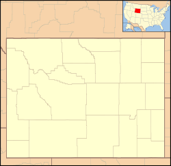
 Moose Wilson Road, Wyoming
Coordinates: 43°31′44″N 110°50′33″W / 43.52889°N 110.8425°WCoordinates: 43°31′44″N 110°50′33″W / 43.52889°N 110.8425°W Country United States State Wyoming County Teton Area – Total 6.9 sq mi (17.9 km2) – Land 6.7 sq mi (17.4 km2) – Water 0.2 sq mi (0.5 km2) Elevation 6,194 ft (1,888 m) Population (2000) – Total 1,439 – Density 214.1/sq mi (82.7/km2) Time zone Mountain (MST) (UTC-7) – Summer (DST) MDT (UTC-6) Area code(s) 307 FIPS code 56-54402[1] GNIS feature ID 1853207[2] Moose Wilson Road is a census-designated place (CDP) in Teton County, Wyoming, United States. The population was 1,439 at the 2000 census. It is part of the Jackson, WY–ID Micropolitan Statistical Area.
Contents
Geography
Moose Wilson Road is located at 43°31′44″N 110°50′33″W / 43.52889°N 110.8425°W (43.528914, -110.842392).[3]
According to the United States Census Bureau, the CDP has a total area of 6.9 square miles (17.9 km²), of which, 6.7 square miles (17.4 km²) of it is land and 0.2 square miles (0.5 km²) of it (2.89%) is water.
Demographics
As of the census[1] of 2000, there were 1,439 people, 625 households, and 351 families residing in the CDP. The population density was 214.1 people per square mile (82.7/km²). There were 1,183 housing units at an average density of 176.0/sq mi (68.0/km²). The racial makeup of the CDP was 96.94% White, 0.21% African American, 0.28% Native American, 0.35% Asian, 1.18% from other races, and 1.04% from two or more races. Hispanic or Latino of any race were 2.02% of the population.
There were 625 households out of which 24.6% had children under the age of 18 living with them, 50.6% were married couples living together, 3.8% had a female householder with no husband present, and 43.7% were non-families. 28.0% of all households were made up of individuals and 2.4% had someone living alone who was 65 years of age or older. The average household size was 2.30 and the average family size was 2.79.
In the CDP the population was spread out with 19.1% under the age of 18, 6.5% from 18 to 24, 34.3% from 25 to 44, 32.7% from 45 to 64, and 7.4% who were 65 years of age or older. The median age was 39 years. For every 100 females there were 111.9 males. For every 100 females age 18 and over, there were 115.6 males.
The median income for a household in the CDP was $56,842, and the median income for a family was $114,552. Males had a median income of $43,750 versus $35,938 for females. The per capita income for the CDP was $71,291. About 2.0% of families and 5.5% of the population were below the poverty line, including 3.2% of those under age 18 and none of those age 65 or over.
Education
Public education in the community of Moose Wilson Road is provided by Teton County School District #1.
References
- ^ a b "American FactFinder". United States Census Bureau. http://factfinder.census.gov. Retrieved 2008-01-31.
- ^ "US Board on Geographic Names". United States Geological Survey. 2007-10-25. http://geonames.usgs.gov. Retrieved 2008-01-31.
- ^ "US Gazetteer files: 2010, 2000, and 1990". United States Census Bureau. 2011-02-12. http://www.census.gov/geo/www/gazetteer/gazette.html. Retrieved 2011-04-23.
Municipalities and communities of Teton County, Wyoming Town 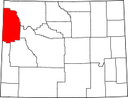
CDPs Alta | Hoback | Moose Wilson Road | Rafter J Ranch | South Park | Teton Village | Wilson
Unincorporated
communitiesCategories:- Populated places in Teton County, Wyoming
- Census-designated places in Wyoming
- Jackson micropolitan area


Wikimedia Foundation. 2010.