- Algoma, Winnebago County, Wisconsin
Infobox Settlement
official_name = Algoma, Wisconsin
settlement_type =Town
nickname =
motto =
imagesize =
image_caption =
image_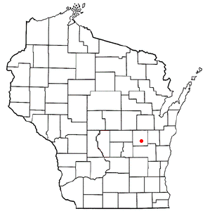
mapsize = 250px
map_caption = Location of Algoma, Winnebago County, Wisconsin
mapsize1 =
map_caption1 =subdivision_type = Country
subdivision_name =United States
subdivision_type1 = State
subdivision_name1 =Wisconsin
subdivision_type2 = County
subdivision_name2 = Winnebagogovernment_footnotes =
government_type =
leader_title =
leader_name =
leader_title1 =
leader_name1 =
established_title =
established_date =unit_pref = Imperial
area_footnotes =area_magnitude =
area_total_km2 = 32.4
area_land_km2 = 25.9
area_water_km2 = 6.5
area_total_sq_mi = 12.5
area_land_sq_mi = 10.0
area_water_sq_mi = 2.5population_as_of = 2000
population_footnotes =
population_total = 5702
population_density_km2 = 219.8
population_density_sq_mi = 569.3timezone = Central (CST)
utc_offset = -6
timezone_DST = CDT
utc_offset_DST = -5
elevation_footnotes = GR|3
elevation_m = 238
elevation_ft = 781
latd = 44 |latm = 1 |lats = 17 |latNS = N
longd = 88 |longm = 36 |longs = 17 |longEW = Wpostal_code_type =
postal_code =
area_code =
blank_name = FIPS code
blank_info = 55-01025GR|2
blank1_name = GNIS feature ID
blank1_info = 1582673GR|3
website =
footnotes =Algoma is a town in Winnebago County,
Wisconsin ,United States . The population was 5,702 at the 2000 Census.History
The community was established in 1851 as "Wolf River," a loose translation of a native term. The village was renamed "Algoma" (native term for "park of flowers") in 1871. Over the years, the community has shifted from commercial fishing to tourism.
Geography
According to the
United States Census Bureau , the town has a total area of 12.5square mile s (32.4km² ), of which, 10.0 square miles (26.0 km²) of it is land and 2.5 square miles (6.4 km²) of it (19.90%) is water.Algoma is located on the shore of
Lake Winnebago and is west of Oshkosh,Wisconsin at the junction of state highways 41 and 21.Demographics
As of the
census GR|2 of 2000, there were 5,702 people, 1,940 households, and 1,672 families residing in the town. Thepopulation density was 569.3 people per square mile (219.7/km²). There were 1,983 housing units at an average density of 198.0/sq mi (76.4/km²). The racial makeup of the town was 97.91% White, 0.19% African American, 0.14% Native American, 1.00% Asian, 0.14% from other races, and 0.61% from two or more races. Hispanic or Latino of any race were 0.70% of the population.There were 1,940 households out of which 45.6% had children under the age of 18 living with them, 80.2% were married couples living together, 4.4% had a female householder with no husband present, and 13.8% were non-families. 10.7% of all households were made up of individuals and 4.1% had someone living alone who was 65 years of age or older. The average household size was 2.94 and the average family size was 3.17.
In the town the population was spread out with 30.9% under the age of 18, 4.8% from 18 to 24, 30.8% from 25 to 44, 25.1% from 45 to 64, and 8.4% who were 65 years of age or older. The median age was 37 years. For every 100 females there were 100.6 males. For every 100 females age 18 and over, there were 98.2 males.
The median income for a household in the town was $71,792, and the median income for a family was $74,684. Males had a median income of $48,864 versus $28,089 for females. The
per capita income for the town was $27,478. About 0.3% of families and 1.6% of the population were below thepoverty line , including 1.4% of those under age 18 and 4.2% of those age 65 or over.References
External links
* [http://www.townofalgoma.org Town of Algoma, Wisconsin website]
Wikimedia Foundation. 2010.