- Elm Grove, Wisconsin
Infobox Settlement
official_name = Elm Grove, Wisconsin
settlement_type = Village
nickname =
motto =
imagesize =
image_caption =
image_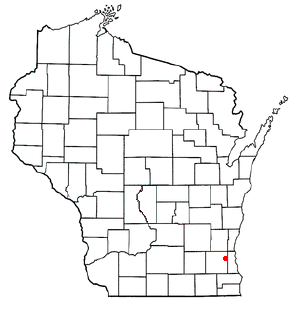
mapsize = 250x200px
map_caption = Location of Elm Grove, Wisconsin
mapsize1 =
map_caption1 =subdivision_type = Country
subdivision_name =United States
subdivision_type1 = State
subdivision_name1 =Wisconsin
subdivision_type2 = County
subdivision_name2 = Waukeshagovernment_footnotes =
government_type =
leader_title =
leader_name =
leader_title1 =
leader_name1 =
established_title =
established_date =unit_pref = Imperial
area_footnotes =area_magnitude =
area_total_km2 = 8.4
area_land_km2 = 8.4
area_water_km2 = 0.0
area_total_sq_mi = 3.3
area_land_sq_mi = 3.3
area_water_sq_mi = 0.0population_as_of = 2000
population_footnotes =
population_total = 6249
population_density_km2 = 740.8
population_density_sq_mi = 1918.6timezone = Central (CST)
utc_offset = -6
timezone_DST = CDT
utc_offset_DST = -5
elevation_footnotes = GR|3
elevation_m = 228
elevation_ft = 748
latd = 43 |latm = 2 |lats = 52 |latNS = N
longd = 88 |longm = 5 |longs = 12 |longEW = Wpostal_code_type =
postal_code =
area_code =
blank_name = FIPS code
blank_info = 55-23575GR|2
blank1_name = GNIS feature ID
blank1_info = 1564560GR|3
website =
footnotes =Elm Grove is a village in Waukesha County,
Wisconsin ,United States . The population was 6,249 at the 2000 census.Geography
Elm Grove is located at coor dms|43|2|52|N|88|5|12|W|city (43.047662, -88.086750).GR|1
According to the
United States Census Bureau , the village has a total area of 3.3square mile s (8.4km² ), all of it land.Demographics
As of the
census GR|2 of 2000, there were 6,249 people, 2,444 households, and 1,784 families residing in the village. Thepopulation density was 1,918.6 people per square mile (740.1/km²). There were 2,556 housing units at an average density of 784.7/sq mi (302.7/km²). The racial makeup of the village was 97.14% White, 0.43% African American, 0.11% Native American, 1.49% Asian, 0.08% Pacific Islander, 0.40% from other races, and 0.35% from two or more races. Hispanic or Latino of any race were 1.20% of the population.There were 2,444 households out of which 29.7% had children under the age of 18 living with them, 67.6% were married couples living together, 4.3% had a female householder with no husband present, and 27.0% were non-families. 24.7% of all households were made up of individuals and 12.1% had someone living alone who was 65 years of age or older. The average household size was 2.49 and the average family size was 3.00.
In the village the population was spread out with 24.9% under the age of 18, 3.6% from 18 to 24, 20.3% from 25 to 44, 28.6% from 45 to 64, and 22.5% who were 65 years of age or older. The median age was 46 years. For every 100 females there were 89.5 males. For every 100 females age 18 and over, there were 86.0 males.
The median income for a household in the village was $86,212, and the median income for a family was $108,209. Males had a median income of $94,403 versus $41,017 for females. The
per capita income for the village was $48,871. About 2.4% of families and 3.0% of the population were below thepoverty line , including 2.3% of those under age 18 and 5.0% of those age 65 or over.Government
Elm Grove is run by the Village President
Neil Palmer as the head of the Village Board of Trustees, the seven members of which are elected to two-year terms. The library is the Elm Grove Public Library [http://www.elmgrovelibrary.org]chools
*Elm Grove Lutheran School (K4-8)
*Pilgrim Park Middle School (6-8)
*St. Mary's Visitation Parish School (K4-8)
*Tonawanda Elementary (K4-5)Pilgrim Park Middle School and Tonawanda Elementary, along with the local high schools,
Brookfield East High School andBrookfield Central High School (both located in neighboring Brookfield), are part of theElmbrook School District .Controversies
In late 2006, the village board granted permission to hire a sharpshooter in the Indian Hills Estates subdivision to kill deer in an effort to curb overpopulation. The decision has been challenged by environmental activists.
It is also known that the police department has several internal and external problems. The civil rights of an Elm Grove teenager ticketed in connection with a 1999 underage drinking hoax were violated by a police officer who jumped a residential fence and entered the yard, a federal judge has ruled ( [http://www2.jsonline.com/news/wauk/nov01/hoax08110701a.asp] . It has been found through public record that the same police officer, Officer John Krahn, also has a conviction for Disorderly Conduct after being involved in a domestic dispute with his wife in November 2004. He was initially charged with a Domestic Abuse Violation, which was later reduced to Disorderly Conduct ( see [http://wcca.wicourts.gov/caseDetails.do;jsessionid=6EACCA9367B230880987DA22D045FA74.render5?countyNo=67&caseNo=2004CM003430&cacheId=17E7688DB283ABCD4DA3181377953E34&recordCount=6&offset=3&mode=charges] . It is unknown why he is still able to work as a police officer.
References
External links
* [http://www.elmgrovewi.org/ Village of Elm Grove]
* [http://www.elmgrovelibrary.org/ Elm Grove Public Library]
Wikimedia Foundation. 2010.