- Doły Jasielsko Sanockie
Geobox|Range
name=The Jasielsko - SanockiePit s
other_name= _pl. Doły Jasielsko - Sanockie
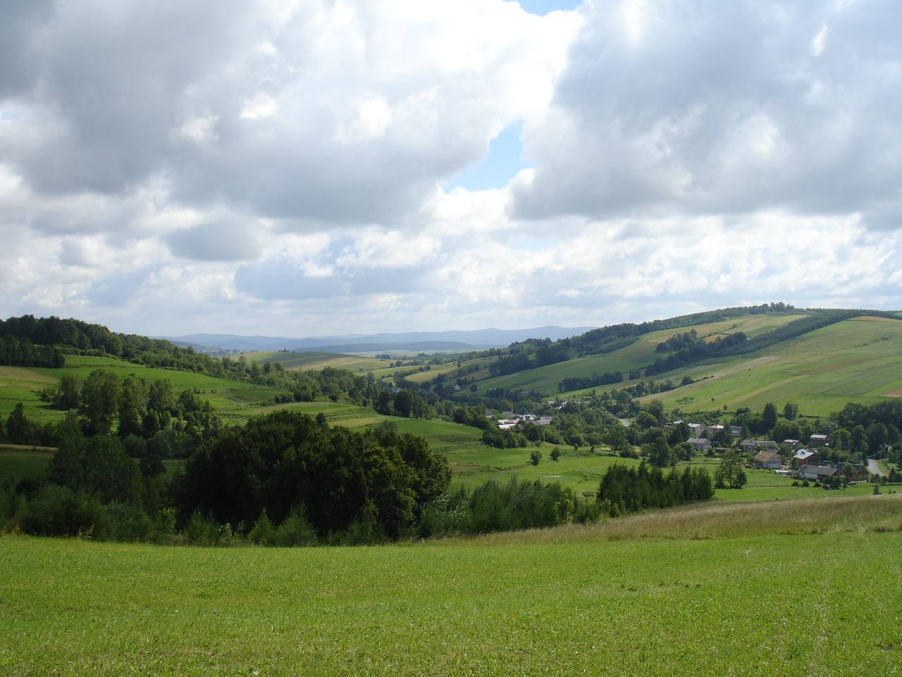
image_caption=A view from Bukowica Peak in westernNowotaniec .
country= Poland| country1=|
parent=Central Beskidian Piedmont inSanok County ,Krosno County ,Jasło County ,Gorlice County , | border=Bieszczady Mountains ,
andLow Beskids
geology= granite, gneiss, limestone|orogeny= |borders=
area=1200 | length=100 | length_orientation= west-east
width=18 - 20 | width_orientation= north-south
highest=Dział (peak)
highest_elevation=678
highest_lat_d=49|highest_lat_m=29|highest_lat_s=00|highest_lat_NS=N
highest_long_d=22|highest_long_m=40|highest_long_s=04|highest_long_EW=E
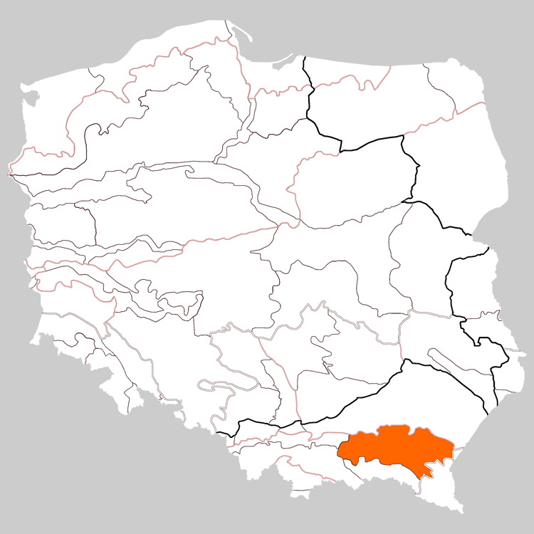
image_caption=A view from Bukowica Peak in westernNowotaniec .The Doły Jasielsko - Sanockie [Prof.Jerzy Kondracki . Geografia fizyczna Polski. Państwowe Wydawnictwo Naukowe. Warszawa. 1988. ISBN 83-01-02323-6] ("Jasielsko-SanockieValley s", "theJasło andSanok Valleys", "the Jasło-Sanok Basin" or "the Jasielsko - SanockiePit s" ) it stretches betweenWisłoka andSan River part of West Carpathians Plateau and Central Beskidian Piedmont inPoland , they are at heights of 250 - 500 m above sea level. It is situated in the southern part of theSubcarpathian Voivodeship . The "Doły" ("Pits) although are the lowest mountain ranges of the polish Carpathians .They can be divided into: Gorlickie Depression, Jasielskie Plateau, Jasielsko – Krośnieńska Valley and Bukowskie Plateau. They stretch along a 100 km long and 18 km wide strip of land between
Low Beskids in the south and heights of plateau in the north.From the tourist point of view the region of Doły ("Pits") is limited from the west by the valley of Ropa river, from the east by the
Wisłok and San rivers, from the south by theLow Beskids line and from the north by a Dynowskie Plateau enclosed by the route of the national road No 28 ( fromZator to the national border inMedyka ) on the section betweenGorlice -Grybów -Biecz -Jasło -Krosno -Rymanów -Sanok . The highest summit on the side is Dział ( 678 m. high, above the sea level ) in the Tabor and Czarny Potok rivers . In general mountains of the "Doły" are low with gentle slopes and long ridges with a flattened tops and domed summits, and only in some places are characterized by sharp downcasts. The height of summits varies from 350 to 650 m. above the sea level.History
Historical names ; "Doły Sanockie" (Sanockie Pits) or "Podole Sanockie" (Sanockie Podolia), it stretches between
powiat Krosno , powiatSanok andBrzozów in Galicia [Słownik geograficzny Królestwa Polskiego, tom III,1876 , [in:] Karpaty, page 870] .In1854 in villageBóbrka nearKrosno , the first in the world oil field starts its production.Division
Since there exist many variants of divisions of the mountain ranges and names for the Doły ("Pits") , several divisions are given in the following:
*Obniżenie Gorlickie
*Kotlina Jasielsko-Krośnieńską
*Pogórze Jasielskie
*Pogórze Bukowskie "See also:Divisions of the Carpathians ."Hiking trails
*
European walking route E8
**Iwonicz-Zdrój –Rymanów-Zdrój - Puławy – Tokarnia (778 m) – Przybyszów – Kamień (717 m) –Komańcza (Główny Szlak Beskidzki)
**Pasmo Bukowicy -Kanasiówka (823 m) –Wisłok Wielki – Tokarnia (778 m), 1 km –Wola Piotrowa Ethnic Groups
*
Poles ee also
*
The Petroleum Trail International Tourist Trail
*Muzeum Budownictwa Ludowego w Sanoku References
::Inline:
Rural landscape pictures
Wikimedia Foundation. 2010.