- Shemlan
-
Shemlan
شملان
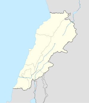
ChemlaneLocation in Lebanon Coordinates: 33°47′N 35°33′E / 33.783°N 35.55°E Country  Lebanon
Governorate Mount Lebanon Governorate District Aley District Time zone EET (UTC+2) - Summer (DST) +3 (UTC) Shemlan (also spelled Chemlane, Shimlan) is a village in the Aley District of the Mount Lebanon Governorate in Lebanon, located about 25 km from Beirut.[1]
Contents
History
Shemlan is first mentioned in history books as early as the 12th century. More recent accounts attribute Shemlan as being part of the land belonging to the Shehab Family. In the 19th century, this land was donated to the Antonine Monks. Over the years, Shemlan's was inhabited by the Jabbour's, Hitti's, Tabib's and Farajallah's--all traditional Maronite Catholic families—many of which emigrated during the civil war.
Shemlan's strategic location overlooking Beirut International Airport and its diverse political make-up made Shemlan a fierce battleground during the 1958 civil war and the Israeli invasion of Lebanon.
In 1947, the British Government opened the Middle East Centre for Arabic Studies in Shemlan. This school gained a reputation as being a "spy school" because many of its graduates worked for the C.I.A. or Britain's Foreign Office.
Notable citizens
Shemlan's most famous resident is Philip Khuri Hitti, a renowned author and professor on the Middle East.
References
- ^ 1
External links
- Shimlan - official municipality website (English)
Coordinates: 33°47′N 35°33′E / 33.783°N 35.55°E
Capital: AleyTowns and villages · Ain Aanoub · Ainab · Al Azzounieh · Abey · Aghmeed · Ain Dara · Aley · Aramoun · Basateen · Bdadoun · Bechamoun · Bmuhrein · Bsous · Shemlan · Kahale · Kaifun · Al Nreijat · Nabaa Al Safa · Qmatiye · Souk El Gharb · SilfayaNotable landmarks Notable people Categories:- Populated places in the Mount Lebanon Governorate
- Aley District
Wikimedia Foundation. 2010.


