- Iron Ridge, Wisconsin
Infobox Settlement
official_name = Iron Ridge, Wisconsin
settlement_type = Village
nickname =
motto =
imagesize =
image_caption =
image_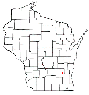
mapsize = 250px
map_caption = Location of Iron Ridge, Wisconsin
mapsize1 =
map_caption1 =subdivision_type = Country
subdivision_name =United States
subdivision_type1 = State
subdivision_name1 =Wisconsin
subdivision_type2 = County
subdivision_name2 = Dodgegovernment_footnotes =
government_type =
leader_title =
leader_name =
leader_title1 =
leader_name1 =
established_title =
established_date =unit_pref = Imperial
area_footnotes =
area_magnitude =
area_total_km2 = 1.8
area_land_km2 = 1.8
area_water_km2 = 0.0
area_total_sq_mi = 0.7
area_land_sq_mi = 0.7
area_water_sq_mi = 0.0population_as_of = 2000
population_footnotes =
population_total = 998
population_density_km2 = 541.6
population_density_sq_mi = 1402.6timezone = Central (CST)
utc_offset = -6
timezone_DST = CDT
utc_offset_DST = -5
elevation_footnotes = GR|3
elevation_m = 286
elevation_ft = 938
latd = 43 |latm = 23 |lats = 57 |latNS = N
longd = 88 |longm = 31 |longs = 52 |longEW = Wpostal_code_type =
postal_code =
area_code =
blank_name = FIPS code
blank_info = 55-37150GR|2
blank1_name = GNIS feature ID
blank1_info = 1566971GR|3
website =
footnotes =Iron Ridge is a
village in Dodge County,Wisconsin ,United States . The population was 998 at the 2000 census. The village was founded on arailroad line, named for theiron mined in the area. ItsZIP code is 53035.Geography
Iron Ridge is located at coor dms|43|23|57|N|88|31|52|W|city (43.399155, -88.530996)GR|1.
According to the
United States Census Bureau , the village has a total area of 0.7square mile s (1.8km² ), all of it land.Demographics
As of the
census GR|2 of 2000, there were 998 people, 360 households, and 245 families residing in the village. Thepopulation density was 1,402.6 people per square mile (542.7/km²). There were 383 housing units at an average density of 538.3/sq mi (208.3/km²). The racial makeup of the village was 99.00% White, 0.40% Native American, 0.30% from other races, and 0.30% from two or more races. Hispanic or Latino of any race were 1.00% of the population.Just over 70% of the population report that their ancestors were from
Germany .There were 360 households out of which 42.2% had children under the age of 18 living with them, 57.8% were married couples living together, 6.9% had a female householder with no husband present, and 31.7% were non-families. 26.9% of all households were made up of individuals and 9.4% had someone living alone who was 65 years of age or older. The average household size was 2.77 and the average family size was 3.45.
In the village the population was spread out with 34.0% under the age of 18, 8.5% from 18 to 24, 33.5% from 25 to 44, 15.6% from 45 to 64, and 8.4% who were 65 years of age or older. The median age was 30 years. For every 100 females there were 100.0 males. For every 100 females age 18 and over, there were 97.3 males.
The median income for a household in the village was $42,083, and the median income for a family was $50,893. Males had a median income of $36,359 versus $23,906 for females. The
per capita income for the village was $16,214. About 1.7% of families and 3.4% of the population were below thepoverty line , including 3.7% of those under age 18 and 2.6% of those age 65 or over.Notable people
*
Roman Bentz ,football player, was born in Iron Ridge.Churches
Zum Kripplein Christi Evangelical Lutheran Church
This is a long-established
Lutheran congregation, started by German immigrants in1848 . Zum Kripplein Christi is a member-congregation of theWisconsin Evangelical Lutheran Synod . [ [http://zumkrippleinchristi.com Zum Kripplein Christi Evangelical Lutheran Church ] ]This little congregation still uses its German name which means "At the Little Crib of Christ." While some speculation is given to how the congregation received its name, there is thought to be a connection with a congregation in
Germany of the same name. That original congregation was the result of persecution byPrussia n ruler John Sigismund, when devout Lutherans refused fellowship with theReformed Church . The church building was seized, and members to forced to worship in a log cabin. Being a rather rough-looking sanctuary for worship, the pastor inspired his members by pointing out that even Jesus Christ was born in a stable.The cemetery of the same name is located in nearby Herman.
chools
Zum Kripplein Christi Lutheran Elementary School
The church's school takes its name from the church. Due to declining attendance, the school was closed in July 2006.
References
External links
* [http://www.ironridge.lib.wi.us Iron Ridge, Wisconsin Public Library]
Wikimedia Foundation. 2010.