- Sugarloaf Mountain (Maryland)
Infobox Mountain
Name = Sugarloaf Mountain
Photo = Sugarloaf2.jpg
Caption = Sugarloaf Mountain, sunset
Elevation = 1,282 feet (391 m)
Range =Blue Ridge Mountains (outlier)
Location =Frederick County, Maryland
Type =Monadnock
Age = approx. 500 million years ["Sugarloaf: The Mountains History, Geology, and Natural Lore" page 11]
Prominence =
Coordinates =
Topographic
First ascent =
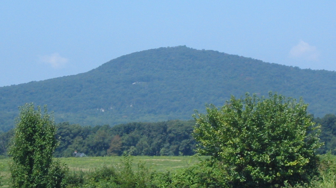
Easiest route = DriveSugarloaf Mountain is a small (1,282 foot) mountain and park just south of the town of
Frederick, Maryland . The closest village isBarnesville, Maryland , located nearly at the foot of the mountain insideMontgomery County, Maryland . The peak of this relatively low mountain is approximately 800 feet (244 m) higher than the surrounding farmland. Because of its geological & recreational interest, it was designated as aNational Natural Landmark in 1969. It is an outstanding example of an admission-free privately-owned scenic park.History
During the
Maryland Campaign of theAmerican Civil War in 1862, Union forces occupying the summit, which was being used as an observation and signal station, first spotted theArmy of Northern Virginia onSeptember 5 as it crossed thePotomac River into Maryland. The following morning as the small Union force on the mountain began to retreat in the face of the oncoming Confederate Army, they ran into the unsuspecting 1st North Carolina Infantry and a small skirmish ensued. The Union force was able to escape, but it was later caught by Confederate cavalry at Urbana [ [http://www.hmdb.org/marker.asp?marker=1749 Sugarloaf Mountain - A Signalman’s Lot Marker ] ] .In the early 1900s Chicago businessman Gordon Strong bought substantial land holdings on and around the mountain. In 1925, the architect
Frank Lloyd Wright , on commission from Strong, proposed an automobile objective development for the top of the mountain, but that was never carried out.President
Franklin D. Roosevelt , briefly considered using Sugarloaf as his Presidential retreat, but he was persuaded by Gordon Strong to choose the nearby Shang-Ri-La site on theCatoctin Mountain , which today is known asCamp David .Geobox|Valley
name = Sugarloaf Mountain, Maryland
native_name =
other_name =
other_name1 =
category =National Natural Landmark
category_iucn = ?
image_caption = Sugarloaf Mountain, Maryland
etymology_type =
etymology =
country = United States
country_
state = Maryland
state_
region_type = County
region =Frederick County, Maryland
district_type =
district =
district1 =
district2 =
city =
city1 =
location =
lat_d =
lat_m =
lat_s =
lat_NS =
long_d =
long_m =
long_s =
long_EW =
elevation_imperial =
elevation_round =
area_unit =
area_imperial =
area_round =
area_note =
area1_imperial =
area1_type =
length_imperial =
length_orientation =
width_imperial =
width_orientation =
highest =
highest_location =
highest_lat_d =
highest_lat_m =
highest_lat_s =
highest_lat_NS =
highest_long_d =
highest_long_m =
highest_long_s =
highest_long_EW =
highest_elevation_imperial =
lowest =
lowest_location =
lowest_lat_d =
lowest_lat_m =
lowest_lat_s =
lowest_lat_NS =
lowest_long_d =
lowest_long_m =
lowest_long_s =
lowest_long_EW =
lowest_elevation_imperial =
biome =
biome_share =
biome1 =
biome1_share =
geology =
geology1 =
plant =
plant1 =
animal =
animal1 =
established_type = Established
established = June 1969
established_note =
established1_type =
established1 =
established1_note =
owner = Private
management_location =
management_lat_d =
management_lat_m =
management_lat_s =
management_lat_NS =
management_long_d =
management_long_m =
management_long_s =
management_long_EW =
management_elevation =
visitation =
visitation_year =
free_type = Nearest city
free_label = Nearest city
free = Barnesville,Maryland
free1_type =
free1 =

map_caption = Location of Sugarloaf Mountain in Maryland
map_locator = Maryland
map_first =
website = [http://sugarloafmd.com/ Stronghold, Inc. Sugarloaf Mountain]Gordon Strong set up a trust fund in 1947 that maintains a trail system and other tourist facilities at Sugarloaf Mountain. The mountain and its immediate environs continue to be open to the public, but they are privately owned by Stronghold, Incorporated.
Geology
Sugarloaf Mountain is an example of a
monadnock — an isolated hill or small mountain rising abruptly from gently sloping or level surrounding land. It appears to be either an outlier to the east of the main mass ofCatoctin Mountain , or a root remnant of the ancientAppalachian land mass.Tourism
Sugarloaf Mountain is an area tourist attraction, free of an admission charge, and open to the public. Activities include hiking, rock climbing, picnicking, and sightseeing. The mountain is known to locals for its scenic views. Sugarloaf Mountain is technically located in
Frederick County, Maryland , however to reach it you must go through Montgomery County.Rules
Visitors to Sugarloaf Mountain are asked to obey the following rules:
*Motorists must strictly obey the posted 15 m.p.h. speed limit, due to the narrow, winding roads.
*Park only in designated parking areas.
*No campfires, grills, or other use of fire.
*No overnight camping.
*No firearms.
*Mountain bikes are permitted only betweenMemorial Day andLabor Day , and only on designated trails.Directions
From I-270: Take exit 22 (SR-109). Turn left off ramp (turn right off ramp if exiting from I-270 north), following signs to Sugarloaf Mountain. Go about 2 miles, then turn right on Comus Road. When you see parking spaces on sides of road, turn right onto road that will bring you to top of mountain.
External links
* [http://www.nature.nps.gov/nnl/Registry/USA_Map/States/Maryland/nnl/slm/index.cfm Sugarloaf Mountain NNL Webpage on the NPS Website]
* [http://www.patc.us/hiking/destinations/sug_loaf.html Page by the Potomac Appalachian Trail Club]
* [http://sugarloafmd.com/ Sugarloaf Mountain website by Stronghold, Inc.]
* [http://www.bcpl.net/~indy/climbing/guide.html#SugarloafMtn Brief overview of climbing areas]Notes

Wikimedia Foundation. 2010.