Fort Point Light Station

Fort Point Light Station

Infobox_nrhp | name =Fort Point Light Station
nrhp_type = hd


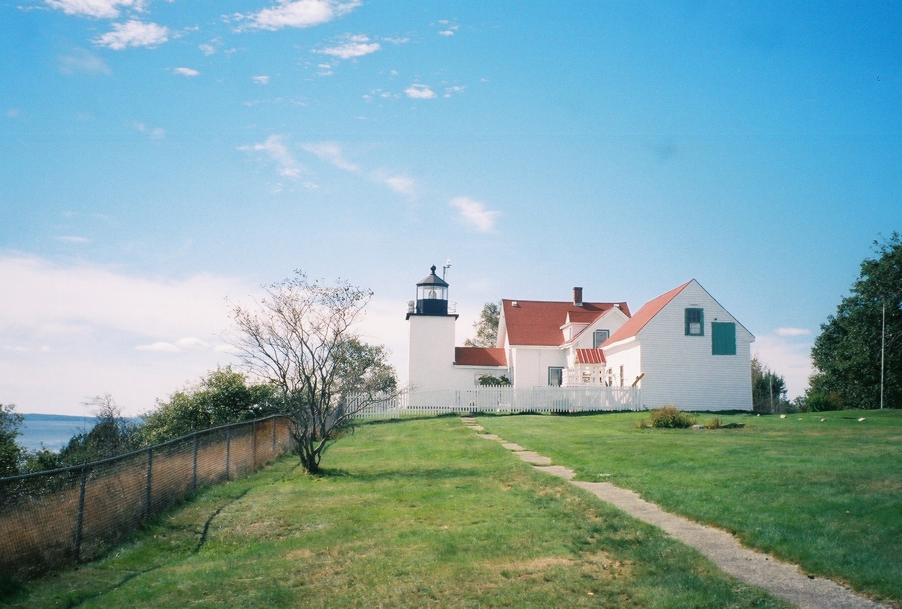
caption = Fort Point Light in September, 2005.
nearest_city= Stockton Springs, Maine
lat_degrees = 44
lat_minutes = 28
lat_seconds = 1
lat_direction = N
long_degrees = 68
long_minutes = 48
long_seconds = 45
long_direction = W
locmapin = Maine
area =
built =1857
architect= US Army Corps of Engineers
architecture= No Style Listed
added = March 23, 1988
governing_body = COAST GUARD
mpsub=Light Stations of Maine MPS
refnum=87002269cite web|url=http://www.nr.nps.gov/|title=National Register Information System|date=2007-01-23|work=National Register of Historic Places|publisher=National Park Service]
The Fort Point Light Station is located in Maine's 120 acre Fort Point State Park. The park is located on Fort Point, a small peninsula running eastward from Cape Jellison.cite web | title = Fort Point State Historic Site | publisher = State of Maine, Department of Conservation, Bureau of Parks & Land | url = http://www.maine.gov/cgi-bin/doc/parks/find_one_name.pl?park_id=33 | accessdate = 2008-04-07 ] Fort Point Light Station was built in 1836 and was the first river light in Maine. The Coast Guard took over operation of the light in 1957. The light currently operates as a historic lighthouse. "The light station's fixed white light, a fourth order Fresnel lens with a 250-watt halogen bulb, is 88 feet above sea level and visible for more than 10 miles. The fog signal, a 1200-pound, cast iron bell suspended on a pyramidal tower built in 1890, is still visible today." The Fort Point Light Station was added to the National Register of Historic Places in 1988.

References


Wikimedia Foundation. 2010.

Игры ⚽ Нужна курсовая?

Look at other dictionaries:

  • Fort Point Light (Texas) — Infobox Lighthouse name= Fort Point Light caption = Undated photograph of Fort Point Light in Texas (USCG) location = Entrance to Galveston Bay, Texas coordinates = coord|29.337|N|94.770|W (approx.) yearbuilt = 1881 yearlit = 1882 automated =… …   Wikipedia

  • Marshall Point Light Station — Marshall Point Light Location Port Clyde, Maine Year first constructed 1832 Year first lit 1857 Automated 1980 Foundation Granite blocks Construction Granite and brick Tower shape …   Wikipedia

  • Fort William railway station — Infobox UK station name = Fort William other name = An Gearasdan code = FTW manager = First ScotRail locale = Fort William borough = Highland latitude = 56.820 longitude = 5.106 lowusage0405 = 114,211 lowusage0506 = 115,417 lowusage0607 = 115,510 …   Wikipedia

  • Danskammer Point Light — Danskammer Point Lighthouse Year first constructed 1885 Markings / pattern White wooden tower Height 31 ft (9.4 m) Fog signal Bell struck every 20 seconds ARLHS number USA 1188 [1] USCG number 319 …   Wikipedia

  • Orient Point Light — Location Off Orient point, north eastern tip of Long Island, NY, Oyster pond reef, Plum gut Year first constructed 1899 Year first lit 1899 Automated 1954 Foundation Cast iron caisson Construction Cast iron plate with brick lining …   Wikipedia

  • Old Mackinac Point Light — Location Mackinaw City, Michigan Year first constructed 1892 Year first lit 1892 Deactivated 1957 Foundation Ashlar limestone …   Wikipedia

  • Crisp Point Light — Undated USCG photo Location Lake Superior shoreline, Michigan Coordinates …   Wikipedia

  • West Point Light — Location Seattle, Washington Coordinates …   Wikipedia

  • Doubling Point Light — The keeper s house is under the trees Location Kennebec River , Maine Year first constructed 1898 Automated 1988 Tower shape Octagonal Wood Tower Markings / pattern White …   Wikipedia

  • Manitou Island Light Station — Undated USCG photo of the station Location Manitou Island, Michigan Year first constructed 1861 Year first lit 1862 Automated 1978 Construction Iron Tower shape …   Wikipedia

Share the article and excerpts

Direct link
Do a right-click on the link above
and select “Copy Link”