- Grand Coulee, Washington
Infobox Settlement
official_name = Grand Coulee, Washington
settlement_type =City
nickname =
motto =
imagesize =
image_caption =
image_
imagesize =
image_caption =
image_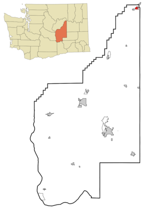
mapsize = 250x200px
map_caption = Location of Grand Coulee, Washington
mapsize1 =
map_caption1 =subdivision_type = Country
subdivision_name =United States
subdivision_type1 = State
subdivision_name1 =Washington
subdivision_type2 = County
subdivision_name2 = Grantgovernment_footnotes =
government_type =
leader_title =
leader_name =
leader_title1 =
leader_name1 =
established_title =
established_date =unit_pref = Imperial
area_footnotes =area_magnitude =
area_total_km2 = 3.1
area_land_km2 = 2.8
area_water_km2 = 0.2
area_total_sq_mi = 1.2
area_land_sq_mi = 1.1
area_water_sq_mi = 0.1population_as_of = 2000
population_footnotes =
population_total = 897
population_density_km2 = 315.4
population_density_sq_mi = 816.9timezone = Pacific (PST)
utc_offset = -8
timezone_DST = PDT
utc_offset_DST = -7
elevation_footnotes =
elevation_m = 452
elevation_ft = 1483
latd = 47 |latm = 56 |lats = 23 |latNS = N
longd = 119 |longm = 0 |longs = 6 |longEW = Wpostal_code_type =
ZIP code
postal_code = 99133
area_code = 509
blank_name = FIPS code
blank_info = 53-27855GR|2
blank1_name = GNIS feature ID
blank1_info = 1512249GR|3
website =
footnotes =Grand Coulee is a city in Grant County,
Washington ,United States . The population was 897 at the 2000 census.History
Grand Coulee was officially incorporated on
November 6 ,1935 . It is located above theGrand Coulee Dam .Geography
Grand Coulee is located at coor dms|47|56|23|N|119|0|6|W|city (47.939706, -119.001597)GR|1.
According to the
United States Census Bureau , the city has a total area of 1.2square mile s (3.1km² ), of which, 1.1 square miles (2.8 km²) of it is land and 0.1 square miles (0.2 km²) of it (7.56%) is water.Demographics
As of the
census GR|2 of 2000, there were 897 people, 410 households, and 246 families residing in the city. Thepopulation density was 816.9 people per square mile (314.8/km²). There were 530 housing units at an average density of 482.7/sq mi (186.0/km²). The racial makeup of the city was 81.27% White, 1.11% African American, 12.49% Native American, 1.34% Asian, 2.79% from other races, and 1.00% from two or more races. Hispanic or Latino of any race were 4.91% of the population.There were 410 households out of which 25.6% had children under the age of 18 living with them, 44.1% were married couples living together, 12.2% had a female with no husband present, and 39.8% were non-families. 35.1% of all households were made up of individuals and 15.6% had someone living alone who was 65 years of age or older. The average household size was 2.13 and the average family size was 2.71.
In the city the population was spread out with 22.5% under the age of 18, 6.6% from 18 to 24, 20.4% from 25 to 44, 26.9% from 45 to 64, and 23.6% who were 65 years of age or older. The median age was 45 years. For every 100 females there were 92.5 males. For every 100 females age 18 and over, there were 80.5 males.
The median income for a household in the city was $21,818, and the median income for a family was $29,375. Males had a median income of $25,625 versus $18,125 for females. The
per capita income for the city was $13,639. About 11.7% of families and 19.3% of the population were below thepoverty line , including 25.3% of those under age 18 and 17.6% of those age 65 or over.References
External links
Wikimedia Foundation. 2010.