- Columbus Streetcar
-
The Columbus Streetcar was a proposed streetcar system to be located in and close to Downtown Columbus, Ohio, USA. Initially planned to run along High Street, the line would have run for 2.8 miles (4.5 km) and connected the Ohio State campus with the Franklin County Government Center.[1] As of February 2009, the plan is indefinitely on hold. Discussion of a larger scale light rail system which would run along the streetcar route and also connect the northern part of the city to downtown is ongoing.[2]
Contents
Plans for a modern system
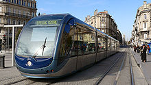
 Example of a modern streetcar on the Tramway de Bordeaux
Initially proposed in a February 2006 State of the City speech by Mayor Michael Coleman, the new system is touted as a tool to connect the various sections of downtown as well as promote development.[3] On 22 March 2006, the mayor convened a working group consisting of various political and business leaders as well as community stakeholders to investigate the feasibility of returning streetcars to the city.[4] Initially, three routes were proposed.[5] A Blue line route would run along High Street from Frankfort Street in German Village to Buttles Avenue in the Short North. A Red line route would extend the blue line north to 11th Avenue adjacent to the Ohio State campus. A Green Line (initially called the Z-line) would run in a Z pattern from the Arena District to the Discovery District around the Main Library. After the results of the economic study showed 3,000 new downtown jobs, 300 hotel rooms and 1,500 new housing units from the most conservative standpoint, the working group voted overwhelmingly in favor of pursuing a streetcar system in Columbus.[6]
Unlike recently built systems in Kenosha and Little Rock, the Columbus system will not use vintage cars or equipment. Media reports have often used the term "trolley" to describe the new system, to which Mayor Coleman has publicly stated his dislike.[7][8] He cited the fact that the system will use modern cars similar to the Portland Streetcar, and will not be intended as a tourist attraction.
The proposal has gained support from organizations such as the Columbus chapter of the American Institute of Architects, Experience Columbus, the Ohio Rail Development Commission, COTA, the Building Owners and Managers Association of Columbus, and the Mid-Ohio Regional Planning Commission.[9][10][11][12][13][14] In a survey of 1,000 downtown residents, employees, and students, 73% said they would ride the streetcar if it were built.[15] Ridership is projected to be between 5,000 and 7,200 riders per day depending on the final route chosen.
Funding
The initial system is projected to cost approximately US$103 million.[1] Mayor Coleman has proposed a funding plan which will rely on fees rather than income or property taxes. The majority of the funding will come from sources within a "benefit zone" which is the area within six blocks of the route. A 4% surcharge would be added to concert, sport, and theatre tickets with a face value above $10. Parking meter rates would be raised by 75¢ per hour, and all money from meters in the area would go to funding the streetcar. Off street parking in lots and garages would also be subject to the 4% fee. The Ohio State University pledged to provide $12.5 million over 25 years. Various small federal grants are also expected to support the streetcar.
The funding system was designed such that Columbus residents who live in suburban areas far away from the line will not have any of their tax dollars diverted to fund the system. It is not yet clear how people who work downtown and park in employer owned garages would be affected.
History
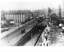
First formed in 1854, the Columbus Street Railroad Company was authorized by the city to build a number of lines, but nothing came about initially.[16] A Horse powered streetcar line first ran along High Street on 10 June 1863.[17] Similar to the proposed modern line, the initial line ran for 1.5 miles (2.4 km) from Union Station to Mound Street. When traffic dropped off after the Civil War, the Columbus Street Railroad Company faced financial difficulties, but started making a profit by 1868. Following the stabilization of the High Street line, the Friend Street Railroad Company set up shop in the same year, first reaching East Public Lane (now Parsons Avenue) and eventually reaching the Fairgrounds (now Franklin Park).
Subsequently, the North Columbus Railroad Company, East Park Place Street Railroad Company, State and Oak Street Railroad Company, and the Glenwood & Green Lawn Railroad Company were formed. The horse powered cars were slow, but made it possible to travel to locations within the city that were beyond a comfortable walking distance. Mergers were frequent, and the Columbus Railroad Company (formerly CSRC) merged with the Friend Street Railroad Company and the East Park Place Railroad Company.[18] The new venture was known as the "Columbus Consolidated Street Railroad Company". The State and Oak Street lines were bought by the new company in the following years.
It was also during this era that long distance rail travel became quite popular. The High Street line faced delays of up to seven hours per day due to the grade level crossing of 10 tracks across High Street at Union Station. To remedy the problem, subway tunnels were built under the tracks. They were dark, and the smell from the horse droppings made the trip unpleasant. From the period of 1863-1892, more than a dozen horsecar companies set up shop in the city, and total trackage was expanded to 34.5 miles (55.5 km) prior to electrification.[19]
In 1888, the first electric powered streetcar ran on Chittenden Avenue from High Street to the current site of the Ohio State Fair.[18] However, it was not successful initially. The first line with successful electrification was the Glenwood & Green Lawn Street Railroad (with trackage mainly along Broad Street), which was completed in August 1890.[18] The High Street, Long Street, and Mount Vernon Avenue lines were electrified in the following year. The advantages in speed and cleanliness quickly made equestrian power obsolete, and the last horse drawn car ran in 1892. Also in that year, yet another naming change came with the sale of the Columbus Consolidated Street Railroad Company to the newly formed "Columbus Street Railway Company" for $3,000,000. At this time, the Glenwood & Green Lawn line was acquired. In 1895, the Columbus Railway, Power and Light Company purchased an amusement park that would be known as Olentangy Park. It was located on the southern end of Clintonville. The idea behind the purchase was to increase ridership on the line during non-peak hours by providing an attractive destination at the terminus. Likewise, other transit companies built Indianola Park on North Fourth Street and Minerva Park in the village of the same name.
Electric power ushered in the golden age of street traction in Columbus. In 1899, the subway tunnels were replaced with an Arcade which ran above the tracks. The system was so popular that Columbus Railway Power & Light experimented with a double deck streetcar in 1914.[20] However, the delays in loading and unloading gave the bi-level design no advantage over its standard counterpart, and the cars were quickly retired. Total trackage reached 71 miles (114 km) by 1916, and the system carried 66,000,000 paying passengers with an additional 16,000,000 people riding on transfer tickets that year.[21] By 1927, steetcars ran to Bexley, Gahanna, Green Lawn Cemetery, Minerva Park, Marble Cliff, Upper Arlington, Westerville, and Worthington.[22]
Most streetcar lines in Columbus used a broad gauge track which measured 5 ft 2 in (1,575 mm).[23] Building non-standard gauge was sometimes used as a way to keep long distance passenger and freight railroads from accidentally or intentionally running their cars on city streets. However, some lines built in the late 1800s used the 4 ft 8 1⁄2 in (1,435 mm) standard gauge width, such as the Worthington Line which ran long Summit Street, Hudson Avenue, Arcadia Avenue, and High Street. With the advent of the interurban, many sections of dual gauge[23] track were built to allow the streetcars and interurbans to use the same route despite their different widths.
In 1933, a decision was made to gradually convert the system to trolley buses (trackless trams).[24] Slowed by the effects of the Great Depression and World War II, the process took 15 years to compete. On 5 September 1948, the last two fixed rail trams ran along Neil Avenue and Main Street. A lack of investment in maintenance of the tracks, as well as the age of the automobile had slowly brought the demise of the system. The trolley buses did not last long either, being gradually replaced by diesel buses as well. The last trolley bus ran on 30 May 1965.[25]
Despite some changes over the years, many current COTA buses run the same routes as the former streetcars. Bus route numbers 1, 2, 4, 6, 7, 8, 10, 11, 15, 16, 19, and 54 deviate very little from the path taken by their railed predecessors.
References
- ^ a b Vitale, Robert (2008-03-27). "Mayor proposes ticket surcharge to pay for streetcars". The Columbus Dispatch (The Columbus Dispatch). http://www.dispatch.com/live/content/local_news/stories/2008/03/27/streetcar.html?type=rss&cat=&sid=101
- ^ Gebolys, Debbie; Vitale, Robert (2009-01-09). "Will stimulus plan put light rail back on track?". The Columbus Dispatch. http://www.dispatchpolitics.com/live/content/local_news/stories/2009/01/09/copy/localstim.ART_ART_01-09-09_A1_05CG0KN.html?sid=101
- ^ "2006 State of the City" (PDF) (Press release). City of Columbus. 2006-02-23. http://mayor.columbus.gov/Asset/iu_files/2006-state-of-the-city-speech.pdf. Retrieved 2008-04-01.
- ^ "Mayor Coleman Announces Streetcar Working Group" (PDF) (Press release). City of Columbus. 2006-03-22. http://mayor.columbus.gov/Asset/iu_files/street-car.pdf. Retrieved 2008-04-01.
- ^ McGinn, Dennis (2006-11-17). "Downtown Streetcar Enews Volume 4". Downtown Streetcar Working Group mailing list. http://downtowncolumbus.com/publications/streetcar_enews/streetcarnews4.html. Retrieved 2008-04-05.
- ^ McGinn, Dennis (2006-11-17). "Downtown Streetcar Enews Volume 4". Downtown Streetcar Working Group. http://downtowncolumbus.com/publications/streetcar_enews/streetcarnews4.html. Retrieved 2008-04-05.
- ^ Henderson, Angela (2008-03-31). "Gee endorses trolley". The Lantern. http://media.www.thelantern.com/media/storage/paper333/news/2008/03/31/Campus/Gee-Endorses.Trolley-3292590.shtml?reffeature=recentlycommentedstoriestab. Retrieved 2008-04-01.
- ^ Ferenchik, Mark (2008-03-29). "Not all aboard on streetcar notion". The Columbus Dispatch. http://www.dispatch.com/live/content/local_news/stories/2008/03/29/STREETCAR.ART_ART_03-29-08_B1_KD9PDC0.html?sid=101. Retrieved 2008-04-01.
- ^ Bernstein, Scott (2007). "Reconnecting Columbus" (PDF). American Institute of Architects. http://www.downtowncolumbus.com/development/docs/AIAColumbusStreetcars.pdf. Retrieved 2008-04-21.[dead link]
- ^ "Experience Columbus Supports Streetcars" (Press release). Experience Columbus. 2008-03-31. http://columbusretrometro.typepad.com/columbus_retrometro/2008/04/experience-colu.html. Retrieved 2008-04-07.
- ^ "The Ohio Rail Development Commission Endorses Columbus Streetcars" (Press release). Ohio Rail Development Commission. 2008-03-28. http://columbusretrometro.typepad.com/columbus_retrometro/2008/04/the-ohio-rail-d.html. Retrieved 2008-04-07.
- ^ Doulin, Tim (2008-04-01). "COTA willing to run streetcars, sees benefits". The Columbus Dispatch. http://www.dispatch.com/live/content/local_news/stories/2008/04/01/COTASTCAR.ART_ART_04-01-08_B2_AT9Q5QF.html?sid=101. Retrieved 2008-04-07.
- ^ "BOMA Columbus joins Mayor Coleman’s Office in support of Downtown Streetcars" (Press release). Building Owners and Managers Association. 2008-04-03. http://columbusretrometro.typepad.com/columbus_retrometro/2008/04/building-owners.html. Retrieved 2008-04-07.
- ^ "Mid-Ohio Regional Planning Commission Committed to Streetcars" (Press release). MORPC. 2008-03-27. http://columbusretrometro.typepad.com/columbus_retrometro/2008/04/mid-ohio-region.html. Retrieved 2008-04-07.
- ^ Danter Group (2006). "Downtown Streetcar Enews Volume 6". http://www.murphyepson.com/public/enews/streetcarnews7.html. Retrieved 2008-04-21.[dead link]
- ^ Hooper, Osman Castle (1920). History of the City of Columbus Ohio. Columbus-Cleveland: The Memorial Publishing Company. pp. 230.
- ^ Lentz, Ed (1998). As It Were. Red Mountain Press. pp. 98. ISBN 0-9667950-0-8.
- ^ a b c Hooper, pp. 232
- ^ Campbell, Alex (2007). "The Columbus Horsecar System - 1863-1892". http://www.columbusrailroads.com/hc-horsecars.htm. Retrieved 2008-04-01.
- ^ Vitale, Robert (2008-04-14). "When streetcars ruled". The Columbus Dispatch. http://www.dispatch.com/live/content/local_news/stories/2008/04/14/OLDTROLLEY.ART_ART_04-14-08_A1_P59S41B.html?sid=101. Retrieved 2008-04-15.
- ^ Pomerene, William R. (1917). Trams and Trolleys. Columbus, Ohio: The Champlin Press. pp. 24–25.
- ^ The Motor Bus Society (In Motor Coach Age, July-August 1990 issue, pp. 6–7) (PDF). Columbus July 1927 (Map) (Second ed.). http://www.columbusrailroads.com/images/columbus-streetcars-1927.pdf. Retrieved 2008-04-01.
- ^ a b Campbell, Alex (2007). "Track Gauge". http://www.columbusrailroads.com/track%20gauge.htm. Retrieved 2008-04-04.
- ^ Campbell, Alex (2007). "The End of an Era". http://www.columbusrailroads.com/1948%20end%20of%20era.htm. Retrieved 2008-04-01.
- ^ "Columbus OH Trolley Coaches". 2008. http://www.trolleybuses.net/cmh/cmh.htm. Retrieved 2008-04-02.
Categories:- Transportation in Columbus, Ohio
- Light rail in Ohio
- Proposed public transportation in the United States
Wikimedia Foundation. 2010.

