- Williston, Vermont
Infobox Settlement
official_name = Williston, Vermont
settlement_type = Town
nickname =
motto =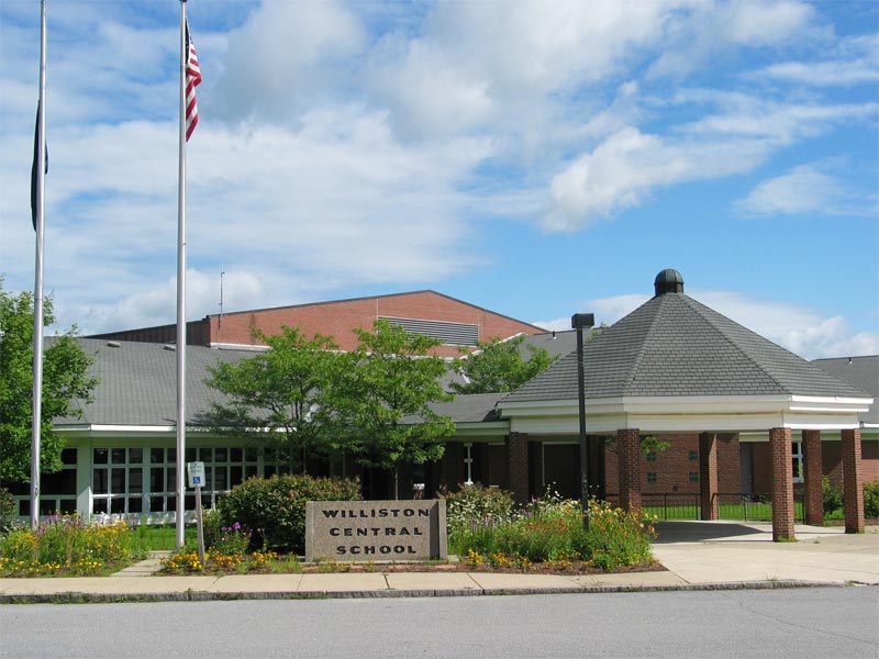
imagesize = 250px
image_caption = Williston Central School
image_
mapsize = 250px
map_caption = Williston, Vermont
mapsize1 =
map_caption1 =subdivision_type = Country
subdivision_name =United States
subdivision_type1 = State
subdivision_name1 =Vermont
subdivision_type2 = County
subdivision_name2 = Chittendengovernment_footnotes =
government_type =
leader_title =
leader_name =
leader_title1 =
leader_name1 =
established_title =
established_date =unit_pref = Imperial
area_footnotes =
area_magnitude =
area_total_km2 = 79.5
area_land_km2 = 78.6
area_water_km2 = 1.0
area_total_sq_mi = 30.7
area_land_sq_mi = 30.3
area_water_sq_mi = 0.4population_as_of = 2000
population_footnotes =
population_total = 7650
population_density_km2 = 97.4
population_density_sq_mi = 252.1timezone = Eastern (EST)
utc_offset = -5
timezone_DST = EDT
utc_offset_DST = -4
elevation_footnotes =
elevation_m = 184
elevation_ft = 604
latd = 44 |latm = 26 |lats = 43 |latNS = N
longd = 73 |longm = 5 |longs = 57 |longEW = Wpostal_code_type =
ZIP code
postal_code = 05495
area_code = 802
blank_name = FIPS code
blank_info = 50-84475GR|2
blank1_name = GNIS feature ID
blank1_info = 1462263GR|3
website =
footnotes =Williston is a town in Chittenden County,
Vermont ,United States . The population was 7,650 at the 2000 census. It is one of the fastest-growing towns in the state and is becoming a major retail center.Fact|date=March 2008Geography
According to the
United States Census Bureau , the town has a total area of 30.7square mile s (79.5km² ), of which, 30.3 square miles (78.6 km²) of it is land and 0.4 square miles (1.0 km²) of it (1.20%) is water.Brooks in Williston
Allen Brook drains the center of the town. It begins and flows from Mud Pond north to the village of Williston, and then in a northwesterly direction where it meets the Winooski River.Length: 10 miles.Watershed area: 6,900 acres.
Muddy Brook flows on the western edge of Williston and marks the border between Williston and South Burlington.
Nature trail
The Williston Nature Trail has been developed.Fact|date=May 2008
Demographics
As of the censusGR|2 of 2000, there were 7,650 people, 2,921 households, and 2,141 families residing in the town. The
population density was 252.1 people per square mile (97.4/km²). There were 3,036 housing units at an average density of 100.1/sq mi (38.6/km²). The racial makeup of the town was 97.45% White, 0.50% African American, 0.14% Native American, 1.20% Asian, 0.01% Pacific Islander, 0.10% from other races, and 0.59% from two or more races. Hispanic or Latino of any race were 0.95% of the population.There were 2,921 households, out of which 36.8% had children under the age of 18 living with them, 65.1% were married couples living together, 5.3% had a female householder with no husband present, and 26.7% were non-families. 20.4% of all households were made up of individuals, and 7.9% had someone living alone who was 65 years of age or older. The average household size was 2.59 and the average family size was 3.02.
In the town the population was spread out, with 27.5% under the age of 18, 4.1% from 18 to 24, 32.0% from 25 to 44, 24.6% from 45 to 64, and 11.7% who were 65 years of age or older. The median age was 39 years. For every 100 females there were 95.8 males. For every 100 females age 18 and over, there were 91.6 males.
Economy
One measure of economic activity is retail sales. Williston led the state in 2007 with US$434.8 million. [cite book | author = McLean, Dan |title = Retail Sales by the numbers | publisher = Burlington Free Press | year = July 13, 2008]
Personal Income
The median income for a household in the town was $61,467, and the median income for a family was $69,762. Males had a median income of $49,048, versus $31,740 for females. The
per capita income for the town was $29,757. About 0.8% of families and 1.5% of the population were below thepoverty line , including 0.8% of those under age 18 and 4.9% of those age 65 or over.Education
Williston has two schools: the Allen Brook School, Pre-K-4, and the Williston Central School, K-8. The town does not have its own high school; Williston's high school students attend
Champlain Valley Union High School , 9-12, in nearby Hinesburg,Vermont . A private boarding school has been in Williston for over 35 years as well, the Pine Ridge School.Transportation
Major Routes
which runs between the two highways. Vermont Route 2A provides a north-south route through town, connecting it to Hinesburg and Essex Junction.
Notable residents
*
Thomas Chittenden , first governor of Vermont and founder of Williston.
*Jerry Greenfield , entrepreneur, a co-founder ofBen & Jerry's .
*Ben Cohen, entrepreneur, a co-founder ofBen & Jerry's .References
External links
* [http://www.williston.k12.vt.us/ Williston School District Website]
* [http://town.williston.vt.us/ Williston Vermont Official Website]
* [http://www.williston.lib.vt.us/ Dorothy Alling Memorial Library]
*
Wikimedia Foundation. 2010.