- Colvocoresses Reef
-
Coordinates: 04°54′S 72°37′E / 4.9°S 72.617°E
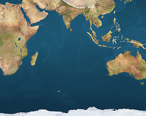
 Colvocoresses ReefLocation of Colvocoresses Reef in the Indian Ocean
Colvocoresses Reef is a wholly submerged atoll structure in the Northeast of the Chagos Archipelago, Indian Ocean. It is located 15 km east of Speakers Bank and 28 km northeast of Blenheim Reef.[1] The reef measures 8 km north-south, and is 1 to 2 km wide[2], with a total area of about 10 km². Breakers are visible only during heavy seas.
Contents
History
This submerged atoll is named after Dr. Alden Partridge Colvocoresses who developed in 1973 - 1979 the Space-oblique Mercator projection with John P. Snyder and John L. Junkins. The least charted depth is 9 meters deep above the reef. This sounding was one of only a few that were ever incorporated into US nautical charts, having been derived not from sonar or lead line data, but from radiometric data from the Landsat Multispectral Scanner (MSS) imagery.[3]
Colvocoresses Reef is unique in that it was discovered by use of images taken by the National Aeronautics and Space Administration's (NASA) Landsat Satellite. The Landsat MSS images the earth with several spectral bands. Each band provides a black and white image that is taken through a spectral filter. It has two non-thermal infrared bands for sensing plant vigor. These bands have very limited water penetration. Landsat also has two visible wavelength bands: red and green. Although the red band penetrates clear water to only about eight meters, the green band has been proven to see through clear ocean waters to depths of about 30-40 meters. Since light is exponentially attenuated through the water column, given clear water and similar bottom reflectances, deeper water will appear darker on the Landsat images.[4]
The original depth data for the shallow water areas on Chagos Archipelago nautical charts had been collected in the mid-1830s. Except for the areas around Diego Garcia, the 1830's data is still shown on the current chart. In 1975, the Defense Mapping Agency's Hydrographic Center, subsequently incorporated into the National Geospatial-Intelligence Agency (NGA), requested NASA to collect Landsat images over the Chagos Archipelago. The images revealed the previously uncharted Colvocoresses Reef as well as errors in positioning of numerous other reefs in the Archipelago. Some were out of position by as much as 18 kilometers.
By the summer of 1976 a new edition of the Chagos Archipelago nautical chart (#61610) was printed showing the corrected positions of the banks and shoals as well as Colvocoresses Reef[5]. This was the first nautical chart known to have been completely revised using the Landsat imagery.[6]
Notice to mariners
The brightness of the reef was compared with the brightness of other reefs that had known depths and similar bottom reflections. It was deemed advisable to give in a notice to mariners a probable depth range for the reef with a caution on the chart that there were probably shallower features on the reef.[7]
See also
Notes and references
- ^ British Admiralty nautical chart 11000030 - 3 Chagos Archipelago, Scale 1:360 000
- ^ Oceandots - Colvocoresses Reef
- ^ Personal experience from J. C. Hammack who had initially discovered the reef using the Landsat MSS images
- ^ Personal experience from J. C. Hammack.
- ^ Current version edition of the Chagos Archipelago nautical chart #61610
- ^ June 1977 Journal of the American Society of Photogrammetry and Remote Sensing, by Hammack J Also presented at the Second Annual William T. Pecora Memorial Symposium, Sioux Falls, S. D., as "Landsat Goes to Sea," by Hammack J. Oct. 25-29, 1976
- ^ Personal experience from J. C. Hammack
External links
Atolls with land area Totally submerged Colvocoresses Reef · Benares Shoals · Victory Bank · Cauvin Bank · Pitt Bank · Ganges Bank · Wight Bank · Centurion Bank · Owen Bank
This British Indian Ocean Territory location article is a stub. You can help Wikipedia by expanding it.
