- Minamichita Road
-


南知多道路 Route information Length: 19.6 km (12.2 mi) Existed: 1970[1][2] – present Major junctions From: Handa Interchange in Handa, Aichi
 Chitahantō Road
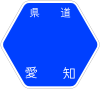
Aichi Prefectural Route 34To: Toyooka Interchange in Minamichita, Aichi
Aichi Prefectural Route 7
Aichi Prefectural Route 280Highway system The Minamichita Road (南知多道路 Minamichita Dōro) is a 4-laned toll road in Aichi Prefecture, Japan. It is managed by Aichi Prefectural Road Public Corporation.
Contents
Overview
Officially the road is designated as Aichi Prefectural Route 7. The road is designated for motor vehicles only (自動車専用道路 Jidōsha Senyō Dōro) (motor vehicles must have a displacement of at least 125 cc), and the design standard of the road is similar to national expressways.
The road connects the southern portion of the Chita Peninsula with Nagoya through the Chitahantō Road. A toll plaza formerly separated these two roads since the Chitahantō Road was administered by Japan Highway Public Corporation, however since the administration of that road was transferred to Aichi Prefectural Road Public Corporation the toll plaza has been abandoned and a unified toll structure has been implemented.
Interchange list
- IC - interchange, PA - parking area
Name Connections Dist. from
Ōdaka ICNotes Location
(all in Aichi)Through to Chitahantō RoadHanda IC Pref. Route 34 (Handa Tokoname Route) 20.9 Handa Taketoyo IC/
PAPref. Route 71 (Taketoyo Kosugaya Route) 26.5 PA: Handa-bound only Taketoyo Mihama PA ↓ Toyooka-bound only Mihama Mihama IC Pref. Route 274 (Kosugaya Kōwa Route) 31.3 Minamichita IC Pref. Route 52 (Handa Minamichita Route) 35.5 Toyooka Toll Gate ↓ Kō IC 37.4 Toyooka-bound exit, Handa-bound entrance only Toyooka IC Pref. Route 280 (Toyooka Toyohama Route) 40.5 Minamichita Expressway ends, road continues as Pref. Route 7 References
- ^ Aichi Prefectural Government. "Toll Road Information". http://www.pref.aichi.jp/dourokensetsu/yuryodouro/. Retrieved 2008-05-19.
- ^ Ministry of Land, Infrastructure and Transport. "History of the Expressway Network in the Greater Nagoya Area". http://www.tokai-kansen.go.jp/naruhodo/jisendo/2006_07/p03_04.html. Retrieved 2008-04-17.
External links
- (Japanese) Aichi Prefectural Road Public Corporation
Categories:- Toll roads in Japan
- Aichi geography stubs
- Japan road stubs


Wikimedia Foundation. 2010.