- Port Mansfield, Texas
Infobox Settlement
official_name = Port Mansfield, Texas
settlement_type = CDP
nickname =
motto =
imagesize =
image_caption =
image_
mapsize = 250px
map_caption = Location of Port Mansfield, Texas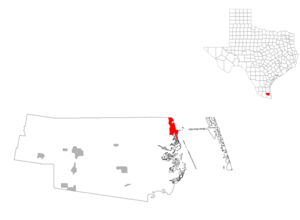
mapsize1 = 250px
map_caption1 =subdivision_type = Country
subdivision_name =United States
subdivision_type1 = State
subdivision_name1 =Texas
subdivision_type2 = County
subdivision_name2 = Willacygovernment_footnotes =
government_type =
leader_title =
leader_name =
leader_title1 =
leader_name1 =
established_title =
established_date =unit_pref = Imperial
area_footnotes =area_magnitude =
area_total_km2 = 14.8
area_land_km2 = 13.5
area_water_km2 = 1.3
area_total_sq_mi = 5.7
area_land_sq_mi = 5.2
area_water_sq_mi = 0.5population_as_of = 2000
population_footnotes =
population_total = 415
population_density_km2 = 30.7
population_density_sq_mi = 79.6timezone = Central (CST)
utc_offset = -6
timezone_DST = CDT
utc_offset_DST = -5
elevation_footnotes =
elevation_m = 1
elevation_ft = 3
latd = 26 |latm = 33 |lats = 20 |latNS = N
longd = 97 |longm = 25 |longs = 52 |longEW = Wpostal_code_type =
ZIP code
postal_code = 78598
area_code = 956
blank_name = FIPS code
blank_info = 48-58928GR|2
blank1_name = GNIS feature ID
blank1_info = 1344369GR|3
website =
footnotes =Port Mansfield is a
census-designated place (CDP) in Willacy County,Texas ,United States . The population was 415 at the 2000 census.Geography
Port Mansfield is located at coor dms|26|33|20|N|97|25|52|W|city (26.555453, -97.431051)GR|1.
According to the
United States Census Bureau , the CDP has a total area of 5.7square mile s (14.8km² ), of which, 5.2 square miles (13.5 km²) of it is land and 0.5 square miles (1.3 km²) of it (8.76%) is water. A navigational channel connects Port Mansfield to the Laguna Madre, to the Intercoastal Waterway (canal), and cutting through South Padre Island, to the Gulf of Mexico. The cut through South Padre Island has shoaled considerably and as of early 2008 only shallow draft boats can safely enter at the Mansfield cut.Demographics
As of the
census GR|2 of 2000, there were 415 people, 187 households, and 137 families residing in the CDP. Thepopulation density was 79.6 people per square mile (30.8/km²). There were 563 housing units at an average density of 108.0/sq mi (41.7/km²). The racial makeup of the CDP was 93.01% White, 0.96% Native American, 4.58% from other races, and 1.45% from two or more races. Hispanic or Latino of any race were 14.22% of the population.There were 187 households out of which 14.4% had children under the age of 18 living with them, 64.7% were married couples living together, 5.3% had a female householder with no husband present, and 26.7% were non-families. 21.4% of all households were made up of individuals and 9.1% had someone living alone who was 65 years of age or older. The average household size was 2.22 and the average family size was 2.50.
In the CDP the population was spread out with 13.5% under the age of 18, 4.6% from 18 to 24, 16.9% from 25 to 44, 37.1% from 45 to 64, and 28.0% who were 65 years of age or older. The median age was 55 years. For every 100 females there were 102.4 males. For every 100 females age 18 and over, there were 107.5 males.
The median income for a household in the CDP was $26,500, and the median income for a family was $27,500. Males had a median income of $18,333 versus $26,667 for females. The
per capita income for the CDP was $15,087. About 20.5% of families and 26.8% of the population were below thepoverty line , including 53.5% of those under age 18 and 5.4% of those age 65 or over.Education
Port Mansfield is served by the
San Perlita Independent School District .In addition,
South Texas Independent School District operates magnet schools that serve the community.References
External links
* [http://www.tsha.utexas.edu/handbook/online/articles/PP/hrpaq.html Handbook of Texas Online article]

Wikimedia Foundation. 2010.