- Neckarelz
-
Neckarelz Stadtteil of Mosbach 

 Neckarelz
Coordinates 49°20′21″N 9°06′29″E / 49.33917°N 9.10806°ECoordinates: 49°20′21″N 9°06′29″E / 49.33917°N 9.10806°E Administration Country Germany State Baden-Württemberg Admin. region Karlsruhe District Neckar-Odenwald-Kreis Town Mosbach Basic statistics Elevation 148 m (486 ft) Population 6,500 Other information Time zone CET/CEST (UTC+1/+2) Licence plate MOS Postal code 74821 Area code 06261 Neckarelz is a suburb of Mosbach in Baden-Württemberg, Germany.
Contents
Geography
Neckarelz is in northern Baden-Württemberg, between the Odenwald and Kraichgau, at the confluence of the Neckar and Elz rivers. On the other side of the Neckar, are the towns of Hochhausen and Obrigheim. Next to Neckarelz, is the suburb of Diedesheim.
History
The town was part of the Electoral Palatinate from around 1362. From 1944 to 1945, there was a Nazi concentration camp in Neckarelz, with the prisoners barracked in the school. The factory in Obrigheim which produced bomber engines used nearly ten thousand prisoners, of whom about half came from the concentration camp. In April 1945, 900 of them were rescued.
Religion
Until World War II, Neckarelz was almost completely Protestant. After the arrival of Catholic refugees, a new church was built.
Demographics
Neckarelz is the largest suburb of Mosbach, with approximately 6,500 inhabitants.
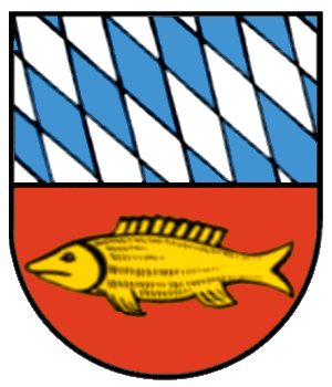
Coat of arms
This depicts the rhombuses of the Electoral Palatinate at the top and a fish below.
Education
Neckarelz has several kindergartens, a primary school (named after Clemens Brentano), and a grammar and Hauptschule, (both named after Auguste Pattberg).
Transport
Neckarelz has a train station, connecting to the Neckar Valley Railway and the line to Osterburken, and a harbour.
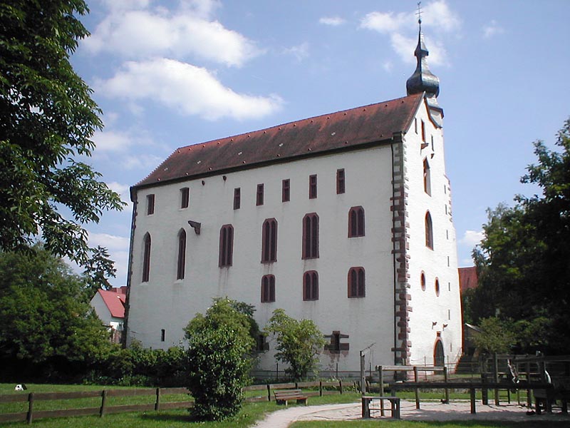
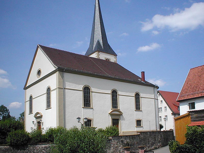
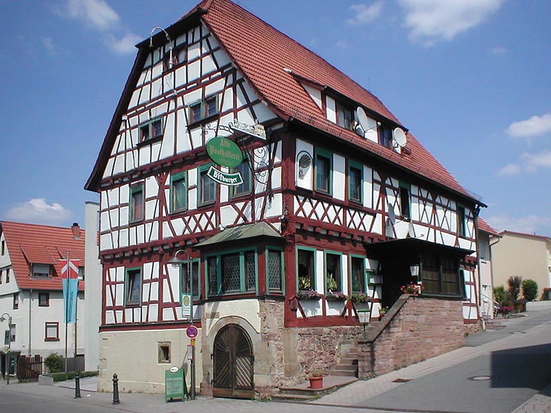
Buildings
-

thumb|Tempelhaus - old castle of the Knights Hospitaller (12th/13th century)
-

Protestant church
-

Verwaltungsstelle - "subsidiary" of the town hall of Mosbach
-

example for a timber framing in Neckarelz: the "Alte Posthalterei"
External links
Categories:- Neckar-Odenwald-Kreis
- Baden-Württemberg geography stubs
-


Wikimedia Foundation. 2010.