- Rosebud, Texas
Infobox Settlement
official_name = Rosebud, Texas
settlement_type =City
nickname =
motto =
imagesize =
image_caption =
image_
mapsize = 250px
map_caption = Location of Rosebud, Texas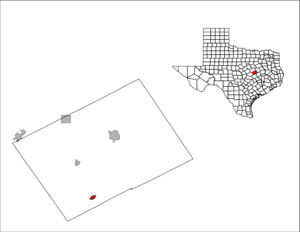
mapsize1 = 250px
map_caption1 =subdivision_type = Country
subdivision_name =United States
subdivision_type1 = State
subdivision_name1 =Texas
subdivision_type2 = County
subdivision_name2 = Fallsgovernment_footnotes =
government_type =
leader_title =
leader_name =
leader_title1 =
leader_name1 =
established_title =
established_date =unit_pref = Imperial
area_footnotes =area_magnitude =
area_total_km2 = 2.0
area_land_km2 = 2.0
area_water_km2 = 0.0
area_total_sq_mi = 0.8
area_land_sq_mi = 0.8
area_water_sq_mi = 0.0population_as_of = 2000
population_footnotes =
population_total = 1493
population_density_km2 = 741.0
population_density_sq_mi = 1919.2timezone = Central (CST)
utc_offset = -6
timezone_DST = CDT
utc_offset_DST = -5
elevation_footnotes =
elevation_m = 121
elevation_ft = 397
latd = 31 |latm = 4 |lats = 31 |latNS = N
longd = 96 |longm = 58 |longs = 32 |longEW = Wpostal_code_type =
ZIP code
postal_code = 76570
area_code = 254
blank_name = FIPS code
blank_info = 48-63188GR|2
blank1_name = GNIS feature ID
blank1_info = 1366870GR|3
website =
footnotes =Rosebud is a city in Falls County,
Texas ,United States . The population was 1,493 at the 2000 census. It is the birthplace of NFL running backLaDainian Tomlinson . It is also the birthplace ofKenneth McDuff , a serial killer suspected of at least 14 murders.Geography
Rosebud is located at coor dms|31|4|31|N|96|58|32|W|city (31.075209, -96.975581)GR|1.
It is approximately 130 miles south of
Dallas . According to theUnited States Census Bureau , the city has a total area of 0.8square mile s (2.0km² ), all of it land.Demographics
As of the
census GR|2 of 2000, there were 1,493 people, 571 households, and 379 families residing in the city. Thepopulation density was 1,919.2 people per square mile (739.0/km²). There were 673 housing units at an average density of 865.1/sq mi (333.1/km²). The racial makeup of the city was 59.14% White, 18.29% African American, 0.13% Native American, 0.07% Asian, 0.27% Pacific Islander, 19.16% from other races, and 2.95% from two or more races. Hispanic or Latino of any race were 29.74% of the population.There were 571 households out of which 31.7% had children under the age of 18 living with them, 45.4% were married couples living together, 17.0% had a female householder with no husband present, and 33.6% were non-families. 32.0% of all households were made up of individuals and 20.3% had someone living alone who was 65 years of age or older. The average household size was 2.53 and the average family size was 3.21.
In the city the population was spread out with 28.8% under the age of 18, 6.6% from 18 to 24, 21.8% from 25 to 44, 20.8% from 45 to 64, and 22.0% who were 65 years of age or older. The median age was 40 years. For every 100 females there were 90.9 males. For every 100 females age 18 and over, there were 78.1 males.
The median income for a household in the city was $24,063, and the median income for a family was $33,300. Males had a median income of $25,662 versus $18,462 for females. The
per capita income for the city was $13,577. About 21.0% of families and 24.5% of the population were below thepoverty line , including 30.5% of those under age 18 and 22.7% of those age 65 or over.Education
The City of Rosebud is served by the
Rosebud-Lott Independent School District .References
External links
* [http://www.tsha.utexas.edu/handbook/online/articles/RR/hjr14.html Rosebud, Texas] from the
Handbook of Texas Online

Wikimedia Foundation. 2010.