Rábida Island

Rábida Island
File:Rábida Island.jpg
Sea lion mother and pup at Rabida Island.

Rábida Island, is one of the Galápagos Islands. The island has also been known as Jervis Island named in honour of the 18th-century British admiral John Jervis. In Ecuador it is officially known as Isla Rábida.

Geography

The island is located in the eastern Pacific Ocean, approximately 600 miles (965 km) west of Ecuador. The island has a total area of 4.9 km2 and a maximum altitude of 367 meters.

The island has red sand beaches and a saltwater lagoon inhabited by flamingos and a bachelor sea lion colony. The landscape is studded with small volcanic craters along sharp slopes and cliffs.
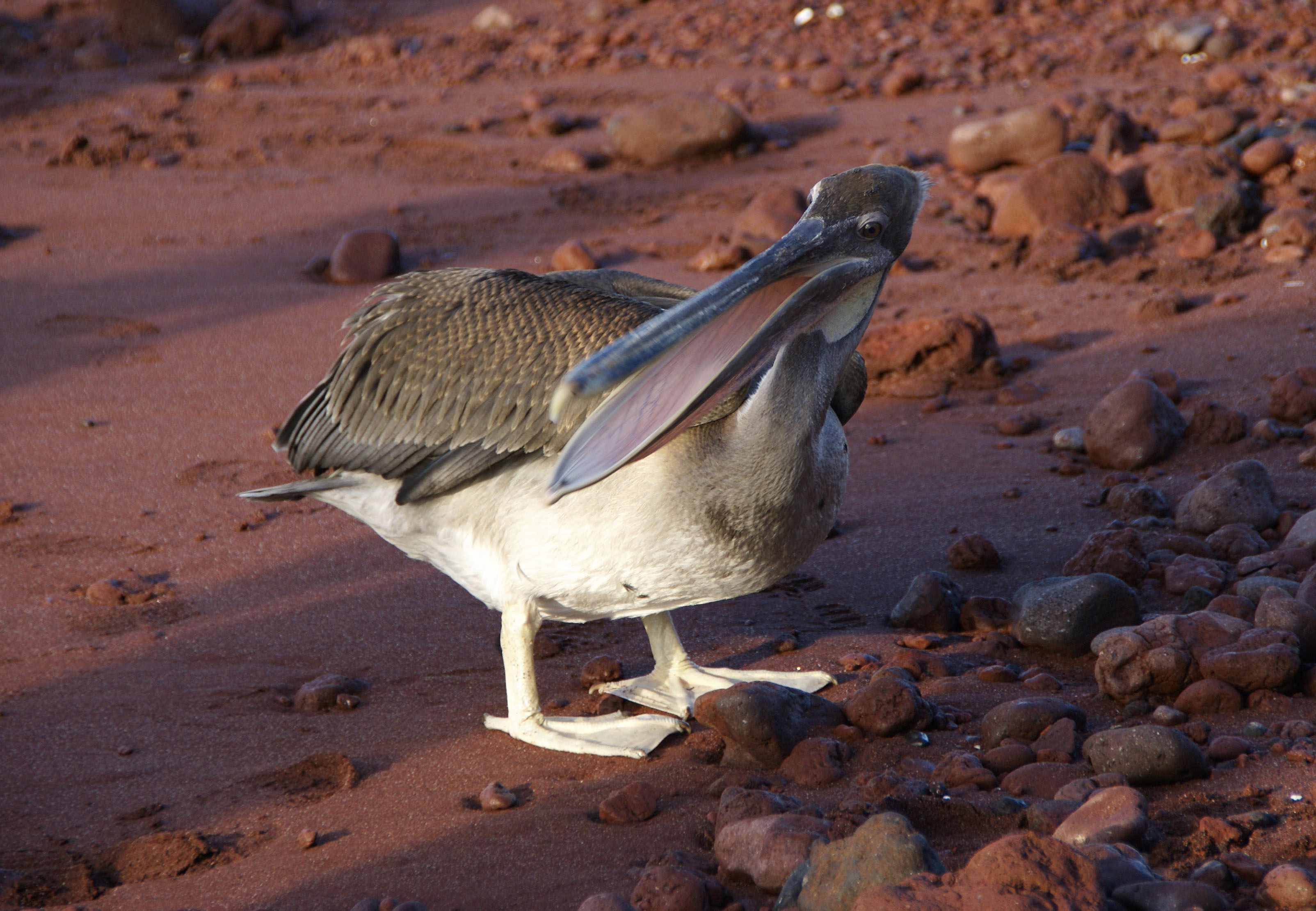
Wildlife

Brown pelican on red sand.

In addition to flamingos and the bachelor sea lion colony, pelicans, white-cheeked pintails, boobies, and nine species of finch have been reported. The rich wildlife attracts a number of tourists cruises.

In 1971 the National Park Service successfully eradicated goats from Rabida. This introduced species upset the natural environment and led to the extinction of several native creatures including Geckos, Land Iguanas, and Rice Rats.

Coordinates: 0°24′47″S 90°42′32″W / 0.413°S 90.709°W / -0.413; -90.709


Wikimedia Foundation. 2010.

Игры ⚽ Поможем сделать НИР

Look at other dictionaries:

  • Rábida Island — ▪ island, Pacific Ocean also called  Jervis Island,         one of the Galápagos Islands, in the eastern Pacific Ocean, about 600 miles (965 km) west of Ecuador. The island has an area of about 1 square mile (3 square km) and is studded with… …   Universalium

  • Rábida Galapagos — Rabida also known as Jervis Island, is one of two small islands located to the south of Santiago. Has an area of 4.9 km² and a maximum altitude of 367 meters.Rabida looks red with the lava containing a lot of ferric oxide in the lava. Very… …   Wikipedia

  • Île Rábida — Île Jervis L île Rábida Géographie Pays …   Wikipédia en Français

  • Darwin Island — redirects here. For another island, see Darwin Island (Antarctica) …   Wikipedia

  • Fernandina Island — Fernandina Fernandina Island (centre) and Isabela Island Elevation 1,476 m (4,843 ft) …   Wikipedia

  • Marchena Island — Named after Fray Antonio Marchena, Marchena Island has an area of 130 km² and a maximum altitude of 343 meters. There aren t any visitor s sites on this island, although it is possible to dive in the waters around Marchena on organised… …   Wikipedia

  • North Seymour Island — North Seymour, Galapagos, Land Iguana North Seymour (Spanish: Isla Seymour Norte) is a small island near to Baltra Island in the Galapagos Islands. It was formed by uplift of a submarine lava formation. The whole island is covered with low, bushy …   Wikipedia

  • Daphne Island — Daphne Major is a volcanic island just north of Santa Cruz Island and just west of the Baltra Airport in the archipelago Colon, commonly known as the Galápagos Islands. It consists of a tuff crater, devoid of trees, whose rim rises… …   Wikipedia

  • Nameless Island — is an islet of the Galapagos Islands group, in Ecuador. The island is most commonly used for scuba diving.[1] References ^ Ecuador PlanetEcuador Galapagos islands Activities Diving Scuba iguana . http://www.plan …   Wikipedia

  • Isla Rábida (Galápagos) — Saltar a navegación, búsqueda Isla Rábida Localización País …   Wikipedia Español

Share the article and excerpts

Direct link
Do a right-click on the link above
and select “Copy Link”