- Alcester, South Dakota
Infobox Settlement
official_name = Alcester, South Dakota
other_name =
native_name =
nickname =
settlement_type =City
motto = "Small Town Treasure"
imagesize =
image_caption =
flag_size =
image_
seal_size =
image_shield =
shield_size =
image_blank_emblem =
blank_emblem_type =
blank_emblem_size =
imagesize =
image_caption =
flag_size =
image_
seal_size =
image_shield =
shield_size =
image_blank_emblem =
blank_emblem_type =
blank_emblem_size =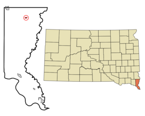
mapsize = 250px
map_caption = Location in Union County and the state ofSouth Dakota
mapsize1 =
map_caption1 =
image_dot_
dot_mapsize =
dot_map_caption =
dot_x =
dot_y =
pushpin_
pushpin_label_position =
pushpin_map_caption =
pushpin_mapsize =
subdivision_type = Country
subdivision_name =United States
subdivision_type1 = State
subdivision_name1 =South Dakota
subdivision_type2 = County
subdivision_name2 = Union
subdivision_type3 =
subdivision_name3 =
subdivision_type4 =
subdivision_name4 =
government_footnotes =
government_type =
leader_title =
leader_name =
leader_title1 =
leader_name1 =
leader_title2 =
leader_name2 =
leader_title3 =
leader_name3 =
leader_title4 =
leader_name4 =
established_title =
established_date =
established_title2 =
established_date2 =
established_title3 =
established_date3 =
area_magnitude =
unit_pref = Imperial
area_footnotes =
area_total_km2 = 0.9
area_land_km2 = 0.9
area_water_km2 = 0
area_total_sq_mi = 0.3
area_land_sq_mi = 0.3
area_water_sq_mi = 0
area_water_percent =
area_urban_km2 =
area_urban_sq_mi =
area_metro_km2 =
area_metro_sq_mi =
area_blank1_title =
area_blank1_km2 =
area_blank1_sq_mi =
population_as_of = 2000
population_footnotes =
population_note =
population_total = 880
population_density_km2 = 977.8
population_density_sq_mi = 2933.3
population_metro =
population_density_metro_km2 =
population_density_metro_sq_mi =
population_urban =
population_density_urban_km2 =
population_density_urban_sq_mi =
population_blank1_title =
population_blank1 =
population_density_blank1_km2 =
population_density_blank1_sq_mi =
timezone = Central (CST)
utc_offset = -6
timezone_DST = CDT
utc_offset_DST = -5
latd = 43 |latm = 1 |lats = 23 |latNS = N
longd = 96 |longm = 37 |longs = 50 |longEW = W
elevation_footnotes =
elevation_m = 419
elevation_ft = 1375
postal_code_type =ZIP code
postal_code = 57001
area_code = 605
blank_name = FIPS code
blank_info = 46-00700GR|2
blank1_name = GNIS feature ID
blank1_info = 1253607GR|3
website = [http://www.alcestersd.org/ http://www.alcestersd.org/]
footnotes =Alcester is a city located in
Union County, South Dakota . It is part of the Sioux City/Iowa/Nebraska /South Dakota Metropolitan Statistical Area . The population was 880 as of the 2000 census.History
Before incorportation, the settlement's original name was Linia before being changed to Irene. In 1879, the town's name was changed to Alcester by the
Western Town Lot Company . The town was named in honor of Colonel Alcester of the British Army.Geography
Alcester is located at coor dms|43|1|23|N|96|37|50|W|city (43.023041, -96.630451).GR|1
According to the
United States Census Bureau , the city has a total area of 0.3square mile s (0.9km² ), all land.Alcester has been assigned the
ZIP code 57001, and theFIPS place code 00700.Demographics
As of the
census GR|2 of 2000, there were 880 people, 388 households, and 233 families residing in the city. Thepopulation density was 2,590.8 people per square mile (999.3/km²). There were 430 housing units at an average density of 1,266.0/sq mi (488.3/km²). The racial makeup of the city was 98.41% White, 0.23% Native American, 0.91% Asian, and 0.45% from two or more races.There were 388 households out of which 25.0% had children under the age of 18 living with them, 53.4% were married couples living together, 5.7% had a female householder with no husband present, and 39.7% were non-families. 36.9% of all households were made up of individuals and 24.7% had someone living alone who was 65 years of age or older. The average household size was 2.10 and the average family size was 2.72.
In the city the population was spread out with 18.9% under the age of 18, 5.8% from 18 to 24, 19.9% from 25 to 44, 22.2% from 45 to 64, and 33.3% who were 65 years of age or older. The median age was 48 years. For every 100 females there were 74.6 males. For every 100 females age 18 and over, there were 71.6 males.
The median income for a household in the city was $29,432, and the median income for a family was $44,286. Males had a median income of $28,047 versus $21,167 for females. The
per capita income for the city was $16,593. About 6.5% of families and 7.9% of the population were below thepoverty line , including 3.8% of those under the age of 18 and 16.0% of those 65 and older.Education
Alcester-Hudson High School is the only high school in the Alcester-Hudson School District.Noted native and former citizen
*
Archie M. Gubbrud - former Governor of South Dakota.References
External links
* [http://www.alcestersd.org/ City of Alcester Official Website]
Wikimedia Foundation. 2010.