- Dair Mar Elia
-
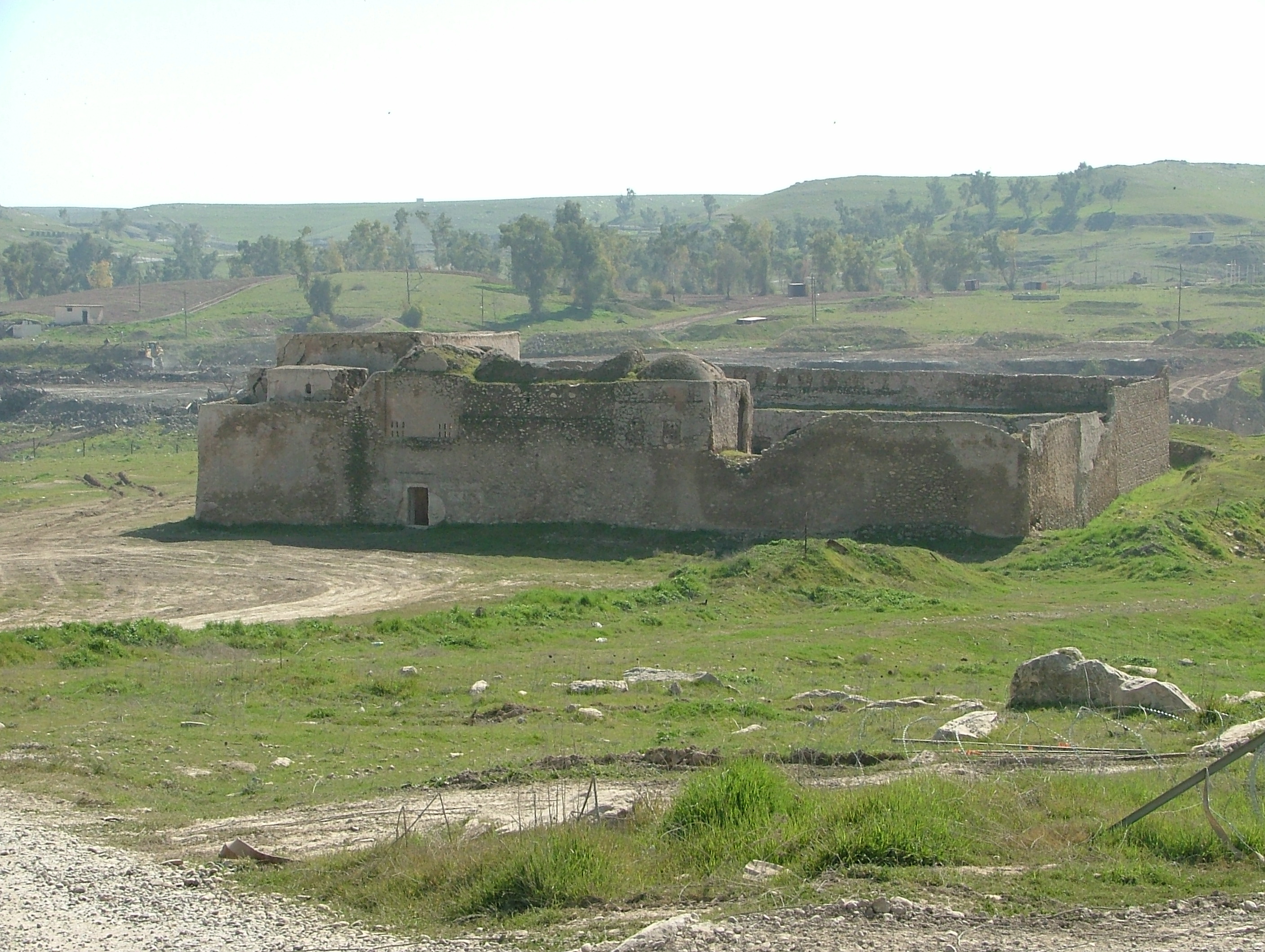
Dair Mar Elia (Syriac: ܕܝܪܐ ܕܡܪܝ ܐܝܠܝܐ, Arabic: دير مار إيليا) (known in English as Saint Elijah's Monastery) is an abandoned Christian monastery,[1] the oldest in Iraq, dating from the 6th century.[2] It is located in the Ninawa Governorate just south of Mosul.
The monastery was founded around 595 AD by Mar Elia, an Assyrian monk who had previously studied at al-Hirah and later in the great monastery at Ezla mountain in Turkey.[3][4] It was later claimed by the Chaldeans.[1] The monastery was the center of the regional Christian community and for centuries thousands of Christians would visit the monastery to observe the Mar Elia Holiday, which falls on the last Wednesday of November.[5]
The monastery was renovated in the 17th century by Hurmizd Alqushnaya. In 1743, the Persian leader Tahmaz Nadir Shah ordered the destruction of its property and the death of the monks who dwelt there. The monastery laid in ruins until the beginning of 20th century, when some restoration was completed on a few halls and rooms. During the First World War, Dair Mar Elia was a place of refuge which lead to the rebuilding of part of the site.[6] The structure, along with its neighboring reservoir and natural mineral water springs, were cared for by the Chaldean Church, and Christian pilgrims continued to visit the ruins.[7]
After the Iraq War, the site lay within Forward Operating Base Marez and American forces began to visit and later tend for the site.[8] After being vacated by the retreating Iraqi Republican Guard, the 101st Airborne Division took charge of the area. Later, the 94th Engineer Battalion made a topographical survey of the monastery. Dair Mar Elia has been fenced off to protect the site and military chaplains guide soldiers on tours of the ruins.[9] These actions were part of a long-term effort to help local Iraqis become more aware of the site as well as to promote the awareness for historic preservation.
In May 2008, Iraqi archaeologists were able to visit the areas for the first time since before the Second Gulf War. While portions needed protection from the elements, other areas that were largely unexcavated had been protected from looters.
References
- ^ a b Smithsonian Magazine, 16 Sep 2008
- ^ NPR's Morning Edition, November 21, 2007
- ^ NewsBlaze
- ^ Chronicle of Seert 13: 445.
- ^ Christians of Iraq
- ^ http://newsblaze.com/story/20051223075743nnnn.nb/topstory.html
- ^ Assyrian International News Agency
- ^ http://www.nytimes.com/2009/12/19/world/middleeast/19monastery.html
- ^ http://www.nytimes.com/slideshow/2009/12/19/world/1219-MONASTERY_2.html
External links
Categories:- Christianity in Iraq
- Christian monasteries in Iraq
- Chaldean Catholic Church
- 590s establishments
- Assyrian Church of the East
Wikimedia Foundation. 2010.